
This post may contain affiliate links, from which we earn an income. Click here to read our affiliate policy.
From the dramatic mountains of the Scottish Highlands to the rugged coastline of Cornwall, the UK is packed with incredible road trips. With winding coastal roads, spectacular national parks, historic towns and beautiful countryside, there’s an amazing variety of landscapes to discover in a relatively small area.
One of the best things about a UK road trip is the freedom to explore at your own pace. You can spend your days driving through remote mountain passes, discovering traditional villages, visiting castles and stopping whenever a view catches your eye.
We’ve spent years exploring the UK by road, travelling through England, Scotland, Wales and Northern Ireland in motorhomes, cars and on motorcycles. Along the way, we’ve driven some of Britain’s most famous touring routes and discovered plenty of lesser-known roads that deserve just as much attention.
In this guide, we’re sharing 18 of the best UK road trips, with scenic driving routes, must-see attractions and practical tips to help you plan your next adventure.
UK Road Trips Key Facts
Routes: The Gap Decaders’ selection of 18 scenic UK road trips across England, Scotland, Wales and Northern Ireland.
Planning: Routes include coastal drives, mountain roads, national parks and historic destinations, with options for short breaks and longer adventures.
Best for: Travellers exploring the UK by car, campervan or motorhome who want inspiration for their next road trip.
First-hand experience: The Gap Decaders have travelled extensively throughout the UK, including Scotland’s iconic touring routes and scenic drives across England and Wales.
Enjoy The Gap Decaders? Add us as a preferred source on Google.

Best UK Road Trips by Interest
Best for coastal scenery: North Coast 500, Causeway Coastal Route and Devon and Cornwall.
Best for foodies: Yorkshire Dales, Devon and Cornwall and Argyll Coastal Route.
Best for mountain scenery: Lake District, Snowdonia and Anglesey and the Isle of Skye.
Best for history and castles: Northumberland Coast Route, Snowdonia and Anglesey and the Causeway Coastal Route.
Best for a romantic getaway: Cotswolds, Dorset and South West Coastal 300.
Best for getting off the beaten track: Northumberland Coast Route, Norfolk and South West Coastal 300.
Best for outdoor adventures: Peak District, Lake District and Brecon Beacons.
UK Road Trip Map

England Road Trips
Devon and Cornwall
Route: Barnstaple → Tintagel → Port Isaac → Rock → Padstow → Newquay → St Ives → Sennen → Porthcurno → Penzance
Distance: Approximately 170 miles, excluding detours
When to Go: May, June and September for warmer weather and fewer crowds
Best For: Beautiful beaches, dramatic coastal scenery, surfing, seafood and picturesque fishing villages
Devon and Cornwall offer one of the best coastal road trips in the UK, with spectacular Atlantic scenery, golden sandy beaches, traditional fishing villages and some of England’s most beautiful stretches of coastline. It’s a fantastic route for families, beach lovers and anyone who enjoys exploring the coast at a leisurely pace.
Getting to the South West can take longer than expected, particularly during summer weekends when holiday accommodation changeovers bring heavy traffic to the M5, A303 and A30. If possible, travel midweek and consider breaking your journey before reaching Cornwall.
For a more scenic approach, follow the Atlantic Highway along the A39 from Barnstaple in North Devon towards Newquay. Starting just south of Exmoor National Park, this beautiful driving route passes some of North Devon’s best beaches and the walking and cycling trails of the aptly named Adventure Coast before crossing into Cornwall.
If you’re travelling through central Cornwall, consider making a detour to the Eden Project near St Austell. Its enormous covered biomes, tropical gardens and educational exhibits make it a brilliant family day out, although it isn’t directly on the Atlantic Highway route.
Tintagel and Port Isaac
As you follow the Atlantic Highway south through North Cornwall, make time to explore Tintagel and Port Isaac, two of the most atmospheric places on this stretch of coastline.
Tintagel is famous for its connections to the legend of King Arthur and the dramatic ruins of Tintagel Castle, perched on a rugged headland overlooking the Atlantic.
The castle occupies both the mainland and a rocky peninsula, connected by a spectacular footbridge high above the sea. Although the Arthurian legends are what attract many visitors, the site also has a fascinating history as an important early medieval settlement.
The views from the headland are extraordinary, with steep cliffs, crashing waves and coastal paths stretching in both directions. Allow plenty of time to explore, as reaching the castle involves steep paths and numerous steps.
Just south of Tintagel is Port Isaac, a traditional Cornish fishing village famous as the filming location for the television series Doc Martin.
Its narrow lanes, whitewashed cottages and picturesque harbour make it a lovely place to explore on foot. Wander down to the harbour, browse the independent shops and enjoy fresh seafood in one of the village’s excellent restaurants.
Port Isaac is also associated with the Fisherman’s Friends, the sea shanty singing group whose story inspired the popular film of the same name.
Parking is limited and the village streets are extremely narrow, so leave your vehicle in one of the designated car parks above the village and walk down to the harbour.
If you have time, follow a section of the South West Coast Path from Port Isaac towards Port Gaverne, a small sheltered cove with a traditional pub and opportunities for kayaking and coasteering.
Both villages are popular during summer, so visiting early in the morning or outside the main school holidays makes for a more enjoyable experience.
The Camel Estuary
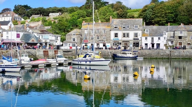
The Camel Estuary is one of Cornwall’s most appealing coastal destinations, with pretty Padstow on one side and fashionable Rock on the other.
Rock is popular for watersports, including sailing, paddleboarding and water-based activities, while nearby Polzeath is a particularly good choice for surfing and bodyboarding.
Across the estuary, Padstow is famous for its excellent seafood restaurants, working harbour and lively atmosphere. Enjoy locally caught fish, explore the independent shops and spend some time wandering around the harbour.
The Camel Trail, a largely traffic-free walking and cycling route following a former railway line between Padstow, Wadebridge and Bodmin, is another excellent way to explore the area.
A passenger ferry connects Rock and Padstow, making it easy to visit both without driving around the estuary.
Newquay
Continue south along the Atlantic Highway towards Newquay, one of Cornwall’s best-known seaside resorts and the surfing capital of England.
With several beautiful sandy beaches, a lively town centre and excellent facilities for watersports, Newquay is a fantastic stop for families and anyone who enjoys spending time by the sea.
The town’s most famous beach is Fistral Beach, renowned for its powerful Atlantic surf and regular surfing competitions. It’s an excellent place to watch experienced surfers or book a lesson with one of the local surf schools.
For a more sheltered beach experience, head to Towan Beach near the town centre, where the distinctive house on Towan Island sits on a rocky outcrop connected to the mainland by a suspension bridge.
Nearby Great Western Beach and Tolcarne Beach are also popular for swimming, sunbathing and family days out, although conditions vary with the tides and weather.
Newquay has a lively atmosphere during summer, with plenty of cafés, restaurants, beach bars and independent shops. It’s also a good base for exploring the surrounding coastline, including Watergate Bay, a vast sandy beach popular with surfers, walkers and families.
For something different, visit Newquay Zoo, home to a variety of animals and conservation projects, or take a walk along the clifftops towards Pentire Headland for spectacular views across Fistral Beach and the Atlantic.
If you’re travelling with a motorhome, check parking restrictions carefully, as some of Newquay’s central car parks have height barriers or restrictions on larger vehicles.
Newquay can be extremely busy during the summer holidays, particularly in July and August, so consider visiting in May, June or September for quieter beaches and easier parking.
St Ives
St Ives is one of Cornwall’s best-known seaside towns, famous for its beautiful beaches, picturesque fishing harbour and thriving arts scene.
The town has several excellent beaches, including Porthmeor, popular with surfers, and Porthminster, known for its sheltered sands and clear water. Its narrow streets are packed with independent shops, galleries, restaurants and traditional pubs.
Art lovers shouldn’t miss Tate St Ives and the Barbara Hepworth Museum and Sculpture Garden, both celebrating the town’s long association with artists.
During summer, St Ives has a lively, cosmopolitan atmosphere, with restaurants and bars staying open into the evening. It’s also an excellent base for exploring the western tip of Cornwall.
St Ives gets extremely busy during the school holidays, and parking can be difficult. If you’re travelling as a couple, try to visit before the schools break up for summer. Alternatively, use one of the park-and-ride rail services into town to avoid the worst of the traffic.
Porthcurno and the Far West
The western tip of Cornwall is home to some of the county’s most spectacular coastal scenery, with turquoise coves, rugged cliffs and fascinating historic sites.
Porthcurno is one of our all-time favourite beaches. Its beautiful white sand and clear water are overlooked by the extraordinary Minack Theatre, an open-air theatre carved into the cliffs above the Atlantic. Even if you’re not attending a performance, it’s worth visiting for the spectacular views.
In summer, arrive at Porthcurno early because the car park fills quickly and the narrow approach roads can become congested.
Further west, Sennen Cove is another beautiful beach, popular with surfers and families. Nearby Land’s End marks the western extremity of mainland Cornwall and offers dramatic clifftop walks.
For a fascinating glimpse into Cornwall’s industrial past, visit the Botallack tin mines, where the remains of historic engine houses cling to the cliffs above the Atlantic. The surrounding landscape forms part of the Cornwall and West Devon Mining Landscape UNESCO World Heritage Site.
Head east along the southern coast to Mousehole, pronounced ‘Mowzle’, a charming fishing village with narrow lanes, granite cottages and a picturesque harbour. Parking is limited, so it’s worth visiting outside the busiest times.
Continue to Penzance, a historic harbour town with connections to Cornwall’s smuggling and maritime past, and nearby St Michael’s Mount.
This remarkable tidal island, crowned by a medieval castle and gardens, can be reached on foot along a granite causeway at low tide or by boat when the causeway is covered. Check the tide times and opening arrangements before visiting.
With so many beautiful beaches, historic villages and coastal attractions within a relatively small area, it’s worth allowing several days to explore the far west of Cornwall properly.
Related Posts: Cornwall Road Trip: The Best Itinerary, Map and Tips | Atlantic Highway: An Epic Devon and Cornwall Road Trip
Make sure you have travel insurance you can trust when visiting the United Kingdom. We recommend True Traveller for their 5-star TrustPilot reviews, variety of cover options, best activities cover as standard, great prices and excellent service.
The Cotswolds
Route: Burford → Bibury → Bourton-on-the-Water → Lower Slaughter → Cheltenham → Painswick → Bath
Distance: Approximately 100 miles, excluding detours
When to Go: May, June and September for beautiful countryside and fewer crowds, or October for autumn colours
Best For: Pretty villages, historic market towns, country walks, traditional pubs and leisurely driving
Is there anywhere more quintessentially English than the Cotswolds? This beautiful corner of southwest England is famous for its rolling green hills, honey-coloured stone cottages, traditional villages and winding country lanes bordered by dry stone walls and hedgerows.
Designated the Cotswolds National Landscape, formerly an Area of Outstanding Natural Beauty (AONB), the region stretches across several counties and is one of the most picturesque places in England for a relaxed road trip.
There is plenty to do beyond exploring the villages. Wildlife lovers should visit the WWT Slimbridge Wetland Centre, where you can discover wetland habitats and watch an extraordinary variety of birds throughout the year.
For something more active, the Cotswold Water Park offers paddleboarding, kayaking and other watersports among its network of lakes. The region is also excellent for cycling and walking, with miles of footpaths crossing open countryside, woodland and historic settlements.
The Cotswolds are best explored slowly, allowing time to stop in villages, browse independent shops and enjoy a leisurely pub lunch. With so much to see within a relatively compact area, this makes a wonderful one-week UK road trip.
Burford
The medieval town of Burford, around 30 minutes west of historic Oxford and approximately an hour and 45 minutes from London by car, is a wonderful place to begin your Cotswolds road trip.
Burford sits on the edge of an area sometimes called the Cotswolds’ Golden Triangle, broadly bordered by the A40, A44 and A429. Within this beautiful stretch of countryside are some of the region’s most attractive villages, including Kingham, Churchill, Broadwell, Bledington and Oddington.
These traditional settlements are perfect for exploring by car, with quiet lanes connecting stone cottages, village greens, ancient churches and welcoming country pubs.
Burford itself has changed remarkably little over the centuries, although it has become one of the Cotswolds’ most popular visitor destinations.
Its famous High Street slopes gently towards the River Windrush, lined with historic buildings, half-timbered houses, Georgian architecture, antique shops and independent boutiques.
Take time to wander through the side streets and narrow alleys, where you’ll find more historic buildings and plenty of lovely places to stop for lunch or afternoon tea.
If you have time, nearby Bourton-on-the-Water, often called the Venice of the Cotswolds because of its low bridges over the River Windrush, and the beautiful village of Lower Slaughter are both worth adding to your route.
Another beautiful village worth visiting is Bibury, around 20 minutes west of Burford. Often described as one of the prettiest villages in England, Bibury is famous for Arlington Row, a collection of 14th-century stone cottages originally built as a monastic wool store and later converted into weavers’ cottages.
The picturesque setting beside the River Coln makes it one of the most photographed locations in the Cotswolds. Parking is limited and the village can become very crowded during the day, so an early morning visit is particularly rewarding.
Bourton-on-the-Water and Lower Slaughter
Bourton-on-the-Water is one of the Cotswolds’ most popular villages, known for its picturesque stone bridges crossing the shallow River Windrush and its beautiful honey-coloured cottages.
Often called the Venice of the Cotswolds, Bourton is a wonderful place to wander along the riverside, browse independent shops and enjoy afternoon tea overlooking the water.
Families will enjoy the Cotswold Motoring Museum, which houses a fascinating collection of vintage cars, motorcycles and motoring memorabilia, including Brum, the little yellow car from the children’s television series.
Another popular attraction is the Model Village, a remarkable one-ninth-scale replica of Bourton-on-the-Water, built using local Cotswold stone.
Bourton gets very busy during weekends and school holidays, so arrive early if you want to enjoy the village before the crowds.
Just a short drive away is Lower Slaughter, one of the prettiest villages in the Cotswolds.
Despite its unusual name, which comes from an Old English word meaning muddy place, Lower Slaughter is a peaceful village of traditional stone cottages, a beautiful stream and a historic watermill.
The Old Mill, with its distinctive red waterwheel, is one of the village’s most photographed landmarks, while the surrounding lanes and footpaths are perfect for a leisurely stroll.
One of the loveliest ways to explore is to follow the easy walking route between Lower Slaughter and Upper Slaughter, passing through open countryside and alongside the River Eye.
Upper Slaughter is even quieter, with an attractive ford, traditional cottages and a peaceful village atmosphere.
Allow a few hours to explore both villages, particularly if you want to enjoy a walk and stop for lunch at one of the local pubs.
Parking in Lower Slaughter is limited, so avoid blocking narrow lanes or residents’ access. If you’re travelling in a larger motorhome, consider parking in Bourton-on-the-Water and exploring the surrounding villages on foot.
Cheltenham
Continue west towards Cheltenham, an elegant Regency spa town on the western edge of the Cotswolds.
Known for its grand architecture, attractive parks and lively cultural scene, Cheltenham offers a change of pace from the region’s smaller villages.
Take a stroll through the Montpellier district, where you’ll find Regency terraces, independent shops, cafés and restaurants, or explore the beautifully landscaped Imperial Gardens.
Cheltenham is particularly well known for its festivals, including the Cheltenham Literature Festival and the famous Cheltenham Festival horse racing event in March. These bring large numbers of visitors, so accommodation and parking can be more difficult during major events.
The town also makes a convenient base for exploring the surrounding countryside, with scenic roads leading towards Winchcombe, Broadway and the Cotswold escarpment.
If you enjoy historic houses and gardens, consider a detour to Sudeley Castle near Winchcombe, where Katherine Parr, the last wife of Henry VIII, is buried.
Painswick
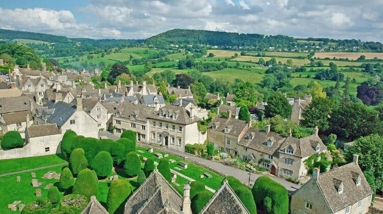
Painswick, affectionately known as the Queen of the Cotswolds, is a beautiful historic wool town and one of the best-preserved settlements in the region.
Built largely from locally quarried Cotswold stone, its narrow streets, traditional cottages and elegant buildings reflect the wealth generated by the wool trade during the Middle Ages.
Close enough to Cheltenham to make exploring easy, Painswick is surrounded by small country roads and tiny villages that are a pleasure to discover at a leisurely pace.
The town sits approximately halfway along the Cotswold Way National Trail, a 102-mile walking route following the Cotswold escarpment between Chipping Campden and Bath.
If you enjoy walking, head up to Painswick Beacon, an Iron Age hillfort offering spectacular panoramic views across the Severn Valley towards the mountains of Wales. On a clear day, the views are superb.
Back in the village, don’t miss St Mary’s Church, famous for its collection of ancient yew trees in the churchyard, or the beautiful Rococo Garden, an unusual 18th-century garden set in a hidden valley just outside town.
Painswick is a lovely place to spend a night, particularly if you prefer somewhere quieter than Cheltenham.
Bath
Finish your Cotswolds road trip in the magnificent city of Bath, celebrated for its Roman heritage, natural hot springs and elegant Georgian architecture.
A UNESCO World Heritage Site, Bath is one of England’s most beautiful historic cities and makes a fitting finale to this scenic driving route.
Start at the fascinating Roman Baths, built around Britain’s only natural hot springs used for bathing in Roman times. The remarkably preserved complex offers an insight into Roman life, with ancient bathing chambers, archaeological finds and the famous Great Bath.
For a more modern spa experience, visit Thermae Bath Spa, where you can bathe in naturally warm, mineral-rich water and enjoy views across the city from the rooftop pool.
Make time to admire the magnificent Royal Crescent, a sweeping terrace of Georgian townhouses, and the nearby Circus, an extraordinary circular arrangement of elegant period buildings.
Bath also has strong literary connections, particularly with Jane Austen, who lived in the city during the early 19th century. Fans can visit the Jane Austen Centre or explore the streets and landmarks associated with her time here.
The city is compact enough to explore on foot, and its independent shops, cafés, restaurants and traditional pubs make it a wonderful place to spend a couple of days.
Parking in central Bath can be expensive and difficult, particularly for larger vehicles. Consider using one of the city’s park-and-ride services and exploring the historic centre on foot.
Related Post: Road Trips from London: The 6 Best Routes to Explore
Dorset
Route: Bournemouth → Swanage → Corfe Castle → Kimmeridge → Lulworth → Weymouth → Portland → Abbotsbury
Distance: Approximately 100 miles, excluding detours
When to Go: May, June and September for coastal walks, pleasant weather and fewer crowds
Best For: Jurassic Coast scenery, fossil hunting, sandy beaches, historic castles and traditional seaside towns
Dorset is home to one of England’s most spectacular stretches of coastline, making it an excellent choice for a scenic UK road trip. With dramatic limestone cliffs, beautiful beaches, traditional fishing villages and lively seaside resorts, there’s plenty to discover along this relatively short route.
The county’s biggest attraction is the magnificent Jurassic Coast, a 95-mile stretch of coastline running from Exmouth in East Devon to Studland Bay in Dorset. Designated a UNESCO World Heritage Site, its cliffs reveal around 185 million years of geological history, with fossils, extraordinary rock formations and even the remains of an ancient fossil forest.
Start in Bournemouth, famous for its long sandy beaches and traditional seaside atmosphere, before heading west towards the Isle of Purbeck and the Jurassic Coast. Along the way, you’ll find everything from family-friendly beaches and historic castles to excellent walking routes and opportunities for kayaking and paddleboarding.
Allow at least three or four days for this Dorset road trip, or longer if you want to spend time exploring the beaches and walking sections of the coast. The roads around the most popular attractions can become congested during summer, particularly at weekends and during school holidays.
Swanage and the Isle of Purbeck
Swanage is a traditional English seaside resort that became popular during the Victorian era, when sea bathing and coastal holidays were fashionable.
Located at the eastern end of the Jurassic Coast on the Isle of Purbeck, Swanage has a sheltered sandy beach, a picturesque pier and a lively seafront lined with cafés, shops and traditional seaside attractions.
One of the town’s highlights is the Swanage Railway, a heritage steam railway that runs through the beautiful Purbeck countryside towards Corfe Castle. It’s a wonderful way to experience the landscape without driving.
Nearby Corfe Castle is one of Dorset’s most recognisable landmarks. The dramatic ruins of this medieval fortress stand high above the village of the same name, with spectacular views across the surrounding countryside.
Originally built following the Norman Conquest, the castle played an important role in English history before being partially demolished during the English Civil War. Today, its atmospheric ruins are managed by the National Trust and are well worth exploring.
Swanage is also known for its wreck diving, with several historic shipwrecks lying offshore, while the nearby Durlston Country Park offers fantastic coastal walking, wildlife watching and views from the cliffs.
The park’s restored Victorian castle houses exhibitions and a visitor centre, and the surrounding coastline is particularly good for spotting seabirds, dolphins and other marine wildlife.
Lulworth Cove and Durdle Door
Continue west across the Isle of Purbeck towards two of Dorset’s most famous natural landmarks, Lulworth Cove and Durdle Door.
Lulworth Cove is an almost perfectly circular bay, formed over millions of years as the sea eroded through bands of rock with different levels of resistance. It’s considered one of Europe’s finest examples of a coastal landform created by this type of erosion.
The sheltered cove is a wonderful place to spend a few hours, with its clear water, shingle beach and surrounding limestone cliffs. Kayaking, paddleboarding and swimming are popular in suitable conditions, although the beach can become very busy in summer.
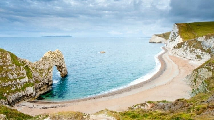
Just along the coast is Durdle Door, one of the most photographed natural landmarks in England. This extraordinary limestone arch rises from the sea beside a beautiful shingle beach, backed by the imposing cliffs that make the Jurassic Coast so distinctive.
The walk down to Durdle Door is steep, with steps and uneven ground, so wear suitable footwear. There are also steep drops and unstable cliffs in places, and swimming can be dangerous because of strong currents and rapidly shelving water.
Both Lulworth Cove and Durdle Door lie on the magnificent South West Coast Path, England’s longest National Trail, which runs for 630 miles from Minehead in Somerset to Poole Harbour in Dorset.
For more spectacular scenery, follow the coast path west from Lulworth Cove towards the quieter stretches of coastline around Kimmeridge Bay. Parts of this route cross or border the Lulworth military ranges, so check public access arrangements before setting off.
Kimmeridge Bay is particularly fascinating for its geology, with extensive rock ledges, fossil-rich cliffs and the remains of an ancient fossil forest nearby. The bay is also popular for rock pooling and snorkelling in suitable conditions.
The surrounding cliffs can be unstable, so fossil collecting should be limited to loose material where permitted, and it’s important to keep well away from the cliff edges.
Chesil Beach and Portland
Continue west towards Weymouth, another traditional English seaside town with a sweeping sandy beach, colourful harbour and plenty of places to enjoy fish and chips overlooking the water.
From Weymouth, head towards the extraordinary Chesil Beach, one of Dorset’s most distinctive natural landmarks.
This remarkable 18-mile shingle barrier stretches from West Bay towards the Isle of Portland and is estimated to contain around 180 billion pebbles. The stones gradually change in size along its length, becoming larger towards Portland.
Chesil Beach separates the sea from the shallow tidal waters of the Fleet Lagoon, an important habitat for wildlife and birds.
For one of the best views across Chesil Beach and the Fleet, visit Abbotsbury Subtropical Gardens, where exotic plants thrive in the sheltered coastal valley.
Nearby Abbotsbury Swannery is home to a large breeding colony of mute swans, which nest in the sheltered waters of the Fleet Lagoon. It’s a fascinating place to visit, particularly during spring and early summer when the cygnets are hatching.
The Abbotsbury area has also featured in film productions, including the Harry Potter films, adding another reason to explore this beautiful stretch of coast.
If you have time, drive south across the causeway to the Isle of Portland, a rugged limestone peninsula connected to the mainland by a narrow strip of land.
At its southern tip stands the distinctive red-and-white Portland Bill Lighthouse, overlooking the turbulent waters where the English Channel meets the Portland Race.
The exposed headland is a spectacular place for a coastal walk, with dramatic seascapes, historic quarries and views along the Jurassic Coast.
Portland is also known for its maritime history and excellent diving opportunities, with numerous shipwrecks lying in the surrounding waters.
Related Post: A South England Road Trip to Dorset and the New Forest
The Lake District
Route: Ullswater → Keswick → Borrowdale → Honister Pass → Grasmere → Ambleside → Windermere
Distance: Approximately 75 miles, excluding detours
When to Go: May, June and September for walking and outdoor activities, or October for spectacular autumn colours
Best For: Mountain scenery, beautiful lakes, hiking, watersports and adventurous driving
The rugged Lake District in Cumbria is one of England’s most spectacular national parks and home to some of the most scenic roads in the UK. Known as Wordsworth country, its dramatic mountains, deep valleys and beautiful lakes have inspired poets, writers and artists for centuries.
This is a fantastic UK road trip for active families and couples, with opportunities for hiking, mountain biking, kayaking, paddleboarding and sailing. The national park is also a UNESCO World Heritage Site, recognised for its distinctive cultural landscape and the relationship between people and the land.
There are 16 main lakes and numerous smaller tarns across the Lake District, surrounded by some of England’s highest mountains. You can explore the lively towns of Keswick and Ambleside or escape into quieter valleys where the scenery feels wonderfully remote.
Although the driving distances are relatively short, allow at least three or four days for this road trip, and preferably longer if you enjoy walking. Narrow roads, steep mountain passes and frequent stops to admire the views mean journeys often take much longer than expected.
If you’re driving a large motorhome, plan your route carefully. Some of the Lake District’s most scenic roads, particularly Honister Pass, Hardknott Pass and Wrynose Pass, have steep gradients, tight bends and narrow sections that are unsuitable for larger vehicles.
Ullswater
Start your Lake District road trip at Ullswater, the second-largest lake in the national park and one of its most beautiful.
Surrounded by dramatic fells, Ullswater stretches for around seven and a half miles through a spectacular glacial valley. Its peaceful shores and surrounding mountains make it a wonderful place to enjoy the outdoors.
One of the area’s most popular attractions is Aira Force, a magnificent 65-foot waterfall set among ancient woodland. A network of walking trails leads through the trees to viewpoints overlooking the falls, with longer routes continuing onto Gowbarrow Fell.
For a more challenging walk, tackle Helvellyn, England’s third-highest mountain, which rises above the western side of Ullswater. The famous Striding Edge route is an exhilarating ridge scramble for experienced walkers with a good head for heights, but there are less exposed approaches to the summit.
If you prefer something gentler, take a trip on one of the historic Ullswater Steamers, which connect lakeside locations including Glenridding, Pooley Bridge and Howtown. The views of the surrounding mountains from the water are superb.
Ullswater is also an excellent place for kayaking, paddleboarding and sailing, with equipment hire available around the lake during the main season.
Keswick
Continue west towards Keswick, a lively market town sitting between beautiful Derwentwater and the imposing Skiddaw mountain range.
Keswick is one of the Lake District’s main centres for outdoor activities, with independent shops, traditional pubs, cafés and outdoor equipment retailers lining its streets.
Derwentwater is particularly beautiful, with wooded islands, dramatic mountain reflections and walking trails around its shores. You can hire a rowing boat or kayak, take a cruise on a traditional launch or simply enjoy the views from the lakeside.
One of the most rewarding walks in the area is Catbells, a relatively modest fell on the western shore of Derwentwater. Although the climb involves some steep sections, the summit rewards walkers with spectacular views across the lake towards Keswick and the surrounding mountains.
For something different, visit the prehistoric Castlerigg Stone Circle, just outside Keswick.
Dating back around 4,500 years, this atmospheric Neolithic monument is one of Britain’s earliest stone circles and occupies an extraordinary position surrounded by mountains. It’s particularly beautiful in the early morning or late afternoon when the light catches the surrounding fells.
More experienced walkers can tackle Skiddaw, one of England’s highest mountains, or explore the many trails leading into the surrounding valleys.
Keswick is also a good place to spend a night or two, with plenty of accommodation and restaurants, and easy access to some of the national park’s finest scenery.
Borrowdale and Honister Slate Mine
From Keswick, follow the eastern shore of Derwentwater south into Borrowdale, one of the Lake District’s most beautiful valleys.
The road winds past woodland, traditional stone cottages and dramatic fells, with lovely places to stop for short walks and photographs.
Continue towards Seatoller and the steep climb to Honister Pass, where the road crosses the mountains between Borrowdale and Buttermere.
At the top of the pass is Honister Slate Mine, England’s last working slate mine and one of the Lake District’s most unusual visitor attractions.
The mine offers guided underground tours exploring its fascinating industrial history, including the difficult conditions experienced by generations of slate miners.
For those looking for adventure, Honister also offers a range of adrenaline-filled activities, including a Via Ferrata climbing experience, underground adventure courses and the spectacular Infinity Bridge, suspended high above the mountain landscape.
These activities are great fun for adventurous families with older children and adults, although age, height and other participation restrictions apply.
The scenery around Honister Pass is extraordinary, with steep mountainsides, rocky slopes and views towards the surrounding valleys.
The pass itself is one of the steepest roads in England, with gradients reaching around 25% and narrow sections where passing other vehicles can be difficult.
It’s a memorable drive in a suitable vehicle and good conditions, but larger motorhomes should avoid it. If you’re travelling in a motorhome, you can visit Borrowdale from Keswick and return the same way rather than crossing the pass.
Grasmere
Head south towards Grasmere, one of the prettiest villages in the Lake District and closely associated with the Romantic poet William Wordsworth.
Wordsworth described Grasmere as the loveliest spot that man hath ever found, and it’s easy to understand why. The village is surrounded by beautiful fells, with a peaceful lake, traditional stone cottages and plenty of lovely walking routes.
Visit Dove Cottage, where Wordsworth lived with his sister Dorothy and later his wife Mary. The adjoining museum explores the poet’s life and his connection to the Lake District.
Another popular stop is St Oswald’s Church, where Wordsworth and several members of his family are buried.
Don’t leave without trying the famous Grasmere Gingerbread, made to a closely guarded recipe dating back to 1854 and sold from a tiny shop beside the church.
For a beautiful walk, follow the paths around Grasmere Lake or head towards nearby Rydal Water, where you’ll find woodland trails, small beaches and wonderful views of the surrounding mountains.
Ambleside and Windermere
Continue south through the heart of the Lake District towards Ambleside, a bustling town at the northern end of Windermere.
Ambleside is a popular base for exploring the national park, with excellent walking routes, outdoor shops, restaurants and traditional pubs.
One of its best-known landmarks is Bridge House, a tiny 17th-century building standing over Stock Beck. Originally used for storage, it’s now cared for by the National Trust and is one of the most photographed buildings in the Lake District.
Just outside town, a short woodland walk leads to Stock Ghyll Force, a beautiful waterfall surrounded by trees.
From Ambleside, follow the road south towards Windermere, England’s largest natural lake, which stretches for more than ten miles through the southern Lake District.
The lakeside town of Bowness-on-Windermere is a lively place to finish your road trip, with boat cruises, watersports, shops and restaurants overlooking the water.
Take a cruise on Windermere Lake Cruises to enjoy the scenery from a different perspective, or hire a small boat and explore at your own pace.
Families may enjoy visiting The World of Beatrix Potter Attraction in Bowness, celebrating the much-loved children’s author who lived in the Lake District and drew inspiration from its countryside and wildlife.
For a quieter experience, head to the western shore of Windermere, where you’ll find woodland walks, peaceful lakeside paths and beautiful views away from the busiest tourist areas.
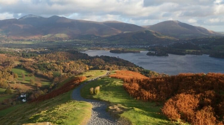
The Lake District is especially beautiful in autumn, when the woodland around Derwentwater, Grasmere and Windermere turns shades of gold and copper. It’s one of our favourite times to explore the national park, although the weather can change quickly and the mountain roads require extra care.
Related Post: Road Trip England: 10 of the Best Routes
The New Forest
Route: Fordingbridge → Lyndhurst → Brockenhurst → Lymington
Distance: Approximately 30 miles, excluding detours
When to Go: May, June and September for outdoor activities, or October for beautiful autumn colours and wildlife watching
Best For: Free-roaming ponies, woodland walks, cycling, watersports and family adventures
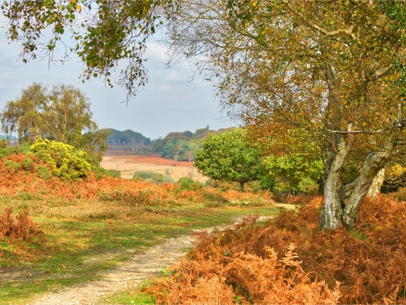
The historic New Forest in Hampshire is one of England’s most distinctive landscapes, with ancient woodland, open heathland, traditional villages and thousands of free-roaming animals. It’s a wonderful destination for a relaxed UK road trip, particularly if you enjoy wildlife and spending time outdoors.
Established as a royal hunting forest by William the Conqueror in 1079, the New Forest retains a strong sense of tradition. Its famous ponies roam freely alongside cattle, donkeys and deer, while pigs are released onto the open forest during the autumn pannage season to forage for fallen acorns and other nuts.
Autumn is a particularly special time to visit, when the summer crowds have gone, the woodland turns beautiful shades of gold and copper, and you may be lucky enough to see rutting deer. Spring is equally lovely, with newborn foals grazing on the open heathland.
The New Forest is also a hub for outdoor activities, with excellent walking and cycling trails, horse riding, kayaking and paddleboarding. Just a few hours from London, it’s one of the best UK road trips for an activity-filled long weekend.
Driving through the national park is part of the experience, with quiet roads crossing open heathland and passing through beautiful stretches of woodland. However, the free-roaming animals have right of way in practice, and drivers need to be especially careful. Many unfenced roads have a 40mph speed limit, and ponies and cattle can wander onto the carriageway without warning.
Fordingbridge and Lyndhurst
Start your New Forest road trip in Fordingbridge, a traditional market town on the River Avon at the western edge of the national park.
Known for its historic seven-arched bridge, independent shops and riverside setting, Fordingbridge makes a pleasant introduction to the New Forest.
From here, head east towards Lyndhurst, often described as the capital of the New Forest. This lively village is home to the New Forest Heritage Centre, where you can learn about the forest’s history, wildlife and the traditional commoning system that allows local animals to graze freely.
Lyndhurst is also a good starting point for exploring the surrounding woodland and heathland on foot or by bicycle.
Nearby Bolderwood is one of the best-known places to spot deer, with a viewing platform overlooking an area where fallow deer are often seen. Sightings aren’t guaranteed, but the surrounding woodland walks are lovely at any time of year.
Brockenhurst
Brockenhurst is a charming village in the southern part of the New Forest and an excellent base for cycling and walking.
Ponies, cattle and donkeys frequently wander through the village, grazing on roadside verges and occasionally holding up traffic. It’s one of the things that makes Brockenhurst such a memorable place to visit.
The village has several welcoming pubs, cafés and independent shops, including the excellent Rainbow Fish Bar for traditional fish and chips.
Brockenhurst is particularly popular with cyclists, with miles of waymarked gravel tracks leading through woodland and across open heathland. You can hire bicycles locally or bring your own and follow one of the many designated cycling routes.
The New Forest National Park Authority provides useful walking and cycling information, including maps and guidance on where cycling is permitted.
For a lovely walk, head towards the surrounding woodland at Balmer Lawn or explore the forest tracks around Ober Water, where streams wind through ancient trees and open clearings.
Brockenhurst also has a mainline railway station, making it one of the easiest places in the national park to reach without a car.
New Forest Water Park
On the western fringes of the national park, near Fordingbridge, New Forest Water Park is a fantastic destination for families and anyone who enjoys getting out on the water.
The park offers wakeboarding, kayaking and stand-up paddleboarding, along with a giant inflatable aqua park where you can climb, slide, jump and scramble across floating obstacles.
The inflatable course is brilliant fun, although staying upright is much harder than it looks! It’s an excellent way to spend a few hours on a warm summer day, particularly with older children and teenagers.
Activities are seasonal and some have age or other participation restrictions, so check opening dates and book ahead during busy periods.
As the water park is close to Fordingbridge, it makes sense to visit at the beginning of your road trip or as a short detour before continuing towards Brockenhurst.
Lymington
Finish your New Forest road trip in Lymington, a bustling Georgian market town on the southwestern edge of the national park.
With its attractive High Street, historic buildings, independent shops and busy harbour, Lymington is a lovely place to spend a day or two.
The town is a major sailing centre, with marinas and boatyards lining the waterfront and easy access to the Solent. Take a stroll along the quayside to watch the yachts coming and going, or enjoy a seafood lunch overlooking the harbour.
From Lymington, you can visit Hurst Castle, an artillery fortress built by Henry VIII on a long shingle spit extending into the Solent.
The castle occupies a dramatic position overlooking the western entrance to the Solent, with views towards the Isle of Wight. Access is normally by walking along Hurst Spit from Milford-on-Sea or by seasonal ferry from Keyhaven, although parts of the castle have been affected by coastal erosion and storm damage. Check current access arrangements before travelling.
On warmer days, head to the historic Lymington Sea Water Baths, one of the oldest outdoor seawater swimming pools in the UK. It’s a great place for a refreshing swim, with seasonal inflatable activities and family-friendly facilities.
Lymington also makes an excellent base for visiting the Isle of Wight, which lies across the Solent.
The island was once home to Queen Victoria, who spent time at Osborne House near East Cowes, and is known for its beautiful beaches, coastal scenery and traditional seaside towns.
You can take the Wightlink car ferry from Lymington to Yarmouth, making it easy to explore the western side of the island on a day trip.
If you have time, consider extending your New Forest road trip with a few days on the Isle of Wight, where you’ll find more scenic driving routes, historic attractions and beautiful coastal walks.
Related Post: Top 16 New Forest Outdoor Adventures
Norfolk
Route: Norwich → Wroxham → Winterton-on-Sea → Horsey → Cromer → Blakeney → Hunstanton → King’s Lynn
Distance: Approximately 125 miles, excluding detours
When to Go: May, June and September for coastal walks and wildlife watching, or November to January for the grey seal pupping season
Best For: Unspoilt beaches, seal watching, the Norfolk Broads, traditional seaside towns and historic villages
Norfolk is one of England’s most beautiful counties for a leisurely road trip, with wide-open landscapes, huge skies, traditional seaside towns and an extraordinary coastline. Its peaceful country roads take you through pretty villages, alongside salt marshes and past some of the best wildlife habitats in the UK.
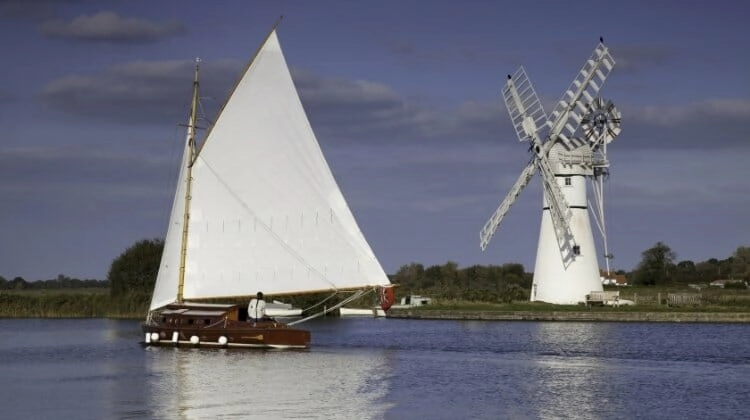
The county is famous for the Norfolk Broads, a network of rivers and shallow lakes formed largely through medieval peat digging. Now protected as the Broads National Park, this beautiful landscape is a haven for birds and wildlife, with miles of waterways to explore.
One of the best ways to experience the Broads is from the water, either by hiring a day boat or taking a trip on a traditional Norfolk wherry, a historic sailing craft once used to transport goods around the region.
Norfolk’s coastline is equally impressive, with vast sandy beaches, traditional seaside resorts and nature reserves where you can spot seals and migrating birds. The North Norfolk coast is particularly beautiful, with salt marshes, dunes and expansive views across the North Sea.
Allow at least four or five days for this Norfolk road trip, and longer if you want to spend time exploring the Broads and the coast. The roads are generally easy to drive, although some coastal villages have narrow streets and parking can be difficult during summer weekends.
Norwich
Start your Norfolk road trip in Norwich, one of England’s best-preserved medieval cities and a fantastic place to spend a day or two.
The historic city centre is filled with cobbled streets, timber-framed buildings, independent shops and an excellent selection of restaurants and traditional pubs.
One of the city’s most impressive landmarks is Norwich Cathedral, a magnificent Norman building with the second-tallest cathedral spire in England. Its beautiful cloisters, intricate stonework and peaceful cathedral close are well worth exploring.
Nearby Norwich Castle, built by the Normans as a royal palace and fortress, dominates the city skyline. Today it houses a museum and art gallery, with collections exploring Norfolk’s history, archaeology and natural world.
Don’t miss the Norwich Lanes, a maze of narrow pedestrian streets lined with independent boutiques, cafés, vintage shops and galleries. It’s one of the most characterful parts of the city and a lovely place to wander.
Norwich is also known for its excellent food scene, with everything from traditional market stalls to independent restaurants. Norwich Market, with its distinctive striped roofs, is one of the largest permanent outdoor markets in the country.
If you enjoy history, take time to explore Elm Hill, a beautiful cobbled street lined with Tudor buildings that feels remarkably unchanged over the centuries.
Wroxham and the Norfolk Broads
From Norwich, head north towards Wroxham, often described as the capital of the Norfolk Broads.
Situated on the River Bure, Wroxham is one of the best places to experience this unique wetland landscape, with boat hire companies, riverside cafés and easy access to the surrounding waterways.
Hire a small motorboat for a few hours and explore the peaceful rivers and broads at your own pace, passing reed beds, waterside cottages and traditional windmills.
For a more traditional experience, look for a sailing trip aboard a Norfolk wherry. These distinctive vessels, with their large black sails, were once an essential part of the region’s transport network and are now an important part of its heritage.
The Broads are particularly good for wildlife watching, with opportunities to spot kingfishers, herons, marsh harriers and a variety of waterfowl.
Nearby Ranworth Broad is worth visiting for its floating wildlife centre and boardwalk through the reed beds, while the surrounding villages offer peaceful walks and attractive riverside pubs.
If you have time, consider a detour to Horning, one of the prettiest villages on the River Bure, where traditional cottages and boats line the waterfront.
Winterton-on-Sea and Horsey
Continue east from the Norfolk Broads towards Winterton-on-Sea, a peaceful coastal village known for its beautiful sandy beach, rolling dunes and wonderful wildlife.
Unlike Norfolk’s busier seaside resorts, Winterton has a wonderfully unspoilt feel, with miles of golden sand backed by the Winterton Dunes National Nature Reserve. The dunes are an important habitat for rare plants, birds and insects, and the surrounding landscape is particularly beautiful in the softer light of early morning or late afternoon.
Winterton is a fantastic place for a long beach walk, with a traditional village pub and café providing somewhere to stop afterwards. The coastline is also popular with birdwatchers, particularly during spring and autumn migration.
A short drive north brings you to Horsey, one of the best places in the UK to see grey seals in their natural habitat.
Every winter, thousands of grey seals gather along the beaches at Horsey and neighbouring Winterton to give birth to their pups. The main pupping season generally runs from November to January, when the beaches can be covered with mothers and their fluffy white pups.
It’s an extraordinary wildlife spectacle, and one of the highlights of visiting Norfolk in winter. Volunteer wardens from Friends of Horsey Seals help protect the colony and manage visitor access during the breeding season.
Keep well away from the seals, never approach or touch a pup, and follow the marked viewing routes. Dogs should be kept on leads, and some sections of beach may be temporarily closed to protect the animals.
Away from the coast, visit Horsey Windpump, a beautifully restored historic drainage windmill overlooking Horsey Mere and the surrounding Norfolk Broads.
The windpump offers fascinating insight into how the region’s wetlands were managed, and the views across the reed beds and waterways are particularly lovely.
If you have time, explore the quiet lanes around Horsey Mere or take a walk through the surrounding marshland, where you may spot marsh harriers, herons and other wetland birds.
Winterton and Horsey are particularly rewarding outside the main summer season, offering a quieter coastal experience and some of Norfolk’s finest wildlife watching.
Cromer
Follow the coast north towards Cromer, a traditional Victorian seaside town famous for its pier, sandy beach and delicious local crab.
Cromer has been a popular holiday destination since the 19th century, and much of its old-fashioned seaside charm remains.
Take a stroll along Cromer Pier, one of the town’s best-loved landmarks, where you can enjoy views along the coastline or catch a traditional variety show at the Pavilion Theatre.
The town is particularly famous for Cromer crab, prized for its sweet, delicate flavour. You’ll find it served in local restaurants, cafés and seafood shops, often dressed and ready to eat.
For beautiful coastal views, walk along the clifftop paths towards Overstrand or head west towards Sheringham, another attractive seaside town with a heritage railway and traditional high street.
Cromer is also a good place to explore the Norfolk Coast Path, which follows much of the county’s spectacular shoreline.
Blakeney and the North Norfolk Coast
Continue west towards Blakeney, one of the most picturesque villages on the North Norfolk coast.
Set within the Norfolk Coast National Landscape, formerly designated an Area of Outstanding Natural Beauty, Blakeney is surrounded by salt marshes, tidal creeks and wide-open landscapes that stretch towards the sea.
The village has a charming harbour, narrow streets, traditional flint cottages and several excellent pubs and restaurants.
At high tide, small boats gather in the harbour, while at low tide the mudflats and creeks provide feeding grounds for wading birds.
Crabbing from the harbour wall is a popular family activity, although it’s important to return any crabs carefully to the water.
One of the highlights of visiting Blakeney is taking a boat trip to Blakeney Point, a protected nature reserve home to one of England’s largest grey seal colonies.
Both grey and common seals can be seen around the reserve, with grey seals giving birth to their pups during winter. Boat trips usually depart from nearby Morston and operate according to the tides and weather conditions.
The surrounding salt marshes are also excellent for birdwatching, particularly during spring and autumn migration.
For more beautiful coastal scenery, continue west towards Wells-next-the-Sea and Holkham, where vast sandy beaches, pine woods and dunes make for wonderful walks.
Holkham Beach is particularly impressive at low tide, when the sand stretches seemingly endlessly towards the sea.
Hunstanton and Sandringham
Head west towards Hunstanton, a traditional seaside resort overlooking the Wash.
Known locally as Sunny Hunny, the town is famous for its unusual striped cliffs, formed from layers of red limestone, white chalk and brown sandstone.
Unlike most of Norfolk’s coastline, Hunstanton faces west, making it one of the few places on England’s east coast where you can watch the sun set over the sea.
The town has a traditional promenade, sandy beach, seaside attractions and plenty of places to enjoy fish and chips.
From Hunstanton, head south towards the royal estate of Sandringham, one of the British royal family’s best-known country residences.
Set within beautiful woodland and landscaped grounds, Sandringham has been a private royal retreat since the 19th century and remains closely associated with the royal family’s Christmas celebrations.
Visitors can explore Sandringham House and Gardens during the seasonal opening period, along with the surrounding parkland and woodland walking trails.
The estate also hosts events throughout the year, including farmers’ markets, craft fairs and seasonal activities.
Don’t miss St Mary Magdalene Church, where members of the royal family traditionally attend services during their stays at Sandringham.
The church is surrounded by beautiful grounds and contains memorials connected to the royal family.
Finish your Norfolk road trip in King’s Lynn, a historic market town and former Hanseatic port with an impressive collection of medieval buildings.
Explore the historic waterfront, Tuesday Market Place and the beautiful Custom House, which reflects the town’s importance as a trading port during the Middle Ages.
King’s Lynn is a fitting place to finish this relaxed road trip through one of England’s most distinctive and rewarding counties.
Related Post: Things to Do in Norfolk: 37 of the Very Best Attractions
Northumberland Coast Route
Route: Alnmouth → Craster → Embleton → Beadnell → Seahouses → Bamburgh → Holy Island of Lindisfarne → Alnwick
Distance: Approximately 75 miles, excluding detours
When to Go: May, June and September for coastal walks and quieter beaches, or autumn for beautiful light and wildlife watching
Best For: Magnificent castles, vast sandy beaches, historic fishing villages, coastal walks and early medieval history
The Northumberland coast is one of England’s most spectacular stretches of coastline, with enormous sandy beaches, dramatic castles, traditional fishing villages and peaceful country roads. It’s an excellent choice for a UK road trip if you enjoy history, wildlife and exploring places that feel a world away from the busier seaside resorts of southern England.
Much of the coastline is protected as the Northumberland Coast National Landscape, formerly an Area of Outstanding Natural Beauty, and is famous for its wide-open beaches, rolling dunes and extraordinary views across the North Sea.
Northumberland is home to some of England’s most impressive castles, including Bamburgh and Alnwick, as well as the tidal Holy Island of Lindisfarne, one of the country’s most important early Christian sites. Further inland, you’ll find Hadrian’s Wall, built by the Romans across northern England, which makes a worthwhile extension if you have more time.
The region is also fantastic for walking, with the Northumberland Coast Path connecting beaches, historic settlements and nature reserves. Birdwatching is particularly rewarding, especially around the Farne Islands, where thousands of seabirds gather during the breeding season.
Allow at least three or four days for this coastal road trip, and longer if you want to explore the castles, take a boat trip and spend time on the beaches. The main roads are generally straightforward, although the lanes leading into some coastal villages can be narrow and parking is limited during summer.
Alnmouth
Start your Northumberland road trip in Alnmouth, a picturesque coastal village where the River Aln meets the North Sea.
With its colourful houses, traditional pubs and sweeping sandy beach, Alnmouth is a lovely place to begin exploring the coast. The village was once an important trading port, although changes to the river mouth during a violent storm in 1806 contributed to its decline as a harbour.
Today, Alnmouth is a peaceful destination with independent cafés, galleries and beautiful coastal walks.
Take a stroll along the beach, where the vast expanse of sand and views towards the estuary are particularly impressive at low tide. The dunes and surrounding grasslands are also important wildlife habitats.
The river mouth can have dangerous currents and shifting sands, so it’s best to enjoy the scenery from the shore rather than attempting to cross the estuary.
Alnmouth is also an excellent base for exploring nearby Alnwick, which you’ll visit towards the end of this route.
Craster and Dunstanburgh Castle
Continue north to Craster, a traditional fishing village famous for its smoked kippers and beautiful coastal setting.
The village has a small harbour, stone cottages and a handful of welcoming pubs and cafés. It’s a wonderful place to stop for lunch, particularly if you enjoy fresh seafood.
Craster kippers have been produced here for generations, and the village’s traditional smokehouse remains an important part of its identity.
One of the highlights of visiting Craster is the spectacular coastal walk to Dunstanburgh Castle.
The ruined 14th-century fortress stands on a dramatic headland overlooking the North Sea, surrounded by open grassland and rocky cliffs. Built by Thomas, Earl of Lancaster, the castle later played a role in the Wars of the Roses.
The walk from Craster follows a relatively easy stretch of the Northumberland Coast Path, with beautiful views towards the castle as it rises above the coastline.
Allow around 45 minutes each way for the walk, plus time to explore the ruins. The exposed headland can be windy even in summer, so take an extra layer.
Embleton and Beadnell
Continue north towards Embleton Bay, one of Northumberland’s most beautiful beaches.
This magnificent sweep of golden sand stretches beneath the ruins of Dunstanburgh Castle, with grassy dunes and spectacular views along the coast. It’s a fantastic place for a long beach walk, particularly early in the morning when you may have much of the shoreline to yourself.
The nearby village of Embleton has traditional stone cottages and a welcoming country pub, making it a pleasant place to stop before continuing north.
Further along the coast is Beadnell, a charming fishing village with a sheltered harbour and a beautiful crescent-shaped sandy beach.
Beadnell Bay is popular for watersports, including kayaking, paddleboarding, sailing and kitesurfing. The broad sandy beach is also ideal for families, with plenty of space for games and picnics.
The village harbour is particularly interesting because of its historic lime kilns, built during the 18th century when the area was an important centre for lime production.
Both Craster and Beadnell make lovely overnight stops. After a day exploring the coast, there’s little better than a bracing beach walk followed by a traditional fish and chip supper or a meal in a cosy village pub.
Seahouses and the Farne Islands
Seahouses is a lively fishing village and one of the best places on the Northumberland coast for wildlife watching.
The busy harbour is the departure point for boat trips to the Farne Islands, a group of rocky islands famous for their extraordinary seabird colonies and grey seals.
During spring and early summer, thousands of puffins, guillemots, razorbills and Arctic terns gather on the islands to breed. Puffins are particularly popular with visitors, and the best time to see them is generally between April and July.
Grey seals can be spotted around the islands throughout the year, often resting on the rocks or swimming close to the boats.
Several local operators offer wildlife cruises, with some trips including landings when permitted. Access to individual islands can change due to wildlife protection measures, weather and conservation work, so check current arrangements before booking.
Back in Seahouses, wander around the harbour, enjoy fish and chips overlooking the water or explore the nearby beaches.
The village is also a convenient base for visiting Bamburgh, just a short drive further north.
Bamburgh Castle
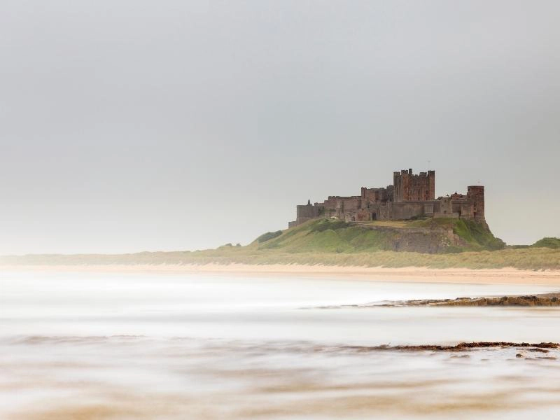
Bamburgh Castle is one of England’s most magnificent coastal fortresses, standing high on a rocky outcrop overlooking a vast sandy beach and the North Sea.
The castle occupies a site that has been fortified for more than 1,400 years and was once the royal seat of the ancient kingdom of Northumbria.
Much of the building you see today dates from later medieval periods and extensive Victorian restoration, but its dramatic setting and long history make it one of Northumberland’s most impressive attractions.
Visit Bamburgh Castle to explore its grand state rooms, historic collections and fascinating exhibitions, including displays connected to the pioneering Victorian inventor William Armstrong, whose family restored the castle.
The views from the castle walls are spectacular, stretching along the coastline towards the Farne Islands and Holy Island on clear days.
Below the castle, Bamburgh Beach is one of the finest in England, with a huge expanse of golden sand backed by dunes. It’s a wonderful place for walking, photography and simply enjoying the dramatic scenery.
The village of Bamburgh is also worth exploring, with attractive stone cottages, traditional pubs and St Aidan’s Church, where the pioneering Victorian heroine Grace Darling is buried.
Grace became famous in 1838 when she helped her father rescue survivors from the wreck of the SS Forfarshire near the Farne Islands.
Holy Island of Lindisfarne
Continue north towards the extraordinary Holy Island of Lindisfarne, one of the most historically significant places in England.
Connected to the mainland by a tidal causeway, Holy Island can only be reached by road when the North Sea tides allow safe passage. Checking the official crossing times is absolutely essential, as the causeway floods twice daily and vehicles are regularly stranded when drivers ignore the warnings.
The island became an important centre of early English Christianity in AD 635, when St Aidan arrived from Iona and established a monastery at Lindisfarne.
The monastery later became associated with St Cuthbert, one of Northumbria’s most revered saints, and developed into an important centre of learning and religious life.
In AD 793, Viking raiders attacked the monastery, an event that shocked Christian Europe and became one of the most famous episodes in early medieval British history.
Today, you can explore the atmospheric ruins of Lindisfarne Priory, wander through the historic village and visit the striking Lindisfarne Castle, which stands on a rocky outcrop overlooking the harbour.
Originally built as a Tudor fort, Lindisfarne Castle was transformed into a country retreat in the early 20th century by architect Edwin Lutyens. It is now cared for by the National Trust.
The island is also known for its traditional mead, produced using a recipe associated with the island’s long religious heritage.
For a quieter experience, explore the surrounding beaches, dunes and nature reserve, where you can enjoy beautiful coastal scenery and excellent birdwatching.
You can also reach Holy Island on foot along the historic Pilgrims’ Way, but this involves crossing tidal sands and should only be attempted with appropriate planning and local guidance.
Before travelling, check the official Holy Island causeway crossing times and allow plenty of time to return to the mainland. Never attempt to cross outside the published safe periods.
Alnwick Castle and Gardens
Finish your Northumberland coast road trip in the historic market town of Alnwick, home to one of England’s most impressive castles.
Alnwick Castle was built following the Norman Conquest and has been extended and remodelled over the centuries. It remains the family seat of the Duke of Northumberland and combines the grandeur of a medieval fortress with the elegance of a country house.
The castle is famous for its appearances in film and television, including Robin Hood: Prince of Thieves, Elizabeth, Transformers: The Last Knight and Downton Abbey, where it appeared as Brancaster Castle.
Perhaps most famously, Alnwick Castle doubled as Hogwarts in the first two Harry Potter films, and visitors can explore some of the filming locations and take part in seasonal broomstick training activities.
Inside, the magnificent state rooms contain paintings, period furniture and historic collections reflecting the castle’s long association with the Percy family.
Next door, The Alnwick Garden is another excellent attraction, with beautifully landscaped grounds, water features and the famous Poison Garden, where visitors can learn about some of the world’s most dangerous plants on guided tours.
The garden is also home to the extraordinary Treehouse Restaurant, built among the trees and connected by wooden walkways and rope bridges.
Allow a full day to explore the castle and gardens, particularly if you’re travelling with children or enjoy historic houses.
Alnwick itself is a lovely market town, with independent shops, cafés and traditional pubs. Book lovers should visit Barter Books, one of Britain’s largest second-hand bookshops, housed in a former Victorian railway station.
It’s a wonderful place to finish a road trip through Northumberland, combining the county’s extraordinary history with the spectacular coastal scenery you’ve enjoyed along the way.
Peak District
Route: Bakewell → Castleton → Edale → Hathersage → Stanage Edge → Chatsworth House → Matlock Bath
Distance: Approximately 85 miles, excluding detours
When to Go: May, June and September for walking and outdoor activities, or August for purple heather on the moors
Best For: Dramatic moorland, scenic driving, hiking, historic villages and magnificent country houses
The Peak District was Britain’s first national park, designated in 1951, and remains one of England’s most rewarding destinations for a scenic road trip. Straddling parts of Derbyshire, Staffordshire, Cheshire, Greater Manchester and South and West Yorkshire, the national park is famous for its dramatic limestone valleys, wild moorland, rugged gritstone edges and picturesque villages.
The landscape is divided into two distinct areas. The White Peak in the south is characterised by rolling green hills, limestone dales and traditional stone villages, while the Dark Peak in the north is a wilder landscape of open moorland, peat bogs and rocky escarpments.
Driving through the Peak District is an experience in itself, with winding roads climbing over high passes, descending into deep valleys and offering spectacular views across the surrounding countryside.
Some of the most scenic drives include the Snake Pass between Glossop and Sheffield, the Cat and Fiddle road between Buxton and Macclesfield, and the dramatic Winnats Pass near Castleton. These roads are particularly beautiful in clear weather, although conditions can change quickly and some routes are unsuitable for larger motorhomes.
The national park is also fantastic for outdoor activities, with hundreds of miles of walking trails, cycling routes and opportunities for climbing, caving and watersports.
Allow at least three or four days for this Peak District road trip, or longer if you enjoy hiking and want to explore the many historic houses and villages along the way.
Bakewell
Start your Peak District road trip in Bakewell, a charming market town on the River Wye and one of the most popular destinations in the White Peak.
Bakewell is famous for its traditional Bakewell pudding, a delicious combination of puff pastry, jam and almond filling that originated in the town during the 19th century.
Several local bakeries claim to produce the original recipe, so trying a slice with a cup of tea is practically compulsory!
The town itself is lovely to explore, with attractive stone buildings, independent shops, cafés and a historic five-arched bridge crossing the River Wye.
Bakewell also makes an excellent base for walking and cycling, with easy access to the Monsal Trail, an 8.5-mile traffic-free route following a former railway line through some of the Peak District’s most beautiful limestone scenery.
The trail passes through old railway tunnels, across viaducts and alongside the River Wye, with spectacular views from the famous Monsal Head viewpoint.
Bicycles can be hired locally, making it a fantastic activity for families or anyone who wants to explore the countryside without tackling steep hills.
Castleton and Winnats Pass
Head north towards Castleton, a picturesque village surrounded by the dramatic limestone hills of the Hope Valley.
Castleton is famous for its show caves, historic castle and spectacular surrounding scenery, making it one of the best places in the Peak District for outdoor adventures.
One of the area’s most impressive natural landmarks is Winnats Pass, a steep limestone gorge with towering cliffs on either side of the road.
Driving through the pass is a memorable experience, particularly when the light catches the rugged rock faces and the valley opens out towards Castleton.
The road is narrow and steep in places, so larger motorhomes should consider alternative routes, particularly during busy periods or poor weather.
Above the village stands Peveril Castle, one of England’s earliest Norman fortresses, built shortly after the Norman Conquest.
The castle ruins occupy a dramatic position overlooking Castleton and the Hope Valley, with wonderful views from the hilltop.
Castleton is also home to several fascinating caves, including Peak Cavern, known locally as the Devil’s Arse, and Speedwell Cavern, where visitors travel by underground boat through a former lead mine.
Nearby Blue John Cavern and Treak Cliff Cavern are famous for Blue John stone, a rare variety of fluorite found in the surrounding hills.
For walkers, the ridge leading to Mam Tor, known as the Shivering Mountain, offers some of the finest views in the national park.
The circular walk from Castleton over Mam Tor and along the Great Ridge towards Lose Hill is particularly rewarding, with spectacular views across the Hope and Edale valleys.
Edale and Kinder Scout
Continue towards Edale, a small village surrounded by some of the wildest landscapes in the Peak District.
Edale is famous as the starting point of the Pennine Way, one of Britain’s best-known long-distance walking routes, which stretches for 268 miles north to Kirk Yetholm on the Scottish border.
The village is also the gateway to Kinder Scout, the highest point in the Peak District at 636 metres above sea level.
Kinder Scout is a vast gritstone plateau characterised by dramatic rock formations, peat bogs and sweeping views across the surrounding moorland.
The area played an important role in the history of public access to the countryside, particularly following the famous Kinder Scout Mass Trespass in 1932, when hundreds of walkers challenged restrictions on access to the moors.
Today, Kinder Scout is one of the most popular hiking destinations in the national park, although the terrain can be challenging and navigation difficult in poor visibility.
The walk to Kinder Downfall, a spectacular waterfall on the western edge of the plateau, is particularly rewarding after heavy rain. In strong winds, the water can even appear to blow upwards over the cliff edge.
If you prefer a gentler walk, explore the paths around Edale village or follow a section of the Pennine Way into the surrounding valley.
Edale has a couple of traditional pubs and cafés, making it a lovely place to stop after a day in the hills.
Hathersage and Stanage Edge
From Edale, head east towards Hathersage, an attractive village in the Hope Valley with strong literary connections and excellent access to the surrounding countryside.
Hathersage is associated with Charlotte Brontë, who stayed nearby while working as a governess and is believed to have drawn inspiration from the area for her novel Jane Eyre.
The village is also linked to the legend of Robin Hood, with Little John’s reputed grave located in the churchyard of St Michael’s Church.
Hathersage is a popular centre for outdoor activities, with climbing shops, independent cafés and access to some of the Peak District’s most spectacular gritstone landscapes.
Just outside the village is Stanage Edge, a dramatic four-mile-long gritstone escarpment offering extraordinary views across the Hope Valley and surrounding moorland.
The edge is one of Britain’s best-known climbing locations, attracting climbers from across the country, but it’s equally rewarding for walkers and photographers.
A relatively short walk from one of the nearby parking areas brings you to the top of the escarpment, where the views stretch for miles across the Dark Peak.
Stanage Edge also featured in the 2005 film adaptation of Pride & Prejudice, adding to its appeal for film enthusiasts.
The exposed location can be very windy, even on sunny days, so take suitable clothing and keep well back from the cliff edges.
Chatsworth House
Continue south towards Chatsworth House, one of England’s most magnificent stately homes and a highlight of any Peak District road trip.
Set within more than 1,000 acres of landscaped parkland beside the River Derwent, Chatsworth has been home to the Cavendish family for centuries and is renowned for its extraordinary architecture, art collections and beautiful gardens.
Inside the house, you’ll find richly decorated state rooms, historic furniture, paintings and sculptures collected over generations.
The gardens are equally impressive, with formal terraces, fountains, woodland walks and the famous Cascade, a spectacular series of stone steps over which water flows.
Families will enjoy the adventure playground and farmyard, while the surrounding parkland offers lovely walks with views back towards the house.
Chatsworth has also appeared in numerous films and television productions, including the 2005 adaptation of Pride & Prejudice, where it represented Mr Darcy’s home, Pemberley.
The estate hosts seasonal events throughout the year, including a popular Christmas market and festive house displays.
Allow at least half a day to explore, and preferably longer if you want to enjoy the gardens and surrounding parkland.
Matlock Bath
Finish your Peak District road trip in Matlock Bath, an unusual inland resort set within the dramatic limestone gorge of the River Derwent.
Developed as a fashionable spa destination during the 18th and 19th centuries, Matlock Bath became known as Little Switzerland because of its steep wooded hillsides and picturesque valley setting.
Today, the village has a lively, traditional holiday atmosphere, with amusement arcades, fish and chip shops, cafés and attractions lining the main road beside the river.
One of the highlights is the Heights of Abraham, a hilltop attraction reached by cable car from the valley floor.
The cable car journey offers spectacular views across the Derwent Valley, while the summit has woodland walks, viewpoints and guided tours of historic show caverns.
Matlock Bath is also home to the Peak District Mining Museum, which explores the region’s long history of lead mining and includes exhibits on the working lives of miners.
For a scenic walk, follow the paths through the surrounding woodland or explore the nearby High Tor limestone cliffs overlooking the valley.
The town of Matlock, just to the north, has attractive Victorian architecture, riverside parks and a good selection of independent shops and restaurants.
Matlock Bath makes a fitting end to this road trip, combining beautiful scenery with a little traditional seaside-style fun, despite being miles from the coast.
Related Post: Road Trip England: 10 of the Best Routes
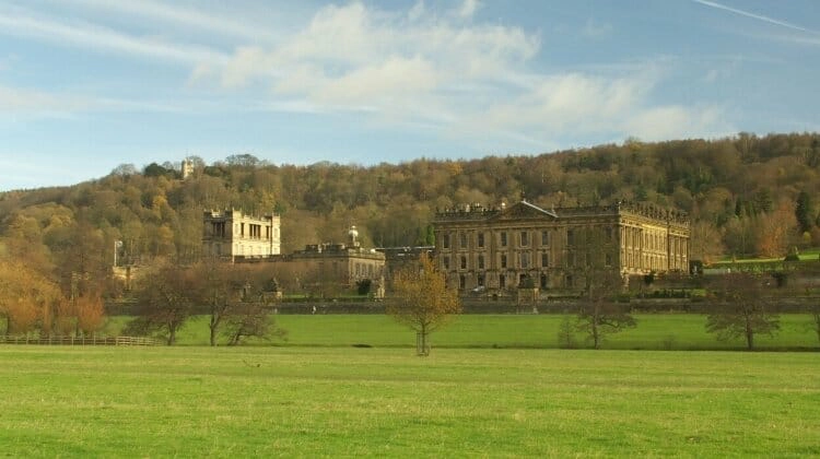
Yorkshire Dales
Route: Harrogate → Malham → Grassington → Aysgarth → Hawes → Muker → Reeth → Richmond
Distance: Approximately 125 miles, excluding detours
When to Go: May, June and September for walking and beautiful countryside, or late May and early June for wildflower meadows
Best For: Limestone landscapes, spectacular waterfalls, traditional villages, scenic driving, local food and walking
The Yorkshire Dales are one of England’s most beautiful landscapes, where winding roads thread through glacial valleys, patchwork fields and rolling green hills, passing traditional stone villages, dry stone walls and welcoming country pubs. It’s a wonderfully scenic place for a road trip, with the landscape changing around every bend as you travel from the limestone country of the southern dales into the wilder, more remote valleys of the north.
Known affectionately as God’s Own Country, Yorkshire has a strong sense of identity and a fascinating history, including its role in the Wars of the Roses, the struggle between the royal houses of Lancaster and York during the 15th century. The Yorkshire Dales National Park is particularly famous for its limestone scenery, with dramatic cliffs, underground caves, waterfalls and distinctive flat-topped hills, while the valleys are dotted with historic market towns and traditional farms.
This is also an excellent UK road trip for food lovers, with local specialities including Wensleydale cheese, Yorkshire puddings, traditional pies and locally brewed ales. Many of the villages have excellent pubs serving hearty Yorkshire food, making it easy to combine a day’s exploring with a good meal beside a roaring fire or in a sunny beer garden.
The roads are a major part of the experience, particularly the high routes between the dales, where steep climbs and sweeping views reveal the extraordinary scale of the landscape. Allow at least four or five days for this road trip, and longer if you enjoy walking, as the narrow roads and frequent stops to admire the scenery mean you’ll rarely cover the distances as quickly as you might expect.
Harrogate
Start your Yorkshire Dales road trip in Harrogate, an elegant spa town on the eastern edge of the national park, where grand Victorian buildings, beautifully maintained gardens and independent shops reflect its fashionable past.
Known historically as the English Spa, Harrogate became a popular destination during the Georgian and Victorian periods, when visitors travelled from across Britain to take the waters from its mineral-rich springs. You can learn more about this fascinating period at the Royal Pump Room Museum before exploring the Valley Gardens, a beautifully landscaped park with colourful flowerbeds, historic buildings and peaceful walking paths.
Harrogate is also known for its excellent cafés and restaurants, and no visit would be complete without afternoon tea at Bettys Café Tea Rooms, a Yorkshire institution famous for its traditional cakes, pastries and elegant surroundings. If you have time before heading into the Dales, the magnificent ruins of Fountains Abbey and the landscaped grounds of Studley Royal Water Garden, a UNESCO World Heritage Site, make a worthwhile detour.
Leaving Harrogate behind, the road west takes you through rolling farmland and attractive villages before the scenery becomes increasingly dramatic as you approach the limestone landscapes of the Yorkshire Dales National Park.
Malham and Malham Cove
The pretty village of Malham lies in the southern part of the Yorkshire Dales, surrounded by some of the national park’s most extraordinary limestone scenery. With traditional stone cottages, welcoming pubs and a stream running through its centre, it’s a lovely place to spend a night, particularly if you want to explore the surrounding countryside on foot.
The area’s most famous landmark is Malham Cove, a vast, curved limestone cliff rising around 80 metres above the valley floor, which was formed by glacial meltwater at the end of the last Ice Age. A relatively easy path leads from the village to the base of the cliff, where you can appreciate its enormous scale, while a steep flight of stone steps takes you to the remarkable limestone pavement above.
This extraordinary natural feature is made up of large limestone blocks separated by deep fissures, formed over thousands of years by the action of water, and was used as a filming location in Harry Potter and the Deathly Hallows: Part 1. Although a waterfall once flowed permanently over the cliff, the water now usually emerges from underground springs at its base, with a waterfall occasionally reappearing over the top during exceptional rainfall.
Malham is also the starting point for one of the finest circular walks in the Yorkshire Dales, taking in Janet’s Foss, Gordale Scar and Malham Cove. Janet’s Foss is a beautiful woodland waterfall associated with local folklore, while nearby Gordale Scar is a dramatic limestone gorge where towering cliffs rise above a narrow stream and waterfalls.
If you have time, continue towards Malham Tarn, a peaceful glacial lake surrounded by open moorland and important wildlife habitats. The surrounding landscape feels wonderfully remote, although the village itself can become very busy during summer weekends, so arrive early and use the designated parking areas rather than leaving your vehicle on the narrow lanes.
Grassington and Wharfedale
From Malham, continue towards Grassington, a traditional market town in the beautiful valley of Wharfedale, where cobbled streets, honey-coloured stone buildings and independent shops create one of the most attractive village centres in the Yorkshire Dales.
Grassington has become particularly well known as a filming location for the television series All Creatures Great and Small, where it represents the fictional market town of Darrowby, and fans of the programme will recognise several of the buildings around the market square.
The town is a lovely place to spend a few hours browsing the shops and enjoying lunch in one of the traditional pubs, before taking a short walk to nearby Linton Falls, where the River Wharfe tumbles over a series of limestone ledges.
For a longer drive through Wharfedale, follow the road north towards Kettlewell and Buckden, passing steep-sided valleys, traditional farms and dry stone walls that are so characteristic of this part of Yorkshire. There are plenty of opportunities to stop for photographs or follow one of the walking trails into the surrounding hills, and the villages along the route have welcoming pubs and cafés.
If you’re interested in history, consider a detour to Bolton Abbey, where the atmospheric ruins of a 12th-century Augustinian priory stand beside the River Wharfe. The surrounding estate has beautiful riverside walks, woodland trails and the famous stepping stones across the river, although the water can be deep and fast-flowing after heavy rain.
Wensleydale and Aysgarth Falls
Heading north into Wensleydale, the landscape opens into a broad green valley of traditional farms, wildflower meadows and rolling hills, with the River Ure winding through the countryside. Unlike most of the Yorkshire Dales, Wensleydale takes its name from the village of Wensley rather than the river that flows through it.
The valley is particularly beautiful in late spring and early summer, when the meadows are filled with wildflowers and the surrounding hills are a vivid green, although it’s a wonderful place to explore at any time of year.
One of the highlights is Aysgarth Falls, where the River Ure tumbles over three broad limestone steps to create a series of spectacular waterfalls. The Upper, Middle and Lower Falls are connected by woodland paths, allowing you to explore the different viewpoints, and the falls are especially impressive after heavy rain when enormous volumes of water cascade over the rocks.
The waterfalls also appeared in the 1991 film Robin Hood: Prince of Thieves, and their dramatic setting makes it easy to see why they were chosen as a filming location.
Not far from Aysgarth is Bolton Castle, a remarkably well-preserved 14th-century fortress overlooking Wensleydale, where Mary, Queen of Scots, was held prisoner during the 16th century. The castle has fascinating exhibitions, medieval gardens and spectacular views across the valley, making it well worth a visit if you enjoy history.
Hawes and Hardraw Force
Continue west through Wensleydale towards Hawes, a lively market town surrounded by beautiful countryside and widely regarded as the capital of Upper Wensleydale.
The town has a long tradition of farming, crafts and local food production, but it’s particularly famous for Wensleydale cheese, the crumbly Yorkshire cheese made famous by Wallace and Gromit. At the Wensleydale Creamery, you can learn how the cheese is made, discover its history and sample a range of traditional and flavoured varieties.
Hawes is also home to the Dales Countryside Museum, housed in a former railway station, where exhibits explore the farming traditions, local crafts and communities that have shaped life in the Yorkshire Dales. Around the town, you’ll find independent workshops and shops selling pottery, handmade gifts and locally produced food, making it a lovely place to spend an afternoon.
Just outside Hawes is Hardraw Force, one of England’s most impressive waterfalls, where the water plunges around 30 metres over a dramatic limestone overhang into a wooded gorge. Access is through the grounds of the Green Dragon Inn at Hardraw, where a small admission charge usually applies, and the waterfall is particularly spectacular after heavy rain.
From Hawes, one of the most memorable drives in the Yorkshire Dales takes you north over Buttertubs Pass towards Thwaite in Swaledale. This spectacular high-level road climbs through open moorland, with steep gradients, tight bends and extraordinary views across the surrounding valleys.
The pass takes its name from the Buttertubs, a series of deep limestone potholes beside the road, traditionally said to have been used by farmers to keep butter cool on their journeys to market. It’s a fantastic drive in a suitable vehicle, although the steep and narrow sections make it unsuitable for some larger motorhomes, particularly in poor weather.
Swaledale and Muker
Crossing into Swaledale, you’ll notice the landscape becoming wilder and more remote, with steep green hillsides divided by dry stone walls, traditional stone barns scattered across the fields and tiny villages tucked into the valley floor.
Swaledale is one of the northernmost valleys in the Yorkshire Dales National Park and is particularly famous for its hardy Swaledale sheep, a distinctive breed with curled horns and dark faces that is well suited to the challenging upland environment.
One of the loveliest places to stop is Muker, a small village surrounded by traditional hay meadows that burst into colour during late spring and early summer. These meadows are among the finest in the Yorkshire Dales, with an extraordinary variety of native flowers and grasses, and June is a particularly rewarding time to visit before the hay is cut.
The village itself has traditional stone cottages, a welcoming pub and a handful of independent shops, while the surrounding footpaths offer wonderful opportunities to explore the valley on foot. A walk through the meadows towards the River Swale is particularly beautiful, with views across the hills and stone barns that make this landscape so distinctive.
Continue east towards Reeth, where Swaledale meets Arkengarthdale, and you’ll find another attractive village with a traditional green surrounded by pubs, cafés and stone houses. It’s a lovely place to stop for lunch or enjoy a gentle walk, particularly if you’ve spent the morning driving through the more remote parts of the valley.
The roads through Swaledale are narrow in places, with occasional steep sections and limited passing opportunities, so take your time and be prepared to pull over for oncoming traffic.
Richmond
Finish your Yorkshire Dales road trip in Richmond, a beautiful Georgian market town overlooking the River Swale, where cobbled streets, historic buildings and an impressive Norman castle create one of the most attractive town centres in North Yorkshire.
Richmond Castle was founded shortly after the Norman Conquest and is one of the finest surviving examples of an early Norman fortress in England. Its enormous keep rises above the town, offering spectacular views across Swaledale to the west and the Vale of York to the south, while the atmospheric ruins and castle grounds are fascinating to explore.
Below the castle, riverside paths lead towards Richmond Falls, where the River Swale cascades over a series of limestone ledges, providing a peaceful contrast to the busy market square above.
Richmond also has a thriving arts scene, independent shops and excellent places to eat, making it a lovely destination for the final night of your road trip. If you have time, visit the Georgian Theatre Royal, one of Britain’s oldest surviving theatres, or follow the riverside path to the atmospheric ruins of Easby Abbey, a 12th-century monastery surrounded by beautiful countryside.
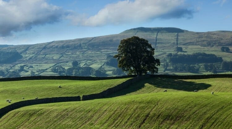
Scotland Road Trips
The Argyll Coastal Route
Route: Tarbet → Inveraray → Lochgilphead → Easdale → Oban → Glen Coe → Fort William → Glenfinnan
Distance: Approximately 220 miles, excluding detours
When to Go: May, June and September for longer days and outdoor activities, or October for beautiful autumn colours
Best For: Dramatic Highland scenery, sea lochs, fresh seafood, Scottish history, wildlife and scenic driving
The Argyll Coastal Route is one of Scotland’s most rewarding road trips, taking you from the shores of Loch Lomond through the beautiful landscapes of Argyll and along the west coast towards Fort William. With mountains rising above deep sea lochs, ancient castles overlooking the water and small fishing villages tucked into sheltered bays, this is a wonderful introduction to the Scottish Highlands.
This part of Scotland has a fascinating and sometimes turbulent history, with clan rivalries, Jacobite rebellions and centuries of maritime trade shaping the towns and landscapes you’ll discover along the way. The region is also renowned for its seafood, with fishing boats bringing in fresh catches to harbours where you can enjoy everything from traditional fish and chips to oysters, mussels and langoustines.
The official Argyll Coastal Route runs from Tarbet on Loch Lomond to Fort William, following around 129 miles of spectacular west coast scenery. We’ve extended the journey to include Easdale Island and Glenfinnan, both of which are well worth the additional driving, and added time to explore some of the beautiful places along the route.
Allow at least four or five days for this road trip, and longer if you want to enjoy boat trips, walking and the many historic attractions along the way. The roads are generally manageable in a car or motorhome, although some of the smaller coastal roads around Easdale are narrow, with passing places and limited parking.
If you’re travelling in summer, be prepared for midges, particularly around sheltered woodland and lochside areas when the weather is warm and still. Spring and early autumn can be lovely times to explore, with quieter roads and beautiful light across the mountains.
Loch Lomond and the Rest and Be Thankful
Begin your road trip at Tarbet, on the western shore of Loch Lomond, where the mountains of the southern Highlands rise above one of Scotland’s most famous freshwater lochs.
Loch Lomond is the largest freshwater loch in Great Britain by surface area and lies within the beautiful Loch Lomond and The Trossachs National Park. Its wooded shores, islands and surrounding hills make it a fantastic place to begin exploring Scotland, with opportunities for walking, kayaking and boat trips.
From Tarbet, follow the A83 towards Arrochar, where the road skirts the head of Loch Long beneath the dramatic Arrochar Alps. The surrounding mountains include the distinctive pointed summit of The Cobbler, one of the area’s most recognisable peaks and a popular destination for experienced hillwalkers.
The road then climbs through Glen Croe towards the famous Rest and Be Thankful viewpoint, where travellers have stopped to admire the scenery for centuries. The name dates from the construction of the original military road in the 18th century, when reaching the summit of the steep climb was considered a cause for celebration.
The views back down Glen Croe are spectacular, particularly when low cloud drifts between the mountains, and there’s a viewpoint where you can stop to appreciate the landscape.
The A83 is occasionally affected by landslides and severe weather, particularly around Rest and Be Thankful, so check road conditions before travelling and follow any temporary diversions.
Inveraray
Continue west towards Inveraray, an attractive Georgian town on the shores of Loch Fyne, where elegant whitewashed buildings and a picturesque waterfront reflect its long association with the powerful Campbell clan.
Inveraray was developed during the 18th century as a planned town by the Dukes of Argyll, and much of its distinctive architecture remains beautifully preserved. Take time to wander along the waterfront, explore the independent shops and enjoy the views across Loch Fyne before visiting the magnificent Inveraray Castle.
The castle has been the ancestral home of the Dukes of Argyll, chiefs of Clan Campbell, for generations and is one of Scotland’s most impressive country houses. Its distinctive turrets, grand interiors and extensive grounds make it a fascinating place to explore, particularly if you’re interested in Scottish clan history.
Another worthwhile stop is Inveraray Jail, a former courthouse and prison that now operates as a living history museum. The exhibitions explore the lives of prisoners, the Scottish justice system and the often harsh conditions of imprisonment during the 19th century.
Loch Fyne is famous for its seafood, particularly oysters and mussels, so this is an excellent place to enjoy a leisurely lunch overlooking the water. The surrounding countryside is also beautiful, with woodland walks and quiet roads leading towards small lochside villages.
Lochgilphead and Kilmartin Glen
Follow the A83 south-west along Loch Fyne towards Lochgilphead, a small town at the head of Loch Gilp that makes a convenient stop before exploring one of Scotland’s most fascinating historic landscapes.
Just north of Lochgilphead lies Kilmartin Glen, an extraordinary area containing one of the most important concentrations of prehistoric monuments in Britain. Within a relatively small area, you’ll find standing stones, burial cairns, stone circles and ancient rock carvings dating back thousands of years.
The glen is particularly rewarding for anyone interested in archaeology, as many of the monuments can be reached on short walks through the surrounding countryside. Among the most impressive are the Temple Wood Stone Circles, the Nether Largie standing stones and the remains of prehistoric burial chambers scattered along the valley floor.
Visit Kilmartin Museum to learn more about the people who lived here and the significance of the remarkable archaeological discoveries made in the area.
Further south, the Crinan Canal connects Loch Fyne with the Sound of Jura, providing a sheltered passage for boats travelling along Scotland’s west coast. Known as Britain’s most beautiful shortcut, the canal passes through peaceful countryside and is a lovely place for a waterside walk.
The small harbour at Crinan is particularly picturesque, with sailing boats, traditional cottages and views towards the islands of the Inner Hebrides.
Easdale Island and Seil
From Lochgilphead, continue north towards Oban, taking a detour onto the Isle of Seil, which is connected to the mainland by the famous Clachan Bridge.
Built in the late 18th century, the bridge is affectionately known as the Bridge over the Atlantic because it crosses a narrow tidal channel separating Seil from mainland Scotland.
Follow the winding roads across Seil towards Ellenabeich, a beautiful former slate-mining village with rows of traditional cottages overlooking the sea. From here, a small passenger ferry makes the five-minute crossing to Easdale Island, one of the most unusual places to visit on Scotland’s west coast.
Easdale is completely car-free, making it a wonderfully peaceful place to explore on foot. Once an important centre of Scotland’s slate industry, the island is dotted with deep, still pools that were originally working quarries before flooding with seawater.
The remains of the slate industry are everywhere, from the distinctive cottages built with local stone to the abandoned quarry workings that now form part of the island’s extraordinary landscape. The Easdale Island Folk Museum provides an insight into the lives of the quarry workers and the community that once depended on the industry.
The surrounding waters are rich in wildlife, and boat trips from the area offer opportunities to spot seals, seabirds and occasionally whales and dolphins. You can also take an excursion towards the famous Corryvreckan Whirlpool, one of the largest permanent whirlpools in the world, which forms in the narrow waters between the islands of Jura and Scarba.
These trips are weather-dependent and the waters around Corryvreckan can be extremely powerful, so choose an experienced local operator and book ahead during the summer months.
With its peaceful atmosphere, unusual history and beautiful coastal scenery, Easdale is well worth the detour, particularly if you enjoy exploring places that feel a little removed from everyday life.
Oban
Continue north towards Oban, a bustling harbour town known as the Gateway to the Isles because of its ferry connections to Mull, Coll, Tiree and several other Hebridean islands.
Oban is one of the best places in Scotland for seafood, with fishing boats landing their catches in the harbour and a wonderful selection of restaurants, traditional pubs and informal seafood stalls serving fresh local produce.
One of the town’s most recognisable landmarks is McCaig’s Tower, a remarkable circular structure built on the hillside above the harbour during the late 19th century. Inspired by the Colosseum in Rome, the unfinished monument offers spectacular views across Oban Bay towards Kerrera and the mountains of Mull.
The climb from the town centre is steep, but the views from the top are particularly beautiful in the evening when the setting sun lights up the islands across the water.
Oban is also home to Oban Distillery, one of Scotland’s oldest working whisky distilleries, where you can learn about traditional whisky production and sample the local single malt.
If you have an extra day, consider taking a ferry to the Isle of Mull, where colourful Tobermory, beautiful beaches and excellent wildlife watching make it a rewarding extension to your road trip. Boat trips to see seals, seabirds and marine wildlife are also available from Oban and the surrounding area.
Oban is a convenient place to stock up on supplies before continuing north into the Highlands, with supermarkets, fuel stations and plenty of accommodation options.
Glen Coe
Leaving Oban, follow the coast north towards Ballachulish and the spectacular landscape of Glen Coe, one of Scotland’s most dramatic and historically significant glens.
The journey takes you alongside Loch Creran and Loch Linnhe, with mountains rising steeply from the water and beautiful views opening up as you approach the Highlands. Once you reach Glen Coe, the scenery becomes increasingly dramatic, with towering peaks, deep valleys and rocky ridges shaped by volcanic activity and powerful glaciers over millions of years.
The glen is part of the Lochaber Geopark, and the Glen Coe Geotrail provides a fascinating introduction to its extraordinary geological history.
Glen Coe is also closely associated with one of the darkest episodes in Scottish history, the Massacre of Glencoe in 1692, when government troops, including men commanded by officers from the Campbell clan, killed members of the MacDonald clan after accepting their hospitality.
You can learn more about the massacre and the history of the glen at the Glencoe Visitor Centre, managed by the National Trust for Scotland, before exploring the surrounding landscape on foot.
The Three Sisters of Glen Coe are among Scotland’s most photographed mountains, and the viewpoints along the A82 offer spectacular views into the steep-sided valleys between their ridges.
For walkers, there are routes ranging from gentle woodland trails to challenging mountain ascents, including the famous Lost Valley walk, which leads into a secluded hanging valley between the mountains.
Glen Coe is particularly beautiful in autumn, when the hillsides turn shades of copper and gold and low cloud moves through the glen, although the weather can change quickly and conditions on the higher trails can be demanding.
Fort William
Continue north along Loch Linnhe towards Fort William, a lively Highland town sitting beneath the mighty Ben Nevis, the highest mountain in the British Isles.
Fort William is widely regarded as the outdoor capital of the UK, with opportunities for hiking, mountain biking, climbing and watersports throughout the surrounding mountains and glens.
Ben Nevis rises to 1,345 metres above sea level, and climbing to its summit is a popular challenge for experienced walkers. Although the main Mountain Track is technically straightforward in good conditions, it’s a long and demanding mountain walk, with rapidly changing weather and snow possible on the summit well outside winter.
If you’d prefer to enjoy the scenery without tackling the mountain, take the gondola at Nevis Range on nearby Aonach Mòr, where you can enjoy spectacular views across the Great Glen and surrounding Highland peaks.
Fort William is also the western end of the Great Glen Way and the northern end of the West Highland Way, making it a popular destination for long-distance walkers.
The town has a good selection of outdoor shops, restaurants and traditional pubs, and makes an excellent base for exploring the surrounding Highlands.
Glenfinnan
We’ve added Glenfinnan as an extension to the official Argyll Coastal Route because it’s only around 17 miles west of Fort William and is one of the most memorable places to visit in this part of Scotland.
Glenfinnan occupies a spectacular position at the head of Loch Shiel and is closely associated with the Jacobite rising of 1745, when Bonnie Prince Charlie raised his standard here and called on the Highland clans to support his claim to the British throne.
The campaign eventually ended in defeat at the Battle of Culloden in 1746, after which the British government introduced measures that profoundly changed traditional Highland society.
Today, the Glenfinnan Monument stands at the head of Loch Shiel, commemorating those who fought in the Jacobite cause. The setting is magnificent, with the long waters of the loch stretching south between steep mountains.
Just a short distance away is the famous Glenfinnan Viaduct, a graceful curved railway bridge that has carried trains on the West Highland Line since 1901.
The viaduct became internationally famous through the Harry Potter films, in which the Hogwarts Express is seen crossing its impressive arches on the journey to Hogwarts.
For one of the best views, follow the Glenfinnan Viaduct Trail to the hillside viewpoint, where you can watch trains crossing the bridge with the surrounding mountains providing a spectacular backdrop.
During the main operating season, the Jacobite steam train runs between Fort William and Mallaig, although services and timetables can change, so check the current schedule if you’re hoping to photograph the steam train crossing the viaduct.
Turn around from the viewpoint and you’ll also enjoy magnificent views towards Loch Shiel and the Glenfinnan Monument, making this one of the most rewarding stops on the entire road trip.
Parking at Glenfinnan is limited and the area becomes extremely busy around train crossing times, so arrive early, use the designated car parks and allow plenty of time for the walk to the viewpoint.
Related Post: Eight Incredible Scotland Road Trips
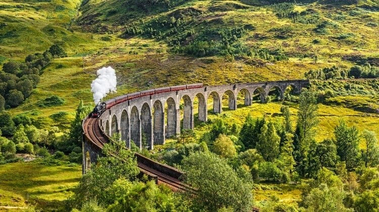
North Coast 500
Route: Inverness → Dornoch → Wick → John o’Groats → Thurso → Tongue → Durness → Lochinver → Ullapool → Gairloch → Torridon → Applecross → Inverness
Distance: Approximately 516 miles, excluding detours
When to Go: May, June and September for longer days, quieter roads and good opportunities for outdoor activities
Best For: Dramatic Highland scenery, remote beaches, rugged mountains, historic castles, wildlife and adventurous driving
The North Coast 500, or NC500, is Scotland’s most famous road trip, following a spectacular circular route through the northern Highlands, where rugged mountains, white sandy beaches, remote fishing villages and ancient castles create some of the most extraordinary scenery in Britain.
Starting and finishing in Inverness, the route covers just over 500 miles around the northernmost part of mainland Scotland, although you’ll almost certainly drive considerably further once you include the many worthwhile detours to beaches, viewpoints, castles and small coastal communities.
We recommend driving the NC500 anticlockwise, beginning with the gentler landscapes and historic towns of the east coast before travelling across the wild and windswept north and finishing with the dramatic mountains, sea lochs and spectacular coastal roads of Wester Ross. It’s a wonderful way to experience the changing character of the Highlands, with the scenery becoming increasingly rugged and remote as the journey progresses.
Although the route has become enormously popular with motorhome and campervan travellers, some sections require careful planning, particularly if you’re driving a larger vehicle. Many of the roads along the north and west coasts are single-track with passing places, and it’s important to understand how these work, allow faster traffic to overtake and avoid stopping in passing places to take photographs.
Wild camping rights in Scotland do not extend to motorised vehicles, so you cannot assume that you can park overnight wherever you like. Use established campsites, designated motorhome stopovers or locations where overnight parking is expressly permitted, and always respect local restrictions and the communities who live along the route.
If you’re planning to explore the NC500 in a campervan or motorhome, our North Coast 500 motorhome guide covers route planning, suitable roads, overnight stops and practical advice for touring this beautiful but sometimes challenging part of Scotland.
Allow at least seven days for this road trip, although ten to fourteen days is far better if you want to explore on foot, enjoy the beaches and experience the Highlands without rushing. The distances can be deceptive, particularly on the west coast, where narrow roads, slow-moving traffic and frequent stops to admire the scenery mean that even a relatively short journey can take most of the day.
Inverness and the Black Isle
Begin your North Coast 500 adventure in Inverness, the capital of the Highlands, which sits beside the River Ness and provides an excellent starting point for exploring northern Scotland.
The city has an attractive riverside setting, a good selection of independent shops and restaurants, and several interesting historic attractions, including Inverness Castle and the Victorian Market. It’s also a convenient place to stock up on supplies before heading into the more remote parts of the Highlands, where supermarkets and fuel stations become less frequent.
If you have time before setting off, visit Culloden Battlefield, where the Jacobite rising came to a devastating end in April 1746. The visitor centre explains the events leading up to the battle and its lasting impact on Highland communities, while the battlefield itself is a moving place to explore.
Nearby Clava Cairns is another worthwhile stop, with remarkably well-preserved Bronze Age burial chambers and standing stones surrounded by peaceful woodland.
From Inverness, cross the Moray Firth towards the Black Isle, a beautiful peninsula of rolling farmland, woodland and attractive coastal villages. The historic village of Cromarty is particularly lovely, with narrow streets, traditional cottages and views across the Cromarty Firth, while nearby Chanonry Point is one of the best places in Britain to watch bottlenose dolphins feeding close to shore.
Continue north towards Dornoch, where the landscape gradually opens out into the rolling countryside of Easter Ross and Sutherland.
Dornoch and Dunrobin Castle
Dornoch is a beautiful historic town overlooking the Dornoch Firth, with attractive stone buildings, independent shops and a magnificent sandy beach stretching along the coast.
The town is particularly famous for its 13th-century cathedral and Royal Dornoch Golf Club, one of Scotland’s most celebrated championship courses, where the links run beside the dunes overlooking the North Sea.
Even if you’re not interested in golf, Dornoch is a lovely place to stop for a walk along the beach or lunch in one of the traditional cafés before continuing north.
A little further along the coast is Dunrobin Castle, one of the most impressive castles in the Scottish Highlands, with fairytale turrets, grand interiors and formal gardens overlooking the sea.
The castle has been home to the Earls and Dukes of Sutherland for centuries, and its history is closely connected with the Highland Clearances, when thousands of people were displaced from their homes during the 18th and 19th centuries.
The castle’s extensive gardens are particularly beautiful, and the views across the coastline make it well worth allowing a couple of hours to explore.
Continue north through the attractive countryside of eastern Sutherland, where the roads are generally wider and easier to drive than those you’ll encounter later on the route.
Wick and the Caithness Coast
As you travel into Caithness, the landscape changes noticeably, with rolling farmland, wide open skies and dramatic coastal cliffs replacing the wooded hills and mountains further south.
Wick was once one of Europe’s busiest herring ports, and the town’s maritime heritage is still evident in its working harbour, historic buildings and traditional fishing communities.
Visit the Wick Heritage Museum to discover more about the lives of the fishermen and their families, and the enormous industry that developed around the herring trade during the 19th century.
Just north of Wick are the dramatic ruins of Castle Sinclair Girnigoe, perched on a rocky headland overlooking the North Sea. The castle has a fascinating history dating back to the medieval period, and its spectacular coastal setting makes it one of the most atmospheric historic sites on the NC500.
The surrounding coastline is also beautiful, with rugged cliffs, seabird colonies and quiet beaches that are often overlooked by visitors keen to reach John o’Groats.
Further south, the village of Helmsdale and its Timespan museum and arts centre provide an interesting insight into the history of the Highlands, including the Highland Clearances and the lives of the communities that once depended on fishing and crofting.
John o’Groats and Duncansby Head
Continue north towards John o’Groats, one of Scotland’s best-known landmarks and the traditional northern endpoint of the famous journey between Land’s End in Cornwall and the far north of mainland Britain.
Although the settlement itself is small, its famous signpost and coastal location make it a popular place to stop for photographs, and the surrounding waters offer opportunities for wildlife watching and boat trips.
A short drive east brings you to Duncansby Head, where a lighthouse stands above dramatic cliffs overlooking the Pentland Firth and the Orkney Islands.
From the lighthouse, follow the coastal path towards the extraordinary Duncansby Stacks, two enormous sea stacks rising from the water just offshore. The walk offers spectacular views along the coastline, particularly during spring and summer when thousands of seabirds nest on the surrounding cliffs.
The area is wonderfully atmospheric, with the sound of the waves and seabirds carrying across the exposed headland, and on a clear day you can see the islands of Orkney stretching across the horizon.
John o’Groats is not actually the northernmost point of mainland Britain, despite its famous association with the end-to-end journey. That distinction belongs to Dunnet Head, which you’ll visit as you continue west along the north coast.
Thurso and Dunnet Head
Follow the north coast west towards Dunnet Head, where a lighthouse stands above spectacular sea cliffs at the northernmost point of mainland Britain.
The views across the Pentland Firth towards Orkney are magnificent in clear weather, and the surrounding cliffs are an excellent place to watch seabirds during the breeding season.
Nearby Dunnet Bay is a beautiful sweep of golden sand backed by dunes, offering a lovely contrast to the dramatic cliffs and rocky headlands further east.
Continue towards Thurso, the most northerly town on mainland Britain, which has a long history as a fishing port and trading centre. The old town has attractive stone buildings, independent shops and a sandy beach overlooking the Pentland Firth, while nearby Scrabster provides ferry connections to the Orkney Islands.
If you have an extra day or two, Orkney makes a fascinating extension to the NC500, with extraordinary prehistoric sites, dramatic coastal scenery and a distinctive island culture.
As you leave Thurso behind, the roads become quieter and the landscape increasingly remote, with long stretches of open moorland and beautiful views across the northern coastline.
Tongue and the North Coast
The drive west towards Tongue is one of the most atmospheric sections of the NC500, with broad sandy bays, rocky headlands and rolling moorland stretching towards the mountains of the north-west Highlands.
Along the way, you’ll pass the beautiful beaches around Bettyhill and Strathy, where pale sand, turquoise water and grassy dunes create coastal scenery that can look almost tropical on a sunny day.
The village of Tongue sits above the Kyle of Tongue, a beautiful tidal inlet surrounded by open countryside and dramatic mountains. The distinctive peak of Ben Loyal rises above the landscape, while Ben Hope, Scotland’s most northerly Munro, dominates the surrounding hills.
Tongue is a lovely place to stop for a walk or enjoy lunch overlooking the Kyle, particularly if you’ve spent the morning exploring the beaches along the north coast.
For wonderful views, follow the footpath to the ruins of Castle Varrich, which stand on a hill above the village. The climb is relatively short but steep in places, and the views across the Kyle and surrounding mountains are spectacular.
The roads through this part of the Highlands include long single-track sections, so take your time, use passing places correctly and allow faster traffic to overtake when it’s safe to do so.
Durness and Smoo Cave
Continuing west, the landscape becomes increasingly rugged as you approach Durness, a small village surrounded by some of the most beautiful beaches and dramatic coastal scenery in Scotland.
The area feels wonderfully remote, with vast stretches of open moorland, rocky headlands and white sandy beaches overlooking the Atlantic Ocean.
One of the main attractions is Smoo Cave, a remarkable limestone sea cave formed by a combination of marine erosion and freshwater streams. The enormous entrance chamber can be reached by a path and steps from the road, while the inner sections contain an underground waterfall and can sometimes be explored on guided boat trips when conditions allow.
Nearby Sango Sands is one of the most beautiful beaches on the NC500, with pale sand framed by rocky cliffs and turquoise water. The beach is particularly impressive in the evening, when the low light catches the surrounding headlands and the Atlantic stretches away towards the horizon.
Durness is also the starting point for excursions to Cape Wrath, the most north-westerly point of mainland Britain, where a lighthouse stands above dramatic cliffs overlooking the Atlantic.
Reaching Cape Wrath involves a seasonal passenger ferry across the Kyle of Durness followed by a minibus journey along a rough track through remote moorland. Services are dependent on weather and military activity, so check arrangements locally before planning your visit.
If you’re travelling by motorhome, Durness is a useful place to pause before tackling the more challenging roads further south, particularly as the route through Assynt includes narrow sections with limited passing opportunities.
Lochinver and Assynt
From Durness, head south into Assynt, one of the most extraordinary landscapes in the Scottish Highlands, where ancient mountains rise above rocky moorland dotted with countless freshwater lochs.
The region is famous for its distinctive isolated peaks, including Suilven, Canisp and Quinag, whose dramatic shapes dominate a landscape formed from some of the oldest rocks in Europe.
As you travel south, the scenery becomes increasingly spectacular, with mountain views opening up around almost every bend and beautiful stretches of coastline appearing between the hills.
Lochinver is a small fishing village set beside a sheltered sea loch, with a working harbour, local shops and some excellent places to eat. The village is particularly well known for its traditional pies, making it a popular lunch stop for travellers following the NC500.
Nearby Achmelvich Beach is one of Scotland’s most beautiful beaches, with brilliant white sand and clear turquoise water that can look almost Mediterranean in sunshine. The water is considerably colder than it appears, but the sheltered bay is a wonderful place for a walk or picnic.
Another spectacular beach is Clachtoll, where pale sand, rocky headlands and clear water create a beautiful coastal landscape, while the ruins of Ardvreck Castle stand on a small promontory beside Loch Assynt.
The castle dates from the 16th century and is associated with the MacLeod clan, although today only atmospheric ruins remain against the backdrop of the surrounding mountains.
This section requires particular care if you’re driving a motorhome. The B869 coastal road through Drumbeg is extremely narrow and twisting, with steep sections and limited passing opportunities, and larger motorhomes should avoid it in favour of the main A894 and A837 routes.
Even in a smaller campervan, allow plenty of time and be prepared for oncoming traffic, particularly during the busy summer months.
Ullapool and Loch Broom
Continue south towards Ullapool, passing through one of the most spectacular mountain landscapes on the NC500, where the distinctive peaks of Stac Pollaidh, Suilven and Ben More Coigach rise above a wilderness of rocky hills, freshwater lochs and open moorland.
Stac Pollaidh is a popular walking destination, with a trail climbing towards its dramatic rocky ridge and offering extraordinary views across Assynt and the surrounding mountains. The higher sections involve steep and rocky terrain, but even the lower viewpoints provide wonderful opportunities to appreciate this unusual landscape.
Ullapool itself is a picturesque fishing town on the shores of Loch Broom, with whitewashed buildings lining the waterfront and fishing boats moving in and out of the harbour beneath the surrounding mountains.
The town has a lively atmosphere during the summer months, with independent shops, galleries, traditional pubs and excellent seafood restaurants, and it’s a lovely place to spend an evening after exploring the remote landscapes further north.
Ullapool is also the departure point for ferries to Stornoway on the Isle of Lewis, making it a convenient gateway to the Outer Hebrides if you have time to extend your Scottish road trip.
For motorhome travellers, Ullapool is a useful place to replenish supplies and make use of established facilities before continuing along the west coast, where services become more widely spaced.
Gairloch and Wester Ross
Leaving Ullapool, follow the coast south into Wester Ross, where rugged mountains, deep sea lochs and beautiful sandy beaches combine to create some of the most memorable scenery on the North Coast 500.
The road winds through a landscape of rocky hills and scattered lochs, with spectacular views towards the mountains of the Torridon range and the islands offshore.
Gairloch is a small coastal village overlooking Loch Gairloch, with views towards the mountains of Skye and the Outer Hebrides on clear days. The surrounding area is known for its beautiful beaches, including the sweeping sands at Big Sand and the attractive beach near the village itself.
Boat trips from Gairloch offer opportunities to spot seals, dolphins, whales and seabirds, while the surrounding hills provide excellent walking routes for anyone wanting to explore the landscape on foot.
Nearby Inverewe Garden is another worthwhile stop, where an extraordinary collection of plants from around the world thrives in the mild coastal climate created by the North Atlantic Drift.
The gardens overlook Loch Ewe and offer a beautiful contrast to the rugged mountains and open moorland that dominate much of the west coast.
Torridon and Shieldaig
Continue south towards Torridon, where some of Scotland’s most impressive mountains rise almost vertically from the shores of deep sea lochs.
The Torridon mountains are among the oldest rock formations in Britain, with distinctive sandstone peaks shaped by millions of years of geological activity and glaciation. Their dramatic profiles dominate the landscape, creating one of the most memorable sections of the entire North Coast 500.
The village of Torridon sits at the head of Upper Loch Torridon, surrounded by magnificent mountain scenery, while nearby Shieldaig is a beautiful fishing village overlooking a sheltered bay dotted with small islands.
This is an excellent area for walking, with routes ranging from gentle lochside paths to challenging mountain ascents, although the higher peaks require suitable experience and equipment.
The scenery around Torridon is particularly beautiful in the early morning and evening, when the changing light illuminates the mountain ridges and reflects across the still waters of the lochs.
As you continue towards Applecross, the roads become narrower and more winding, with spectacular views across the coastline and towards the mountains of Skye.
Applecross and the Bealach na Bà
One of the most famous sections of the North Coast 500 is the road to Applecross, a remote peninsula overlooking the Inner Sound, where the mountains of Skye rise across the water.
The small settlement of Applecross sits beside a beautiful sheltered bay, with traditional cottages, a peaceful waterfront and excellent opportunities to enjoy fresh seafood overlooking the sea.
The surrounding peninsula has a wonderfully remote atmosphere, with scattered crofting settlements, rocky shores and quiet beaches that make it one of the most memorable places on the NC500.
From Applecross, the famous Bealach na Bà, meaning Pass of the Cattle, climbs to around 626 metres above sea level through a series of steep hairpin bends, with extraordinary views across the mountains and towards the Isle of Skye.
The road was historically used by drovers taking cattle from the Applecross peninsula to markets further east, and its steep gradients, narrow carriageway and tight bends still make it one of Britain’s most challenging scenic drives.
The Bealach na Bà is unsuitable for large motorhomes, caravans and inexperienced drivers, and the warning signs should be taken seriously. If you’re travelling in a larger vehicle, use the alternative coastal road via Kenmore and Shieldaig, which provides access to Applecross without crossing the high pass, although it also includes narrow single-track sections.
For those travelling in a suitable vehicle and comfortable with mountain driving, the pass is an unforgettable experience, particularly in clear weather when the views stretch across the surrounding mountains and sea lochs.
After descending towards Loch Kishorn, continue east through the beautiful Highland scenery towards Inverness, bringing your North Coast 500 adventure full circle.
Returning to Inverness
The final stretch of the NC500 takes you back towards Inverness through the mountains and glens of the western Highlands, with beautiful views across the surrounding countryside as the road gradually leaves the more remote coastal landscapes behind.
After days spent exploring wild beaches, ancient castles, dramatic sea cliffs and some of Scotland’s most spectacular mountain roads, returning to Inverness feels like the end of a much longer journey.
The North Coast 500 is one of those road trips where the experience is as much about the places you discover between the main attractions as the famous landmarks themselves, and taking your time is the best way to appreciate the extraordinary beauty of the northern Highlands.
Related Posts: North Coast 500 Route Planner + Itinerary, Map & Tips | How to Take a North Coast 500 Motorhome Trip
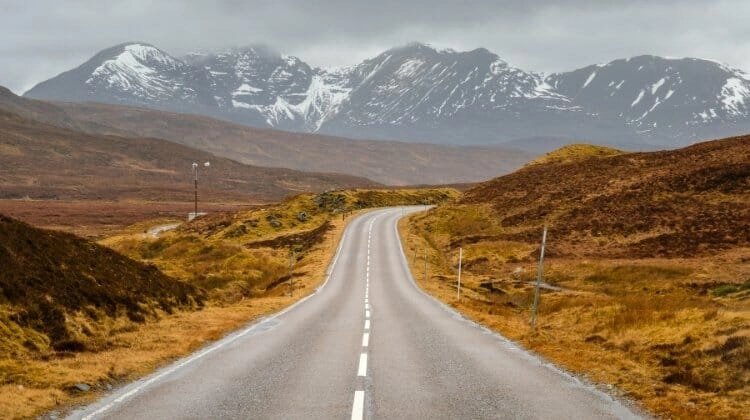
Isle of Skye
Route: Kyleakin → Sligachan → Portree → Old Man of Storr → Kilt Rock → Quiraing → Uig → Dunvegan → Neist Point → Fairy Pools → Carbost → Broadford → Kyleakin
Distance: Approximately 190 miles, excluding detours
When to Go: May, June and September for longer days, walking and fewer crowds, or October for atmospheric autumn landscapes
Best For: Dramatic mountain scenery, rugged coastlines, waterfalls, castles, wildlife and spectacular photography
The Isle of Skye is one of Scotland’s most extraordinary destinations, where jagged mountains rise above deep sea lochs, dramatic cliffs plunge into the Atlantic and small crofting communities are scattered across a landscape shaped by ancient volcanic activity and glaciers. Connected to the mainland by the Skye Bridge, this beautiful island in the Inner Hebrides is a fantastic place for a road trip, with some of the most memorable scenery in the British Isles.
Known as the Misty Isle, Skye has a wonderfully atmospheric quality, particularly when low cloud drifts around the Cuillin mountains or the changing light illuminates the extraordinary rock formations of the Trotternish Peninsula. The island also has a fascinating history, with ruined castles, clan strongholds and traditional crofting settlements reflecting centuries of Highland life.
Although Skye is relatively compact, the roads are often narrow and winding, and you’ll find yourself stopping frequently to admire the views. Many of the smaller roads are single-track with passing places, while popular attractions can become extremely busy during summer, particularly around Portree, the Old Man of Storr and the Fairy Pools.
Allow at least four or five days to explore Skye properly, although a week would give you more time for walking, wildlife watching and discovering some of the island’s quieter corners. May, June and September are particularly good months to visit, with long daylight hours and generally fewer visitors than during the peak summer holidays.
Kyleakin and the Skye Bridge
Begin your Isle of Skye road trip by crossing the Skye Bridge from Kyle of Lochalsh on the mainland to Kyleakin, a small village overlooking the narrow stretch of water that separates Skye from the Scottish Highlands.
Before the bridge opened in 1995, reaching Skye involved a ferry crossing, and although the island is now much easier to access, arriving across the bridge still feels like the beginning of a proper Highland adventure.
Kyleakin has an attractive waterfront, a small harbour and views towards the ruins of Castle Moil, a 15th-century fortress associated with Clan MacKinnon. The castle stands on a rocky headland overlooking the Kyle Akin strait and is a reminder of the island’s long maritime history.
From here, follow the A87 west towards Broadford and Sligachan, where the landscape becomes increasingly dramatic as the mountains of the Cuillin begin to dominate the skyline.
Sligachan and the Cuillin Mountains
Sligachan sits at the junction of the roads leading towards Portree and the western side of Skye, surrounded by some of the island’s most spectacular mountain scenery.
The village is best known for its beautiful old stone bridge, which crosses the River Sligachan beneath the dramatic peaks of the Black Cuillin. It’s one of the most photographed locations on Skye, particularly when the mountains are reflected in the clear water beneath the bridge.
The Cuillin range is divided into the Black Cuillin, a jagged ridge of dark volcanic rock, and the Red Cuillin, whose rounded granite peaks create a softer but equally impressive landscape. Together, they form one of Britain’s most challenging and spectacular mountain ranges, attracting experienced climbers and mountaineers from around the world.
According to local folklore, the waters beneath Sligachan Bridge have magical properties, and washing your face in the river is said to bring eternal beauty. The story adds a little Highland mythology to an already memorable setting, although the surrounding mountain views are reason enough to stop.
Sligachan is also an excellent starting point for walks into the surrounding glens, with routes ranging from gentle riverside paths to demanding mountain expeditions. The higher Cuillin routes require specialist skills and equipment, but you don’t need to climb the peaks to appreciate their extraordinary beauty.
Portree
Continue north to Portree, Skye’s largest town and the island’s main centre for shops, restaurants, accommodation and visitor services.
Portree is famous for its picturesque harbour, where a row of brightly coloured buildings overlooks fishing boats and the sheltered waters of Loch Portree. The waterfront is a lovely place to wander, particularly in the early morning or evening when the harbour is quieter and the surrounding hills are reflected in the water.
The town has a good selection of independent shops, galleries and restaurants, with seafood featuring prominently on many menus. It’s also a convenient place to stock up on supplies before exploring the more remote parts of the island, where facilities can be limited.
For beautiful views across the harbour and towards the Sound of Raasay, follow the short walk around the headland known as the Lump, where you’ll find the Apothecary’s Tower, a small stone folly overlooking the bay.
Portree makes an excellent base for exploring northern Skye, particularly the Trotternish Peninsula, although accommodation and campsites can book up well in advance during the summer months.
Old Man of Storr and the Trotternish Peninsula
From Portree, follow the A855 north onto the Trotternish Peninsula, where some of Skye’s most famous landscapes were formed by enormous ancient landslips.
The first major attraction is the Old Man of Storr, a remarkable pinnacle of rock rising above a dramatic landscape of cliffs, grassy slopes and unusual rock formations. The surrounding scenery is extraordinary, particularly when mist drifts between the pinnacles and the mountains of the mainland appear across the water.
The walk to the Old Man of Storr is one of the island’s most popular hikes, climbing steadily from the roadside car park towards the towering rock formations. Although the route is relatively short, it’s steep and can be muddy and slippery, so sturdy footwear is essential.
The views become increasingly impressive as you climb, with the coastline of eastern Skye stretching away beneath you and the distinctive shape of the Old Man dominating the landscape.
Continue north towards Kilt Rock and Mealt Falls, where dramatic basalt cliffs rise above the sea in a series of vertical columns said to resemble the pleats of a Scottish kilt. The nearby waterfall plunges from the clifftop towards the sea, creating one of the island’s most recognisable coastal views.
The viewpoint is easily reached from the roadside parking area, making it a popular stop for visitors who want to experience Skye’s dramatic scenery without a long walk.
The Quiraing and Staffin
Further north, the landscape becomes even more extraordinary around the Quiraing, a spectacular area of towering cliffs, rocky pinnacles and grassy plateaus formed by one of Britain’s largest landslips.
The Quiraing is one of the most photographed places on Skye, and it’s easy to understand why, with enormous rock formations rising above a landscape that seems almost otherworldly. The narrow road climbing from Staffin towards the Quiraing viewpoint is spectacular in itself, offering sweeping views across the peninsula and towards the islands offshore.
The circular walk through the Quiraing takes you beneath dramatic cliffs and past distinctive formations such as the Needle, the Table and the Prison. It’s a wonderful hike in good conditions, although the paths can be steep, exposed and muddy, and low cloud can make navigation difficult.
If you prefer not to tackle the full walk, the views from the roadside viewpoint are still magnificent, particularly in the early morning when the light catches the eastern slopes.
Nearby Staffin is a small crofting community with a fascinating geological history, and the beach at An Corran is famous for dinosaur footprints preserved in the ancient rock. The footprints are only visible under suitable tidal and lighting conditions, but the surrounding coastline is beautiful even if you don’t manage to spot them.
Continue around the northern tip of the Trotternish Peninsula, where the road passes through small settlements and open moorland before turning south towards Uig.
Uig and the Fairy Glen
Uig is a small harbour village on the western side of the Trotternish Peninsula, best known as the departure point for ferries to the Outer Hebrides.
The village sits at the head of a sheltered bay surrounded by green hills, and its harbour provides a lovely place to stop and watch the ferries arriving and departing against the backdrop of the surrounding mountains.
Just outside Uig is the Fairy Glen, a curious landscape of small conical hills, grassy ridges and miniature valleys that looks quite different from the rugged mountain scenery elsewhere on Skye.
The unusual formations were created by ancient landslips, although their distinctive appearance has inspired plenty of local folklore and stories about fairies.
One of the most recognisable features is Castle Ewen, a rocky outcrop that resembles the ruins of a small castle and offers lovely views across the surrounding hills.
The Fairy Glen is a fascinating place to explore on foot, although visitors should avoid moving stones or building stone circles, as these can damage the landscape and are not part of its natural or historic character.
The access road is narrow and parking is limited, so use the designated parking area and avoid obstructing passing places or local access.
Dunvegan Castle and the West Coast
From Uig, continue towards Dunvegan on the western side of Skye, where the landscape becomes quieter and more open, with rolling moorland, scattered crofts and beautiful views across the sea lochs.
The village is home to Dunvegan Castle, the ancestral seat of Clan MacLeod and one of Scotland’s most historic inhabited castles. Standing on a rocky outcrop overlooking Loch Dunvegan, the castle has been associated with the MacLeod family for around 800 years and contains an extraordinary collection of clan treasures, paintings and historic artefacts.
Among its most famous possessions is the Fairy Flag, an ancient silk banner surrounded by legends about its magical powers and its role in protecting Clan MacLeod during times of danger.
The castle gardens are also beautiful, with woodland walks, waterfalls and sheltered areas where an impressive variety of plants thrive in the mild coastal climate. Boat trips from the castle offer opportunities to see the seals that inhabit the nearby waters, making this a particularly enjoyable stop for families.
Further west, the landscape becomes increasingly remote as you approach the Duirinish Peninsula, where small settlements and quiet roads lead towards some of Skye’s most dramatic coastal scenery.
Neist Point
Neist Point is one of the most spectacular places on Skye, where a lighthouse stands on a rugged headland surrounded by towering sea cliffs and the open waters of the Atlantic.
The drive towards Neist Point takes you through beautiful, remote countryside, with scattered crofts, grazing sheep and wide views across the surrounding landscape. As you approach the coast, the scenery becomes increasingly dramatic, culminating in the extraordinary sight of the headland stretching out into the sea.
From the parking area, a steep path leads down towards the lighthouse, passing along the clifftop before descending towards the narrow headland. The walk is particularly beautiful in clear weather, when you can see across the water towards the Outer Hebrides.
Neist Point is also an excellent place for wildlife watching, with seabirds nesting on the cliffs and occasional sightings of whales, dolphins and basking sharks in the surrounding waters.
Many visitors come here for sunset, when the low light illuminates the cliffs and lighthouse, although the exposed location can be extremely windy and the return climb from the lighthouse is steep.
The final approach road is narrow, with passing places and limited parking, so it’s worth visiting outside the busiest periods, particularly if you’re travelling in a motorhome.
Fairy Pools and Glen Brittle
Continue south towards Glen Brittle, where the dramatic peaks of the Black Cuillin rise above one of Skye’s most popular natural attractions, the Fairy Pools.
These beautiful crystal-clear pools and waterfalls lie along the River Brittle, which flows down from the Cuillin mountains through a rocky valley surrounded by magnificent scenery.
The walk from the designated car park follows a well-used path alongside the river, passing a series of waterfalls and pools whose clear water takes on beautiful shades of turquoise and blue in the right light.
Although the Fairy Pools have become famous as a wild swimming destination, the water is extremely cold throughout the year, and the rocky pools can be slippery with strong currents after heavy rain.
Even if you have no intention of getting into the water, the walk is well worth doing for the views towards the Cuillin, particularly when the mountain peaks emerge from the clouds.
Glen Brittle is also home to a beautiful sandy beach overlooking Loch Brittle, where the mountains rise dramatically behind the shoreline. It’s a lovely place to enjoy the quieter side of Skye, particularly in the evening when the day visitors have departed.
The road into Glen Brittle is narrow and can become congested during busy periods, so allow extra time and avoid stopping in passing places.
Carbost and Talisker
From Glen Brittle, head towards Carbost on the shores of Loch Harport, a small village best known as the home of Talisker Distillery.
Talisker is Skye’s oldest working whisky distillery and produces a distinctive single malt known for its smoky, peppery character and maritime influences.
A distillery tour offers a fascinating introduction to traditional whisky production, with opportunities to learn about the malting, fermentation and distillation processes before sampling the finished whisky.
The village itself has an attractive waterfront and a traditional pub, making it a pleasant place to stop before continuing towards the southern part of the island.
Nearby Talisker Bay is another beautiful coastal destination, reached by a walk through open countryside to a dramatic beach surrounded by cliffs and a distinctive sea stack.
The beach is particularly atmospheric in wild weather, when Atlantic waves crash against the shore and waterfalls spill over the surrounding cliffs, although the exposed coastline demands care during strong winds and high tides.
Broadford and Return to Kyleakin
Complete your circuit of Skye by returning towards Broadford, a small coastal town on the island’s eastern side, where the scenery opens out towards the mainland mountains across the Inner Sound.
Broadford has a good selection of shops, cafés and restaurants, making it a convenient place to stop before leaving the island. The surrounding area is also beautiful, with coastal walks and views towards the mountains of the mainland and the nearby island of Scalpay.
If you have extra time, consider a detour south towards Elgol, a small village on the shores of Loch Scavaig that offers some of the finest views of the Cuillin mountains. The road is narrow and winding, but the scenery is spectacular, with boat trips from Elgol providing access to Loch Coruisk, a remote freshwater loch surrounded by towering peaks.
Loch Coruisk is one of the most dramatic locations on Skye, with dark mountain ridges rising almost vertically from the water, and the boat journey across Loch Scavaig is an experience in itself.
From Broadford, it’s a short drive back to Kyleakin and the Skye Bridge, where the mountains of the mainland provide a fitting backdrop to the end of this unforgettable Scottish road trip.
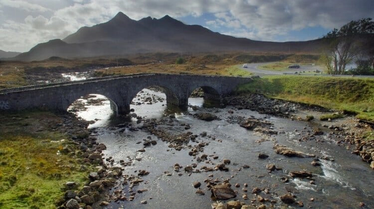
South West Coastal 300
Route: Dumfries → Kirkcudbright → Wigtown → Mull of Galloway → Portpatrick → Girvan → Culzean Castle → Sanquhar → Wanlockhead → Moffat → Dumfries
Distance: Approximately 300 miles, excluding additional detours
When to Go: May, June and September for coastal walks and exploring, or autumn for beautiful colours and dark skies
Best For: Quiet coastal roads, sandy beaches, historic castles, traditional fishing villages, wildlife and stargazing
The South West Coastal 300, often shortened to SWC300, is one of Scotland’s most underrated road trips, following a wonderfully varied circular route through Dumfries and Galloway, along the beautiful Ayrshire coast and across the rolling hills of the Southern Uplands. It’s a very different experience from the North Coast 500, with gentler landscapes, quieter roads and a fascinating mixture of historic towns, sandy beaches, ancient castles and traditional fishing villages.
Starting and finishing in Dumfries, the route covers approximately 300 miles and takes you through some of the least visited parts of southern Scotland, where the coastline is dotted with sheltered bays, rugged cliffs and small harbours overlooking the Irish Sea and Solway Firth. Inland, the scenery changes to forested hills, peaceful glens and open moorland, with winding roads that are a pleasure to drive.
One of the great attractions of the SWC300 is the opportunity to explore at a slower pace, stopping in small towns for lunch, following coastal paths to deserted beaches and discovering historic sites that rarely attract the crowds found elsewhere in Scotland. The region also has a strong literary and artistic heritage, with connections to Robert Burns, Scotland’s national poet, and a thriving community of artists, writers and craftspeople.
The route is generally suitable for cars, campervans and motorhomes, although some of the smaller roads around the Rhins of Galloway and the coastal villages are narrow, with passing places and limited parking. As elsewhere in Scotland, wild camping rights don’t extend to motorised vehicles, so use campsites or places where overnight parking is specifically permitted.
Allow at least four or five days to explore the SWC300, although a week would give you more time to enjoy the beaches, historic attractions and beautiful countryside. The route can be driven throughout the year, but spring and early autumn are particularly rewarding, with quieter roads and lovely light across the coastal landscapes.
Dumfries and Caerlaverock Castle
Begin your South West Coastal 300 road trip in Dumfries, a historic market town on the banks of the River Nith, where handsome sandstone buildings, attractive riverside walks and traditional pubs reflect its long history as an important trading centre in southern Scotland.
Dumfries is closely associated with Robert Burns, who spent the final years of his life here, and you can visit the house where he lived and the mausoleum where he is buried. The town’s literary connections are an important part of its identity, and there are several museums and historic sites where you can learn more about the poet’s life and work.
Before heading west along the Solway coast, take a short detour south to Caerlaverock Castle, one of Scotland’s most distinctive medieval fortresses, which stands surrounded by a moat in peaceful countryside near the Solway Firth.
Built during the 13th century, the castle is famous for its unusual triangular design and was involved in numerous conflicts between Scotland and England. Its dramatic gatehouse, defensive walls and surrounding woodland make it a fascinating place to explore, while the nearby nature reserve is particularly rewarding for birdwatchers.
The Solway Firth is an internationally important habitat for wintering wildfowl and wading birds, and the surrounding saltmarshes and mudflats provide wonderful opportunities to spot wildlife throughout the year.
Kirkcudbright and the Solway Coast
From Dumfries, follow the coast west towards Kirkcudbright, passing through beautiful countryside where quiet roads wind between rolling farmland, wooded hills and small villages overlooking the Solway Firth.
Along the way, consider stopping at New Abbey, a picturesque village dominated by the impressive ruins of Sweetheart Abbey, a 13th-century Cistercian monastery founded by Lady Devorgilla of Galloway in memory of her husband, John Balliol.
Further west, the coast around Sandyhills and Rockcliffe has beautiful beaches and lovely walking trails, with views across the Solway towards the hills of Cumbria on clear days.
Kirkcudbright, pronounced Kir-coo-bree, is one of the most attractive towns in Dumfries and Galloway, with colourful houses, a working harbour and a thriving artistic community that has earned it the nickname Scotland’s Artists’ Town.
The town has been associated with artists for more than a century, including members of the Glasgow Boys and Scottish Colourists, who were drawn to its beautiful light and coastal landscapes. Today, you’ll find independent galleries, studios and exhibitions throughout the town, along with attractive streets lined with cafés and small shops.
One of the most recognisable landmarks is MacLellan’s Castle, a ruined 16th-century tower house standing close to the harbour, while nearby Broughton House was once the home of artist E. A. Hornel and has beautiful Japanese-inspired gardens.
Kirkcudbright is also a wonderful place to enjoy fresh seafood, with local restaurants serving produce landed along the surrounding coastline.
Wigtown and the Machars Peninsula
Continue west towards Wigtown, a small town overlooking Wigtown Bay that has become internationally known as Scotland’s National Book Town.
Despite its modest size, Wigtown has an extraordinary collection of independent bookshops, selling everything from rare and antiquarian books to contemporary fiction and local history. It’s a wonderful place to spend a few hours browsing the shelves, particularly if you enjoy discovering unusual books and independent businesses.
The town also hosts the annual Wigtown Book Festival, which attracts writers, readers and literary enthusiasts from across Britain and beyond.
Wigtown sits on the Machars Peninsula, an attractive area of rolling farmland, quiet lanes and historic settlements extending south towards the Irish Sea.
The peninsula has a fascinating religious history, particularly around Whithorn, one of Scotland’s earliest centres of Christianity and a place associated with St Ninian, who is traditionally credited with establishing a Christian community here during the late Roman period.
Visit the historic town of Whithorn before continuing towards the Isle of Whithorn, a small fishing village with a picturesque harbour and beautiful views across the Irish Sea.
Nearby St Ninian’s Cave is another fascinating destination, reached by a coastal walk through woodland and along a rocky beach, although access requires care and suitable footwear.
The Machars is a particularly peaceful part of the SWC300, with quiet roads, traditional farms and beautiful stretches of coastline that reward travellers who are happy to take their time.
Mull of Galloway
From the Machars, continue west towards the Rhins of Galloway, a long, narrow peninsula extending south into the Irish Sea, where you’ll find some of Scotland’s most dramatic coastal scenery.
The highlight is the Mull of Galloway, the southernmost point of mainland Scotland, where a lighthouse stands high above spectacular sea cliffs overlooking the meeting of the Irish Sea and the North Channel.
Built in 1830, the Mull of Galloway Lighthouse is one of the area’s most recognisable landmarks, and on clear days the views extend towards Northern Ireland, the Isle of Man and the coast of Cumbria.
The surrounding cliffs are home to large colonies of seabirds, including guillemots, razorbills and kittiwakes, while gannets, porpoises and dolphins can sometimes be spotted offshore.
The Mull of Galloway RSPB reserve has walking trails and viewpoints where you can enjoy the spectacular coastal scenery, although the exposed headland can be extremely windy even on otherwise pleasant days.
Nearby Logan Botanic Garden is another worthwhile stop, particularly if you’re interested in plants and gardens. Thanks to the mild climate created by the Gulf Stream and surrounding seas, the gardens are home to an extraordinary collection of exotic plants, including palms and other species more commonly associated with warmer climates.
The roads along the Rhins of Galloway are narrow in places, with sharp bends and limited passing opportunities, so larger motorhomes should take particular care and avoid attempting small coastal lanes without checking the route first.
Portpatrick
Continue north along the western side of the Rhins towards Portpatrick, a beautiful harbour village overlooking the Irish Sea that is one of the highlights of the South West Coastal 300.
The village is centred around a picturesque harbour surrounded by colourful buildings, traditional pubs and seafood restaurants, with fishing boats and pleasure craft adding to its lively maritime atmosphere.
Portpatrick was once an important port for crossings between Scotland and Ireland, although its exposed harbour eventually proved unsuitable for larger vessels, and the main ferry services moved elsewhere.
Today, the village is a popular destination for coastal walks, particularly along the dramatic cliffs surrounding the harbour, where the views stretch across the Irish Sea towards Northern Ireland on clear days.
The Southern Upland Way, Scotland’s coast-to-coast long-distance walking route, begins in Portpatrick and follows the coastline before heading east across the Southern Uplands.
A lovely walk leads north towards the ruins of Dunskey Castle, a dramatic 16th-century fortress perched on a clifftop overlooking the sea. The castle’s atmospheric setting and spectacular views make it a wonderful place for photography, particularly in the late afternoon.
Portpatrick is also an excellent place to enjoy fresh seafood, with several restaurants serving locally caught fish and shellfish overlooking the harbour.
Girvan and the Ayrshire Coast
Leaving Portpatrick, head north towards Stranraer and continue along the beautiful Ayrshire coast, where the landscape opens into sweeping bays, rugged headlands and rolling green hills overlooking the Firth of Clyde.
The coastal drive towards Girvan is particularly scenic, with frequent views across the water towards the distinctive volcanic island of Ailsa Craig, which rises dramatically from the sea.
Ailsa Craig is famous for its seabird colonies and for producing the granite traditionally used to make curling stones, and its unmistakable shape dominates the horizon along this stretch of coastline.
Girvan is a traditional Scottish seaside town with a sandy beach, attractive harbour and lovely views towards Ailsa Craig and the Isle of Arran.
The town makes a pleasant place to stop for lunch or enjoy a walk along the promenade, particularly on a sunny day when the surrounding coastline looks beautiful.
Further north, the small harbour village of Dunure is another worthwhile detour, with traditional cottages, a picturesque harbour and the atmospheric ruins of Dunure Castle overlooking the sea.
This stretch of the SWC300 offers a lovely combination of coastal scenery and traditional seaside towns, with plenty of opportunities to stop and explore.
Culzean Castle and Country Park
One of the most impressive attractions along the Ayrshire coast is Culzean Castle and Country Park, a magnificent 18th-century castle perched dramatically on a clifftop overlooking the Firth of Clyde.
Designed by the celebrated Scottish architect Robert Adam, Culzean Castle is one of Scotland’s finest country houses, with elegant interiors, an extraordinary oval staircase and beautiful views across the sea towards the Isle of Arran.
The surrounding estate is equally impressive, with formal gardens, woodland walks, secluded beaches and extensive parkland that makes it easy to spend most of a day exploring.
The castle has a fascinating history and was once the seat of the Kennedy family, while part of the building was later gifted for the use of General Dwight D. Eisenhower in recognition of his role during the Second World War.
Nearby Alloway is the birthplace of Robert Burns, and the Robert Burns Birthplace Museum offers an excellent opportunity to learn more about Scotland’s national poet.
The village is also home to the atmospheric Brig o’ Doon, a historic stone bridge made famous in Burns’s poem Tam o’ Shanter, and the surrounding countryside is beautiful for walking.
Sanquhar and the Southern Uplands
From the Ayrshire coast, the SWC300 turns inland towards the Southern Uplands, where the landscape changes from sandy beaches and coastal cliffs to rolling hills, peaceful valleys and open moorland.
The roads become quieter as you travel through rural Ayrshire and into Nithsdale, passing traditional farming communities and small villages surrounded by beautiful countryside.
Sanquhar is a historic market town with strong connections to Scotland’s textile industry, particularly the distinctive Sanquhar knitting patterns that have been produced locally for generations.
The town is also famous for its post office, which is recognised as the world’s oldest continuously operating post office, having opened in 1712.
Nearby Drumlanrig Castle, the magnificent ancestral home of the Duke of Buccleuch, is another worthwhile detour, with grand interiors, beautiful gardens and extensive woodland trails.
The surrounding estate offers opportunities for walking and cycling, while the castle’s impressive architecture and art collections make it one of the most significant historic houses in southern Scotland.
Wanlockhead and Leadhills
Continue into the Lowther Hills towards Wanlockhead, the highest village in Scotland, sitting around 467 metres above sea level in a remote upland valley.
The village developed around the lead mining industry, which shaped the lives of local communities for centuries, and its distinctive stone cottages and surrounding mine workings provide a fascinating glimpse into Scotland’s industrial past.
At the Museum of Lead Mining, you can learn about the lives of the miners and their families, explore historic buildings and, when tours are operating, venture underground into a former lead mine.
Nearby Leadhills is another historic mining village, surrounded by open moorland and beautiful upland scenery, with a narrow-gauge heritage railway that operates on selected dates.
The drive through the Lowther Hills is one of the most memorable inland sections of the SWC300, particularly when the surrounding moorland is covered in purple heather during late summer.
The roads can be exposed to strong winds and poor weather, particularly during autumn and winter, so check conditions before travelling and take care on the steeper sections.
Moffat and the Dark Skies of Galloway
Continue towards Moffat, an attractive market town surrounded by the rolling hills of the Southern Uplands, where traditional stone buildings, independent shops and welcoming cafés make it a lovely place to stop before completing the route.
Moffat has a long history as a spa town and wool-trading centre, and today it’s a popular destination for walkers and travellers exploring southern Scotland.
Nearby Grey Mare’s Tail is one of Scotland’s most spectacular waterfalls, plunging around 60 metres down a steep hillside in a dramatic glacial valley.
The surrounding nature reserve is managed by the National Trust for Scotland and offers beautiful walking routes, including a challenging path climbing towards Loch Skeen, a remote upland loch surrounded by rugged hills.
If you have extra time, consider a detour into Galloway Forest Park, one of the largest forests in Britain and home to some of Scotland’s most beautiful woodland scenery.
The park was designated the UK’s first Dark Sky Park in 2009, and its exceptionally low levels of light pollution make it one of the best places in Britain for stargazing.
On a clear night, the Milky Way can be visible stretching across the sky, while the surrounding forests, lochs and hills provide a beautiful setting for walking, cycling and wildlife watching during the day.
From Moffat, return south towards Dumfries, completing your South West Coastal 300 road trip through one of Scotland’s most varied and rewarding regions.
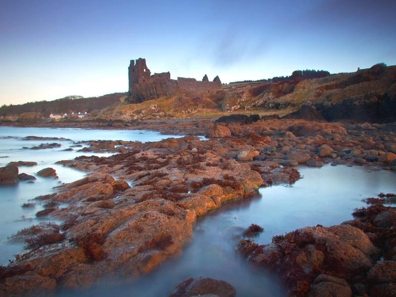
Wales Road Trips
Brecon Beacons (Bannau Brycheiniog)
Route: Abergavenny → Crickhowell → Talybont-on-Usk → Brecon → Pen y Fan → Ystradfellte → Llandeilo → Carreg Cennen Castle
Distance: Approximately 115 miles, excluding detours
When to Go: May, June and September for walking and outdoor activities, or October for beautiful autumn colours
Best For: Mountain scenery, waterfalls, historic castles, scenic driving, walking and stargazing
The Brecon Beacons, officially known as Bannau Brycheiniog National Park, is one of Wales’s most beautiful landscapes, where rolling green hills give way to dramatic mountain ridges, deep wooded valleys and vast stretches of open moorland. Covering more than 500 square miles of southern Wales, the national park is a wonderful place for a road trip, with quiet country roads winding between traditional market towns, ancient castles and some of the finest walking country in Britain.
The park stretches from the Black Mountains in the east to the remote Black Mountain range in the west, with the distinctive peaks of the central Brecon Beacons rising between them. Although the names can be confusing, these are separate mountain ranges, each with its own character, and together they create an extraordinary variety of scenery within a relatively compact area.
Bannau Brycheiniog is also famous for its waterfalls, particularly around the southern edge of the park, where rivers tumble through deep gorges surrounded by ancient woodland. The landscape has a rich history too, with Norman castles, prehistoric hillforts and traditional farming communities scattered throughout the valleys.
This is an excellent road trip for anyone who enjoys spending time outdoors, with opportunities for hiking, cycling, horse riding and canoeing, while the national park’s internationally recognised dark skies make it one of the best places in Britain for stargazing.
Allow at least three or four days to explore, and longer if you want to tackle some of the mountain walks or spend time discovering the quieter western valleys. The main roads are generally suitable for motorhomes, although some of the smaller lanes leading to waterfalls and remote viewpoints are narrow and unsuitable for larger vehicles.
Abergavenny and the Black Mountains
Begin your Brecon Beacons road trip in Abergavenny, a historic market town surrounded by beautiful countryside at the eastern edge of the national park, where the distinctive shapes of the Sugar Loaf, Skirrid and Blorenge mountains dominate the skyline.
Known as the Gateway to Wales, Abergavenny has long been an important trading centre, and its attractive streets are lined with independent shops, traditional pubs and excellent places to eat. The town has a particularly strong reputation for food, with local producers, farmers’ markets and the annual Abergavenny Food Festival attracting visitors from across Britain.
Take time to explore the ruins of Abergavenny Castle, which dates from the Norman period and stands above the River Usk, before wandering through the town centre or enjoying lunch in one of the local cafés.
The surrounding Black Mountains offer some of the most beautiful walking in the national park, with broad grassy ridges, peaceful valleys and wonderful views towards the Welsh borders.
The Sugar Loaf is one of the area’s most recognisable peaks, and the walk to its summit is particularly rewarding on a clear day, when the views stretch across the Usk Valley and towards the mountains of mid-Wales.
For a memorable scenic drive, consider a detour north towards Llanthony Priory, where the atmospheric ruins of a 12th-century Augustinian monastery stand in the beautiful Vale of Ewyas. The road through the valley is narrow and winding, but the scenery is spectacular, with steep green hills rising on either side.
Crickhowell and the Usk Valley
From Abergavenny, follow the A40 west towards Crickhowell, a charming market town on the banks of the River Usk, surrounded by the beautiful mountains of the eastern Brecon Beacons.
Crickhowell is known for its independent shops, traditional pubs and attractive stone buildings, and has a wonderfully relaxed atmosphere that makes it an ideal place to stop for a few hours.
The town’s historic bridge crosses the River Usk and is famous for its unusual arrangement of arches, which appear to number differently depending on which side of the bridge you’re standing.
Above the town, the remains of Crickhowell Castle offer a glimpse into its medieval history, while the surrounding hills provide excellent opportunities for walking.
One of the most popular routes climbs towards Table Mountain, a distinctive flat-topped hill overlooking the town, where the remains of an Iron Age hillfort occupy the summit. The views across the Usk Valley are beautiful, particularly in spring when the surrounding countryside is a vivid green.
Nearby Llangattock Escarpment is another impressive landscape, with dramatic limestone cliffs, caves and walking trails overlooking the valley.
Continue west along the Usk Valley, where the road passes through attractive villages and rolling farmland beneath the mountains, with frequent opportunities to stop and admire the scenery.
Talybont-on-Usk and the Reservoirs
Talybont-on-Usk is a pretty village beside the Monmouthshire and Brecon Canal, surrounded by wooded hills and peaceful countryside, and makes a lovely stop on the journey towards Brecon.
The canal was built during the Industrial Revolution to transport coal, iron and limestone, and today its towpath provides a beautiful walking and cycling route through the Usk Valley.
The village has traditional pubs, a small collection of shops and easy access to the surrounding hills, making it a popular base for outdoor activities.
Just south of Talybont is Talybont Reservoir, a beautiful stretch of water surrounded by forested hills, where the reflections of the surrounding mountains can be particularly impressive on a calm day.
The reservoir forms part of a scenic driving route through the central Brecon Beacons, although the smaller roads around the water and towards the high moorland are narrow and should be approached with care in larger vehicles.
For walkers and cyclists, the surrounding Taff Trail and mountain paths provide opportunities to explore the countryside, while the nearby waterfalls and woodland trails are particularly beautiful in autumn.
Brecon
Continue west towards Brecon, a historic market town on the River Usk that has long been regarded as the traditional heart of the Brecon Beacons.
The town has an attractive centre of Georgian buildings, independent shops and traditional pubs, while its position at the meeting point of the Rivers Usk and Honddu makes it a lovely place for a riverside walk.
Brecon Cathedral is one of the town’s most important historic landmarks, with origins dating back to a Norman priory founded in the 11th century. Its peaceful grounds and beautiful architecture provide an interesting contrast to the dramatic mountain scenery surrounding the town.
The Monmouthshire and Brecon Canal begins nearby, and following the towpath is a wonderful way to explore the countryside at a gentler pace, with narrowboats travelling through peaceful rural landscapes beneath the mountains.
Brecon is also home to the annual Brecon Jazz Festival, which has attracted musicians and visitors to the town for decades, and the surrounding area has an excellent selection of cafés and restaurants.
The town makes a convenient base for exploring the central Brecon Beacons, particularly if you want to tackle Pen y Fan or discover the nearby waterfalls.
Pen y Fan and the Central Beacons
From Brecon, head south towards Pen y Fan, the highest mountain in southern Britain at 886 metres above sea level, and one of the most popular walking destinations in Wales.
The mountain forms part of the central Brecon Beacons range, where broad grassy ridges and steep-sided valleys create a spectacular landscape shaped by glaciers during the last Ice Age.
The most popular walking route begins at the Pont ar Daf car park on the A470 and climbs steadily towards the summit, passing through open moorland with increasingly impressive views across the surrounding mountains.
Although the route is well used, the walk is exposed and the weather can change rapidly, with strong winds, low cloud and poor visibility possible even during summer.
For more experienced walkers, the circular route taking in Corn Du, Pen y Fan and Cribyn offers a magnificent ridge walk, with spectacular views into the glacial valleys below.
If you prefer to admire the mountains without tackling the summit, the A470 through the central Beacons is a beautiful drive, particularly around Storey Arms, where the road passes beneath the high peaks and the surrounding landscape opens out into broad mountain views.
This section of the national park is particularly atmospheric in autumn and winter, when low cloud moves across the ridges and the surrounding hillsides turn shades of copper and gold.
Waterfall Country and Ystradfellte
Continue towards the southern edge of the national park, where the landscape changes from open mountains to deep wooded valleys and dramatic limestone gorges.
The area around Ystradfellte is known as Waterfall Country, and is home to some of the most beautiful waterfalls in Wales, with rivers tumbling over rocky ledges and through ancient woodland.
One of the most popular walks is the Four Waterfalls Walk, which follows forest paths through the valleys of the Rivers Mellte and Hepste, passing Sgwd Clun-Gwyn, Sgwd Isaf Clun-Gwyn, Sgwd y Pannwr and the spectacular Sgwd yr Eira.
Sgwd yr Eira is particularly famous because a path leads behind the curtain of falling water, allowing visitors to experience the waterfall from an extraordinary perspective.
The full walk is around 5.5 miles, depending on the starting point, and includes steep sections, uneven paths and slippery stone steps, so sturdy footwear and waterproof clothing are essential.
The waterfalls are especially impressive after heavy rain, although the paths can become muddy and difficult, and the area gets very busy during summer weekends.
The Bannau Brycheiniog National Park Authority provides information about walking routes and visitor facilities, and it’s worth checking parking arrangements before travelling, particularly if you’re in a motorhome.
The roads leading to some of the smaller waterfall car parks are narrow and unsuitable for larger vehicles, so consider using the main designated parking areas and exploring on foot.
Llandeilo and the Western Beacons
From Waterfall Country, continue west towards Llandeilo, a colourful market town overlooking the River Tywi that makes an excellent base for exploring the western side of Bannau Brycheiniog.
The town is known for its attractive Georgian buildings, independent boutiques, galleries and excellent cafés, and has a lively atmosphere that reflects its position at the heart of the Tywi Valley.
Nearby Dinefwr Park is one of the area’s most fascinating historic landscapes, with beautiful parkland, ancient woodland and the atmospheric ruins of Dinefwr Castle overlooking the river.
The estate is associated with the princes of Deheubarth, one of the medieval Welsh kingdoms, and its long history is reflected in the castle ruins and surrounding landscape.
Further east, the western Brecon Beacons are dominated by the Black Mountain range, where remote moorland, glacial lakes and rugged ridges create some of the wildest scenery in the national park.
The area is particularly beautiful around Llyn y Fan Fach, a glacial lake beneath the dramatic escarpment of Bannau Sir Gaer, which is associated with the Welsh legend of the Lady of the Lake.
Reaching the lake involves a walk through remote upland countryside, but the scenery is magnificent and the surrounding mountains offer some of the finest hiking in southern Wales.
For a spectacular driving experience, consider the A4069 between Llangadog and Brynamman, often called the Black Mountain Pass, where the road climbs through sweeping bends and open moorland with wonderful views across the surrounding hills.
The pass has become popular with driving enthusiasts, but it’s also used by cyclists, walkers and livestock, so take particular care around blind bends and avoid it in poor weather or unsuitable vehicles.
Carreg Cennen Castle
Finish your Brecon Beacons road trip at Carreg Cennen Castle, one of the most dramatically situated castles in Wales, perched on a towering limestone cliff overlooking the beautiful countryside of Carmarthenshire.
The castle’s position is extraordinary, with sheer cliffs dropping away beneath its ruined walls and sweeping views across the surrounding farmland and distant mountains.
Although the present castle largely dates from the 13th century, the site has a much longer history, and its commanding position made it an important stronghold during the medieval struggles between Welsh princes and English rulers.
The castle was captured and changed hands several times during its history, and was eventually damaged during the Wars of the Roses to prevent it being used as a fortress again.
Today, visitors can explore the atmospheric ruins, climb the surviving walls and enjoy some of the finest castle views in Wales.
One of the castle’s most unusual features is a natural cave beneath the fortress, which can be explored when access is permitted, although you’ll need a torch and suitable footwear.
The surrounding countryside is beautiful for walking, with footpaths crossing rolling farmland and offering spectacular views back towards the castle on its rocky outcrop.
Carreg Cennen Castle is a fitting place to finish this road trip, combining the dramatic scenery, fascinating history and beautiful countryside that make the Brecon Beacons such a rewarding part of Wales to explore.
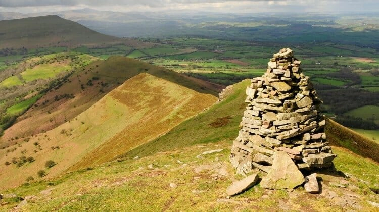
Pembrokeshire Coast
Route: Tenby → Saundersfoot → Manorbier → Freshwater West → Pembroke → Marloes → Dale → St Davids → Abereiddy → Fishguard → Newport
Distance: Approximately 150 miles, excluding detours
When to Go: May, June and September for coastal walks and quieter beaches, or July and August for swimming and seaside activities
Best For: Beautiful beaches, dramatic coastal scenery, wildlife, historic castles, colourful harbour towns and walking
Pembrokeshire is one of the most beautiful coastal regions in Britain, where rugged cliffs, sweeping sandy beaches and picturesque fishing villages create a spectacular landscape along the south-western corner of Wales. Much of the coastline lies within the Pembrokeshire Coast National Park, Britain’s only national park designated primarily for its coastal scenery, and the winding roads between its beaches and harbours make it a wonderful destination for a road trip.
The coastline is extraordinarily varied, with sheltered sandy bays along the south coast, dramatic limestone cliffs around the Castlemartin Peninsula and wild Atlantic scenery further west. You’ll discover medieval castles, tiny harbours, ancient churches and some of the finest beaches in Wales, while the surrounding waters are home to seals, dolphins, porpoises and an extraordinary variety of seabirds.
One of the best ways to appreciate Pembrokeshire is on foot, and the Pembrokeshire Coast Path follows approximately 186 miles of spectacular coastline, passing secluded coves, dramatic headlands and beautiful beaches. You don’t need to tackle the entire trail to enjoy it, as there are countless shorter walks from villages and car parks along the route.
Pembrokeshire is also an excellent destination for outdoor activities, with opportunities for kayaking, coasteering, surfing and boat trips to offshore islands, while its traditional towns and villages have plenty of welcoming pubs and excellent seafood restaurants.
Allow at least four or five days to explore this route, although a week or longer would give you time to enjoy the beaches and discover some of the quieter corners of the national park. The main roads are generally suitable for motorhomes, but many of the smaller lanes leading to beaches and coastal viewpoints are narrow, with limited parking, so it’s worth checking access before setting off.
Tenby
Begin your Pembrokeshire road trip in Tenby, one of Wales’s most attractive seaside towns, where colourful Georgian houses overlook a picturesque harbour and golden sandy beaches stretch beneath the medieval town walls.
Tenby has been a popular holiday destination since the Victorian era, and its combination of historic streets, independent shops and beautiful beaches makes it a lovely place to spend a couple of days.
The old town is surrounded by remarkably well-preserved medieval walls, and wandering through its narrow streets reveals attractive buildings, traditional pubs and small shops selling local produce and handmade gifts.
The harbour is particularly picturesque, with brightly coloured houses overlooking fishing boats and pleasure craft, while the surrounding beaches offer beautiful views across Carmarthen Bay.
North Beach is a wide sweep of golden sand backed by cliffs, while South Beach stretches for more than a mile towards the dunes and headland at Giltar Point. Castle Beach, tucked beneath the ruins of Tenby Castle, is another lovely spot, particularly when the tide is out.
From Tenby harbour, boat trips run to Caldey Island, a peaceful island home to a community of Cistercian monks, where you can explore beautiful beaches, woodland walks and historic religious buildings.
The island has a wonderfully tranquil atmosphere, and its small shop sells products made by the monastic community, including perfumes and chocolate. Boat services are seasonal and weather-dependent, so check arrangements locally before planning your visit.
Saundersfoot and the South Coast
Just a short drive north of Tenby is Saundersfoot, a popular seaside village with a beautiful sandy beach, attractive harbour and a relaxed holiday atmosphere.
The village has a good selection of cafés, pubs and seafood restaurants overlooking the waterfront, making it a lovely place to stop for lunch or enjoy a walk along the beach.
Saundersfoot was once an important centre for the local coal industry, and the surrounding coastline still has reminders of its industrial past, including old railway tunnels and harbour structures that were used to transport coal from nearby mines.
Today, the area is better known for its beautiful coastal walks, particularly the section of the Pembrokeshire Coast Path towards Wiseman’s Bridge, where the route follows the shoreline beneath wooded cliffs.
The beach is popular with families, and the sheltered bay is a lovely place for swimming and paddleboarding when conditions are suitable.
From Saundersfoot, retrace your route towards Tenby before continuing west along the southern Pembrokeshire coast, where the scenery becomes increasingly rugged and the beaches are separated by dramatic limestone headlands.
Manorbier and the Castlemartin Peninsula
Manorbier is a beautiful coastal village where a magnificent medieval castle overlooks a sheltered sandy bay, creating one of the most picturesque settings in Pembrokeshire.
Manorbier Castle dates from the 12th century and is famous as the birthplace of Gerald of Wales, a medieval scholar and chronicler who described the area as one of the most beautiful places in Wales.
The castle is remarkably well preserved, with imposing walls, towers and a gatehouse overlooking the surrounding countryside, while the nearby beach is a lovely place to relax or explore the rock pools at low tide.
Continue west towards the Castlemartin Peninsula, where the coastline becomes wilder and more dramatic, with towering limestone cliffs, secluded coves and beautiful sandy beaches.
One of the most spectacular natural attractions is the Green Bridge of Wales, an enormous limestone sea arch carved by the waves, while nearby Stack Rocks are impressive sea stacks that provide nesting sites for thousands of seabirds during spring and summer.
These formations lie within the Castlemartin military training area, and access to the roads and viewpoints can be restricted during live firing exercises, so check the current arrangements before travelling.
Further west, Freshwater West is one of Pembrokeshire’s most dramatic beaches, with a broad sweep of sand backed by dunes and powerful Atlantic waves that attract experienced surfers.
The beach is also famous as a filming location for Harry Potter and the Deathly Hallows, where it was used for scenes featuring Shell Cottage and Dobby’s burial.
Although the beach is beautiful, the sea can be dangerous because of strong currents and powerful surf, so swimming is only advisable when conditions are suitable and within designated lifeguarded areas.
Pembroke and Pembroke Castle
From the coast, head inland towards Pembroke, a historic town dominated by one of the finest medieval castles in Wales.
Pembroke Castle stands on a rocky promontory overlooking the Pembroke River and is one of the most impressive Norman fortresses in Britain, with enormous defensive walls, towers and a magnificent circular keep.
The castle is particularly famous as the birthplace of Henry VII, the first Tudor king of England, who was born here in 1457.
Today, visitors can explore the castle’s atmospheric interiors, climb the towers for spectacular views across the surrounding countryside and learn about its long and often turbulent history through exhibitions and displays.
One of the castle’s most unusual features is Wogan Cavern, a vast natural cave beneath the fortress that was used by people long before the medieval castle was built.
Pembroke itself has an attractive historic centre, with traditional buildings, independent shops and cafés, making it a lovely place to spend a few hours before continuing west towards the coast.
Nearby Lamphey Bishop’s Palace is another interesting historic site, with the remains of a grand medieval residence once used by the bishops of St Davids.
Marloes and the Dale Peninsula
Continue west towards the Dale Peninsula, one of the quieter and more beautiful parts of Pembrokeshire, where narrow roads wind through farmland towards spectacular cliffs and secluded beaches overlooking the Atlantic.
Marloes Sands is one of the area’s most impressive beaches, with a vast sweep of golden sand backed by dramatic cliffs and unusual rock formations that are revealed as the tide retreats.
The beach has a wonderfully wild atmosphere, particularly outside the summer holidays, and is a fantastic place for a long walk or photography when the light catches the surrounding cliffs.
Nearby Martin’s Haven is the departure point for boat trips to Skomer Island, one of Britain’s most important seabird colonies and a wonderful destination for wildlife enthusiasts.
Skomer is particularly famous for its puffins, which return to the island during spring and early summer to breed, while thousands of guillemots, razorbills and other seabirds nest along the cliffs.
The island is also home to a large population of Manx shearwaters, although these birds are generally more active after dark.
Landing trips are seasonal and places are limited, so book ahead through the Wildlife Trust of South and West Wales if you want to visit the island.
Further south, the village of Dale sits beside a sheltered bay overlooking Milford Haven, with a small harbour, traditional pub and opportunities for kayaking, sailing and other watersports.
The surrounding coastline is particularly beautiful for walking, with paths leading towards St Ann’s Head, where a lighthouse stands above dramatic cliffs overlooking the entrance to Milford Haven.
St Davids
Continue north towards St Davids, Britain’s smallest city, which sits close to the spectacular coastline of St Brides Bay and has been an important place of Christian pilgrimage for more than a thousand years.
Despite its city status, St Davids has the atmosphere of a small market town, with attractive stone buildings, independent shops and welcoming cafés clustered around its historic centre.
The city’s most famous landmark is St Davids Cathedral, a magnificent medieval building standing in a sheltered valley beside the ruins of the Bishop’s Palace.
The cathedral is dedicated to St David, the patron saint of Wales, who is believed to have founded a monastic community here during the 6th century, and its beautiful architecture and peaceful setting make it one of the most important religious sites in Wales.
Nearby St Davids Bishop’s Palace is another fascinating historic attraction, with atmospheric ruins that reveal the wealth and influence of the medieval bishops who once lived here.
The surrounding coastline is equally impressive, particularly around St Non’s Bay, where a small chapel and holy well mark the traditional birthplace of St David.
For spectacular views, follow the coastal path around St Davids Head, where rocky cliffs, heathland and ancient archaeological remains overlook the waters of Ramsey Sound.
Boat trips from nearby St Justinians offer opportunities to explore the coastline around Ramsey Island, with chances to spot seals, seabirds and occasionally dolphins or porpoises.
Abereiddy and the Blue Lagoon
From St Davids, follow the coast north towards Abereiddy, a small coastal settlement famous for its striking Blue Lagoon, one of the most unusual natural attractions in Pembrokeshire.
The lagoon occupies a former slate quarry that was flooded by the sea after the quarry workings were abandoned, creating a deep pool of brilliant blue-green water surrounded by dark rock cliffs.
The unusual colour comes from the minerals in the slate, and the dramatic setting has made the lagoon a popular destination for photography, kayaking and organised coasteering activities.
The lagoon has also hosted international cliff-diving competitions, although jumping from the surrounding cliffs is extremely dangerous and should not be attempted without appropriate professional supervision.
Nearby Abereiddy Beach is a beautiful stretch of dark sand and pebbles, while the surrounding coastal path offers spectacular views towards Porthgain, a small harbour village with a fascinating industrial history.
Porthgain was once an important centre for slate and brick production, and the remains of its industrial buildings still stand above the harbour, creating an atmospheric contrast with the surrounding coastal scenery.
Today, the village is known for its art galleries, traditional pub and excellent seafood restaurant, making it a lovely place to stop after exploring the coast.
Fishguard and Goodwick
Continue north-east towards Fishguard, a historic harbour town overlooking a beautiful bay on Pembrokeshire’s northern coast.
Fishguard has a fascinating maritime history and is particularly famous for its association with the last invasion of mainland Britain, when French troops landed nearby in 1797 before surrendering to local forces.
The town is divided into two distinct areas, with the upper town standing above the harbour and Lower Fishguard occupying a picturesque waterfront of traditional cottages and fishing boats.
Lower Fishguard is particularly attractive, with colourful buildings overlooking the sheltered harbour, and was used as a filming location for the 1972 adaptation of Under Milk Wood.
Nearby Goodwick is home to the ferry terminal for crossings to Rosslare in Ireland, making this part of Pembrokeshire an important gateway between Wales and Ireland.
For a beautiful coastal walk, follow the paths around Fishguard Bay or explore the surrounding cliffs, where the views stretch across the Irish Sea and the rugged northern coastline.
Newport and the Preseli Hills
Finish your Pembrokeshire road trip in Newport, a beautiful small town on the banks of the River Nevern, where traditional stone buildings, independent shops and welcoming pubs sit beneath the rolling hills of the Preseli Mountains.
Newport has a wonderfully relaxed atmosphere, with an attractive estuary, sandy beach and excellent opportunities for walking along the surrounding coastline.
The nearby Pembrokeshire Coast Path offers spectacular views across Newport Bay and towards the rugged headlands of northern Pembrokeshire, while the estuary is a particularly good place for birdwatching.
The surrounding Preseli Hills are famous for their prehistoric monuments, ancient trackways and extraordinary geological history, including the distinctive spotted dolerite rock associated with some of the bluestones used to build Stonehenge.
For a memorable final excursion, explore the hills around Foel Eryr or visit Pentre Ifan, one of Wales’s most impressive prehistoric burial chambers, where enormous standing stones support a massive capstone overlooking the surrounding countryside.
The monument dates from the Neolithic period and stands in a beautiful rural setting, with views towards the Preseli Hills that make it a fitting final stop on this spectacular coastal road trip.
Related Post: Wales Road Trip: The Ultimate 14-Day Itinerary + Map
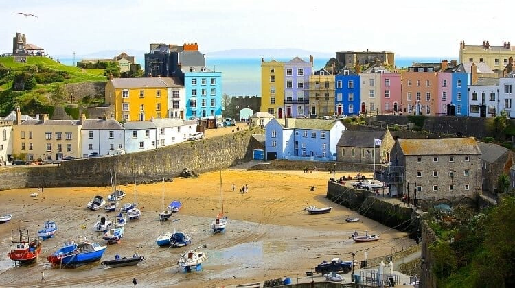
Snowdonia and Anglesey
Route: Betws-y-Coed → Capel Curig → Llanberis → Beddgelert → Porthmadog → Portmeirion → Caernarfon → Newborough → Rhosneigr → South Stack → Cemaes Bay → Benllech → Beaumaris
Distance: Approximately 230 miles, excluding detours
When to Go: May, June and September for walking, mountain scenery and quieter beaches, or autumn for beautiful colours in the valleys
Best For: Dramatic mountain roads, historic castles, scenic railways, beautiful beaches, coastal walks and outdoor adventures
Snowdonia and Anglesey make a spectacular combination for a North Wales road trip, bringing together some of Britain’s most dramatic mountain scenery with beautiful beaches, historic castles and traditional Welsh villages. The route begins among the rugged peaks and deep valleys of Eryri National Park, better known to many visitors as Snowdonia, before heading across the Menai Strait to explore the beautiful coastline of Anglesey.
Eryri is home to Yr Wyddfa, or Snowdon, the highest mountain in Wales at 1,085 metres, along with magnificent glacial valleys, mountain lakes and winding roads that offer some of the finest driving scenery in Britain. The landscape is steeped in Welsh history and culture, with Welsh widely spoken throughout the region and ancient legends associated with its mountains and lakes.
Across the Menai Strait, Anglesey, or Ynys Môn, has a completely different character, with rolling farmland, sheltered bays, wide sandy beaches and rugged coastal headlands overlooking the Irish Sea. The island is particularly rewarding for wildlife enthusiasts, with seabird colonies, seal populations and excellent opportunities for coastal walking.
This is a road trip that deserves plenty of time, particularly if you enjoy walking or want to explore the historic attractions along the way. Allow at least five or six days, although a week or longer would give you time to climb Yr Wyddfa, enjoy the beaches and discover some of the quieter corners of Anglesey.
The main roads through Eryri are generally suitable for cars, campervans and motorhomes, but some of the mountain passes and smaller roads around Anglesey are narrow, with sharp bends and limited passing places. Parking at popular walking locations can also be difficult, especially during summer, so plan ahead and use public transport where appropriate.
Betws-y-Coed and Swallow Falls
Begin your Snowdonia and Anglesey road trip in Betws-y-Coed, a picturesque village surrounded by dense woodland and beautiful river valleys at the eastern edge of Eryri National Park.
The village developed as a popular tourist destination during the Victorian era, and its attractive stone buildings, historic railway station and riverside setting make it a lovely place to spend a few hours before heading into the mountains.
Betws-y-Coed has a good selection of independent shops, outdoor equipment retailers, cafés and traditional pubs, making it an excellent base for exploring the surrounding countryside.
One of the most popular nearby attractions is Swallow Falls, where the River Llugwy tumbles over a series of rocky cascades surrounded by beautiful woodland. The falls are particularly impressive after heavy rain, when the water rushes through the gorge with considerable force.
The surrounding Gwydir Forest has numerous walking and cycling trails, while the nearby village of Trefriw is known for its traditional woollen mill and attractive setting beside the River Conwy.
For another beautiful waterfall, visit Fairy Glen, a narrow wooded gorge where the River Conwy flows between moss-covered rocks, creating an atmospheric landscape that is particularly lovely in autumn.
Capel Curig and the Ogwen Valley
From Betws-y-Coed, follow the A5 west towards Capel Curig, where the landscape gradually opens into spectacular mountain scenery, with rugged peaks rising above the surrounding valleys.
Capel Curig is a small mountain village at the meeting point of several important routes through Eryri, and its position beneath the Glyderau and Carneddau mountain ranges makes it a popular base for walkers and climbers.
The views towards the distinctive pyramid-shaped peak of Moel Siabod are particularly beautiful, while the surrounding lakes and rivers provide wonderful opportunities for photography.
For one of the most dramatic drives in North Wales, take a detour along the A5 through the Ogwen Valley, where the road passes beneath towering mountains and alongside the dark waters of Llyn Ogwen.
The surrounding peaks include Tryfan, one of Wales’s most recognisable mountains, with its distinctive rocky summit rising sharply above the valley floor.
The Ogwen Valley is a magnificent place for walking, although many of the mountain routes are steep and demanding, requiring suitable equipment and experience.
Cwm Idwal, a spectacular glacial valley surrounded by dramatic cliffs, is one of the area’s most accessible and rewarding walks, with a circular path around a beautiful mountain lake.
Parking around Ogwen is limited and the area becomes extremely busy during weekends and holidays, so arrive early or use public transport rather than parking along the roadside.
Llanberis and Yr Wyddfa
Continue towards Llanberis, a traditional slate-mining village standing beside the beautiful waters of Llyn Padarn at the foot of Yr Wyddfa.
Llanberis is one of the most popular bases for exploring Eryri, particularly for visitors planning to climb Wales’s highest mountain, and its combination of mountain scenery, historic attractions and outdoor activities makes it an excellent place to spend a day or two.
The village is home to the Snowdon Mountain Railway, a historic rack-and-pinion railway that climbs the mountain from Llanberis towards the summit, offering spectacular views across the surrounding peaks and valleys.
Services operate seasonally and the upper terminus can vary according to weather and operating conditions, so book ahead and check how far trains are travelling before your visit.
For walkers, the Llanberis Path is one of the most popular routes to the summit of Yr Wyddfa, following a gradual but sustained climb of approximately nine miles return. Although it’s generally considered one of the more straightforward routes, it remains a serious mountain walk, and conditions can change quickly even during summer.
Other popular routes include the Pyg Track and Miners’ Track, both starting from Pen y Pass, where parking must be planned carefully and spaces can require advance booking.
The Sherpa’r Wyddfa bus service connects Llanberis and other nearby towns with the main walking routes, and is often the easiest way to reach the trailheads without worrying about parking.
Llanberis also has several fascinating attractions associated with its industrial heritage, including the National Slate Museum at the former Dinorwig Quarry workshops, where you can learn about the industry that shaped the surrounding communities.
Nearby Dolbadarn Castle, a 13th-century Welsh fortress overlooking Llyn Padarn, is another worthwhile stop, while the lakeside paths offer beautiful views of the mountains without requiring a strenuous climb.
Beddgelert and the Nant Gwynant Valley
From Llanberis, continue towards Beddgelert, travelling through some of the most beautiful mountain scenery in Eryri.
The village stands at the meeting point of the Rivers Glaslyn and Colwyn, surrounded by wooded hills and dramatic peaks, and is one of the most attractive places in the national park.
Beddgelert is famous for the legend of Gelert, the faithful hound of Prince Llywelyn, whose tragic story has become one of Wales’s best-known folk tales.
A short riverside walk leads to Gelert’s Grave, a stone monument associated with the legend, while the surrounding village has traditional stone cottages, independent shops and welcoming cafés.
The nearby Aberglaslyn Pass is one of the most beautiful river gorges in Wales, where the River Glaslyn flows between steep wooded slopes and rocky cliffs. The riverside walking route is particularly lovely, although some sections are uneven and can be slippery after rain.
Another worthwhile excursion is the Nant Gwynant Valley, where the road winds between towering mountains and beautiful lakes, including Llyn Gwynant and Llyn Dinas.
This is one of the most scenic valleys in Eryri, with wonderful views of the surrounding peaks and opportunities for lakeside walks, kayaking and photography.
The roads through the valley can become busy during summer, particularly around popular walking routes and campsites, so take care when passing cyclists and pedestrians.
Porthmadog and Portmeirion
Continue south-west towards Porthmadog, a historic harbour town on the edge of the Glaslyn Estuary, where the mountains of Eryri meet the beautiful coastline of Cardigan Bay.
Porthmadog developed as an important port for the slate industry during the 19th century, and its maritime heritage is still evident in the harbour and historic buildings around the town.
Today, it’s best known for its heritage railways, particularly the Ffestiniog and Welsh Highland Railways, which offer spectacular journeys through the mountains and valleys of North Wales.
The Ffestiniog Railway climbs from Porthmadog towards Blaenau Ffestiniog, passing through beautiful woodland, mountain scenery and historic slate-mining landscapes, while the Welsh Highland Railway travels north through the Aberglaslyn Pass towards Caernarfon.
Just outside Porthmadog is Portmeirion, one of Wales’s most unusual attractions, where colourful Italianate buildings, ornamental gardens and beautiful coastal views create an extraordinary village overlooking the Dwyryd Estuary.
Designed by architect Sir Clough Williams-Ellis and developed over several decades during the 20th century, Portmeirion was created to demonstrate how architecture could complement a beautiful natural setting.
The village is famous as the filming location for the 1960s television series The Prisoner, and its distinctive buildings, colourful squares and landscaped gardens make it a fascinating place to explore.
Allow several hours to wander through the village, enjoy the coastal views and explore the surrounding woodland trails, particularly during spring when the gardens are full of colour.
Caernarfon and the Menai Strait
From Porthmadog, head north towards Caernarfon, a historic walled town overlooking the Menai Strait and dominated by one of the most impressive medieval castles in Britain.
Caernarfon Castle was built by Edward I during the late 13th century as part of his campaign to establish English control over Wales, and its enormous polygonal towers and imposing defensive walls reflect its importance as a royal fortress.
The castle forms part of the UNESCO-listed Castles and Town Walls of King Edward in Gwynedd, alongside Conwy, Beaumaris and Harlech.
Caernarfon’s historic centre is enclosed by medieval walls, with attractive streets leading towards the waterfront, where cafés and restaurants overlook the harbour and Menai Strait.
The town is also the northern terminus of the Welsh Highland Railway, making it possible to enjoy a scenic steam train journey through Eryri without driving.
From Caernarfon, continue towards the Menai Strait, the narrow stretch of tidal water separating mainland Wales from Anglesey.
Two impressive bridges cross the strait, including Thomas Telford’s historic Menai Suspension Bridge and Robert Stephenson’s Britannia Bridge, both important landmarks in the history of British engineering.
Cross onto Anglesey, where the dramatic mountain scenery gives way to rolling farmland, wide sandy beaches and beautiful coastal villages.
Newborough Forest and Llanddwyn Island
Begin exploring Anglesey along its south-western coastline, where Newborough Forest and the magnificent beach at Newborough Warren form one of the island’s most beautiful landscapes.
The forest is home to a network of walking and cycling trails, while the surrounding dunes and saltmarshes provide important habitats for wildlife, including red squirrels, which have successfully returned to parts of Anglesey.
Newborough Beach stretches for miles along the coast, with beautiful views across the Menai Strait towards the mountains of Eryri.
At the western end of the beach is Llanddwyn Island, a tidal peninsula famous for its association with St Dwynwen, the Welsh patron saint of lovers.
The island has a wonderfully romantic atmosphere, with small coves, historic lighthouse buildings and the ruins of St Dwynwen’s Church overlooking the sea.
The walk to Llanddwyn is one of the most rewarding coastal walks on Anglesey, particularly on a clear day when the mountains of Eryri rise dramatically across the water.
Access to parts of the island can be affected by high tides, so check tide times before setting off and allow plenty of time for the return walk.
The surrounding beaches are also excellent for photography, particularly in the late afternoon when the low sun illuminates the dunes and distant mountain peaks.
Rhosneigr and the Western Beaches
Continue north-west towards Rhosneigr, a popular seaside village overlooking two beautiful sandy beaches on Anglesey’s western coastline.
Rhosneigr has a relaxed coastal atmosphere, with independent shops, cafés and restaurants, and is particularly popular with watersports enthusiasts thanks to its exposed position and reliable winds.
The beaches are excellent for windsurfing, kitesurfing and paddleboarding when conditions are suitable, while the surrounding dunes and coastal paths provide lovely opportunities for walking.
Nearby Cable Bay and Porth Trecastell are particularly beautiful, with golden sand, rocky headlands and clear water creating a spectacular setting along the western coast.
Further north, the coastline becomes increasingly rugged as you approach Holy Island, where dramatic cliffs and exposed headlands overlook the Irish Sea.
This stretch of Anglesey is particularly beautiful at sunset, when the light falls across the sandy bays and the distant mountains of the Llŷn Peninsula.
South Stack and Holyhead
One of the most spectacular places on Anglesey is South Stack, where a historic lighthouse stands on a rocky island beneath towering cliffs overlooking the Irish Sea.
South Stack Lighthouse was built in 1809 and is reached by a steep flight of approximately 400 steps descending the cliffs, followed by a bridge across to the island.
The setting is extraordinary, with dramatic rock formations, crashing waves and magnificent views along the rugged coastline.
The surrounding cliffs are home to important seabird colonies, including guillemots, razorbills and puffins during the breeding season, while the nearby RSPB reserve provides excellent viewpoints for birdwatching.
The area is also a wonderful place to spot choughs, distinctive members of the crow family with red bills and legs, which thrive along the exposed coastal cliffs.
For a longer walk, explore the paths around Holyhead Mountain, the highest point on Anglesey, where the summit offers panoramic views across the island, the Irish Sea and the mountains of mainland Wales.
Nearby Holyhead is an important ferry port for crossings to Dublin, and the town has a long maritime history associated with trade and travel between Britain and Ireland.
The surrounding coastline offers beautiful walking routes, particularly around the Breakwater Country Park and the rocky headlands overlooking Holyhead Bay.
Cemaes Bay and the Northern Coast
Continue east along Anglesey’s northern coastline towards Cemaes Bay, a picturesque harbour village with colourful houses, a sheltered sandy beach and traditional fishing boats.
The village has a wonderfully peaceful atmosphere, particularly outside the summer holidays, and makes an excellent place to stop for lunch or enjoy a walk along the waterfront.
The surrounding coastline is characterised by rugged cliffs, rocky coves and quiet beaches, with beautiful views across the Irish Sea.
Nearby Cemlyn Bay is an important nature reserve, where a distinctive shingle ridge separates the sea from a coastal lagoon that supports internationally significant seabird colonies.
During spring and summer, the lagoon is an important breeding site for terns, including sandwich, common and Arctic terns, and the surrounding paths provide excellent opportunities for birdwatching.
Further east, the coast around Amlwch reflects Anglesey’s industrial heritage, particularly at Parys Mountain, where centuries of copper mining have created an extraordinary landscape of colourful mineral-rich rock and abandoned workings.
The site has an almost otherworldly appearance, with shades of orange, red and purple across the exposed rock, and walking trails provide an opportunity to explore this fascinating part of the island’s history.
Benllech and Red Wharf Bay
Continue south-east towards Benllech, one of Anglesey’s most popular seaside destinations, where a beautiful sandy beach stretches along the island’s eastern coastline.
Benllech Beach is particularly attractive at low tide, when the sand extends far out into the bay, creating plenty of space for walking, beach games and relaxing beside the sea.
The village has a good selection of shops, cafés and restaurants, making it a convenient place to stop before exploring the surrounding coastline.
Nearby Red Wharf Bay, known in Welsh as Traeth Coch, is another spectacular stretch of coastline, with a vast sandy expanse revealed at low tide and beautiful views towards the surrounding wooded hills.
The bay is popular with walkers and birdwatchers, while the small village overlooking the beach has traditional pubs and places to eat.
The Isle of Anglesey Coastal Path follows approximately 130 miles of the island’s coastline, and this section provides some particularly lovely walks through woodland, saltmarshes and along sandy beaches.
Check tide times before exploring the foreshore, as the sea can advance quickly across the extensive sands.
Beaumaris and Penmon Point
Finish your Snowdonia and Anglesey road trip in Beaumaris, a beautiful historic town overlooking the Menai Strait, where elegant Georgian buildings, independent shops and a picturesque waterfront create one of the most attractive settings in North Wales.
The town is dominated by Beaumaris Castle, one of Edward I’s great medieval fortresses and a UNESCO World Heritage Site.
Although the castle was never completed, its concentric defensive walls and symmetrical design make it one of the finest examples of medieval military architecture in Britain.
The castle is surrounded by a moat and extensive grounds, and visitors can explore its towers, passages and defensive walls while learning about its fascinating history.
Beaumaris itself is a lovely place to wander, with traditional pubs, cafés and independent shops lining its attractive streets, while the waterfront offers beautiful views across the Menai Strait towards the mountains of Eryri.
Boat trips operate from Beaumaris to explore the surrounding waters, including cruises towards Puffin Island, an important seabird habitat where seals and other marine wildlife can sometimes be spotted.
For a final coastal excursion, continue towards Penmon Point, where a distinctive lighthouse stands in the tidal waters between Anglesey and Puffin Island.
The surrounding coastline is beautiful, with rocky beaches, historic buildings and magnificent views across the sea towards the Great Orme and the North Wales coast.
Nearby Penmon Priory has a fascinating history dating back to the early Christian period, with surviving medieval buildings and an ancient holy well.
Beaumaris is a fitting place to finish this North Wales road trip, combining spectacular coastal scenery, fascinating history and beautiful views towards the mountains where your journey began.
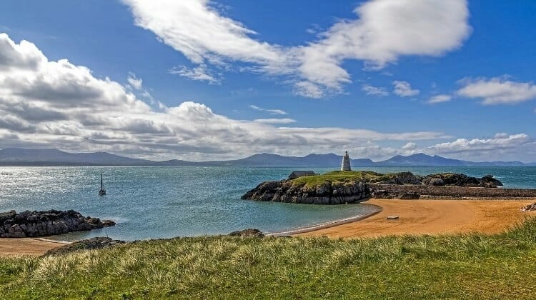
Northern Ireland Road Trips
Causeway Coastal Route
Route: Belfast → Carrickfergus → The Gobbins → Glenarm → Cushendall → Cushendun → Ballycastle → Carrick-a-Rede → Ballintoy → Giant’s Causeway → Dunluce Castle → Portrush → Portstewart → Mussenden Temple → Derry/Londonderry
Distance: Approximately 150 miles, excluding detours
When to Go: May, June and September for longer days, coastal walks and quieter attractions, or July and August for the best chance of beach weather
Best For: Dramatic coastal scenery, ancient castles, beautiful beaches, geological wonders, Game of Thrones filming locations and traditional seaside towns
The Causeway Coastal Route is one of the most spectacular road trips in Northern Ireland, following the rugged coastline of County Antrim before continuing west towards the historic city of Derry/Londonderry. Along the way, the road passes beneath towering cliffs, through picturesque fishing villages and beside beautiful sandy beaches, with magnificent views across the North Channel towards Scotland on clear days.
The route is famous for the Giant’s Causeway, a UNESCO World Heritage Site where thousands of extraordinary basalt columns form one of Britain’s most remarkable natural landscapes. But there’s much more to discover along this coastline, from medieval castles perched above the sea to ancient woodland, dramatic rope bridges and the beautiful valleys of the Glens of Antrim.
Much of the coastal road follows the A2, which winds between the sea and the steep hillsides of the Antrim Plateau, passing through traditional villages and small harbours where fishing boats still land their catch. The scenery is particularly impressive along the eastern coastline, where the road hugs the shore beneath dramatic cliffs, offering almost continuous views across the water.
Northern Ireland’s north coast also has a fascinating history, shaped by ancient kingdoms, Norman settlers and centuries of connections with Scotland, while more recently it has become internationally famous as a filming location for Game of Thrones.
Allow at least three or four days to explore the Causeway Coastal Route, although five or six days would give you more time to enjoy the beaches, coastal walks and historic attractions. The main roads are generally suitable for motorhomes, but some of the smaller lanes leading to viewpoints and beaches are narrow, and parking at popular attractions can become very busy during summer.
Belfast
Begin your Causeway Coastal Route road trip in Belfast, Northern Ireland’s capital, where historic architecture, a fascinating maritime heritage and a lively cultural scene make it well worth spending a day or two before heading north along the coast.
The city has undergone enormous changes in recent decades, with former industrial areas transformed into waterfront attractions, restaurants and cultural spaces, while its Victorian and Edwardian buildings reflect the wealth generated during Belfast’s industrial heyday.
One of the city’s most famous attractions is Titanic Belfast, an award-winning visitor experience standing beside the slipways where RMS Titanic was built at the Harland and Wolff shipyard.
The exhibitions explore Belfast’s shipbuilding history, the construction of the Titanic and the events surrounding its maiden voyage, while the surrounding Titanic Quarter has historic docks, maritime landmarks and waterfront walks.
Elsewhere in the city, St George’s Market is a wonderful place to browse local food, crafts and independent stalls, particularly during its busy weekend markets.
Belfast City Hall is another impressive landmark, with its magnificent Edwardian architecture and beautiful grounds, while the Cathedral Quarter has traditional pubs, restaurants and colourful street art.
For an insight into Belfast’s more recent history, guided tours explore the political murals and neighbourhoods associated with the Troubles, offering an opportunity to understand the city’s complex past and the peace process.
Leaving Belfast, follow the coast north towards Carrickfergus, where the urban landscape gradually gives way to beautiful views across Belfast Lough.
Carrickfergus Castle
Carrickfergus is one of Northern Ireland’s oldest towns, and its waterfront is dominated by a magnificent medieval castle overlooking Belfast Lough.
Carrickfergus Castle was built by the Anglo-Norman knight John de Courcy during the late 12th century and has played an important role in the region’s history for more than 800 years.
The castle’s enormous defensive walls, towers and gatehouse reflect its strategic position overlooking the lough, and it was involved in numerous sieges and conflicts throughout the medieval and early modern periods.
Today, visitors can explore the historic fortress and learn about its fascinating history, while the surrounding waterfront offers beautiful views across Belfast Lough towards the County Down coastline.
Carrickfergus is a convenient first stop on the Causeway Coastal Route, with an attractive harbour and historic town centre that are worth exploring before continuing north.
The Gobbins Cliff Path
Continue north towards Islandmagee, a narrow peninsula overlooking the Irish Sea, where you’ll find one of Northern Ireland’s most unusual coastal attractions.
The Gobbins is a spectacular cliff path built into the rocky coastline, with bridges, tunnels and narrow walkways following the dramatic cliffs above the sea.
Originally developed during the Edwardian era, the path was designed to allow visitors to experience the extraordinary coastal scenery at close quarters, and it has since been restored as a guided visitor attraction.
The route includes dramatic suspension bridges, narrow passages carved into the rock and wonderful views of seabird colonies nesting along the cliffs.
Visits are guided and must be booked in advance, with sturdy walking boots and a reasonable level of fitness required. The path includes steep sections and numerous steps, and access can be affected by weather and sea conditions.
Even if you don’t walk the cliff path, the surrounding Islandmagee coastline is beautiful, with quiet villages, rocky coves and views towards the Scottish coast.
Glenarm and the Glens of Antrim
From Islandmagee, continue north along the A2 towards Glenarm, where the Causeway Coastal Route begins to reveal some of its most beautiful scenery.
The road follows the coastline beneath steep green hills, with the sea stretching towards Scotland and small villages tucked into sheltered bays.
Glenarm is a picturesque village at the southern end of the Glens of Antrim, a region of nine beautiful valleys that descend from the Antrim Plateau towards the coast.
The village has an attractive harbour, traditional stone buildings and a peaceful atmosphere, while the surrounding countryside is characterised by wooded valleys, rolling farmland and dramatic hillsides.
One of the main attractions is Glenarm Castle, the ancestral home of the Earls of Antrim, where beautiful walled gardens and woodland walks provide a lovely contrast to the rugged coastal scenery.
The gardens are particularly attractive during spring and summer, with colourful borders, formal planting and beautiful views towards the surrounding estate.
Further north, the road passes through Carnlough, another attractive harbour village with a picturesque waterfront and traditional pubs overlooking the sea.
Carnlough’s harbour was once used to export limestone from nearby quarries, and the remains of the old mineral railway can still be seen around the village.
The surrounding coastline is especially beautiful where the road curves beneath steep cliffs, with frequent opportunities to stop and enjoy the views.
Cushendall and Cushendun
Continue north towards Cushendall, a charming coastal village known as the Capital of the Glens, where attractive streets, traditional pubs and beautiful views across Red Bay create a welcoming atmosphere.
The village is surrounded by the rolling hills of Glenballyeamon, and its location makes it a popular base for exploring the surrounding valleys and coastal walks.
Cushendall has a strong traditional music culture, with local pubs hosting sessions throughout the year, while the nearby coastline offers beautiful views towards Scotland.
One of the village’s most recognisable landmarks is the Curfew Tower, a distinctive early 19th-century building standing in the centre of the village.
Further north, Cushendun is another picturesque coastal settlement, with whitewashed cottages, a small harbour and a beautiful sandy beach overlooking the North Channel.
The village was designed in part by architect Clough Williams-Ellis, who later became famous for creating Portmeirion in Wales, and its attractive buildings give it a distinctive character.
Cushendun is also known for the nearby Cushendun Caves, which were used as a filming location for Game of Thrones.
The caves were formed by coastal erosion over millions of years and are reached by a short walk from the village, although visitors should take care on slippery rocks and check tide conditions before exploring.
The surrounding coastline is beautiful, with views towards the Mull of Kintyre in Scotland on clear days.
Torr Head and Ballycastle
Between Cushendun and Ballycastle, the main A2 continues through beautiful coastal scenery, but adventurous drivers may want to consider a detour along the Torr Head Scenic Route.
This narrow coastal road winds around steep hillsides and exposed headlands, offering some of the most dramatic views on the Causeway Coastal Route.
At Torr Head, the coastline comes remarkably close to Scotland, with the Mull of Kintyre visible across the North Channel when the weather is clear.
The surrounding landscape is wild and beautiful, with rugged cliffs, small farms and winding roads that seem to cling to the hillsides above the sea.
However, the Torr Head route is extremely narrow in places, with steep gradients, sharp bends and limited passing opportunities, making it unsuitable for larger motorhomes and caravans. If you’re travelling in a larger vehicle, stay on the A2 towards Ballycastle.
Ballycastle is an attractive seaside town overlooking a beautiful sandy beach, with a small harbour, traditional shops and wonderful views towards Rathlin Island.
The town is known for its annual Ould Lammas Fair, one of Ireland’s oldest traditional fairs, which has been held for centuries and attracts visitors from across the region.
From Ballycastle harbour, ferries operate to Rathlin Island, a peaceful island famous for its seabird colonies, dramatic cliffs and fascinating maritime history.
The island is particularly rewarding during spring and early summer, when puffins, guillemots and razorbills gather along the cliffs, while the surrounding waters are home to seals and other marine wildlife.
Ferry services are weather-dependent, so check sailing arrangements and book ahead during busy periods.
Carrick-a-Rede Rope Bridge
Continue west along the north Antrim coast towards one of Northern Ireland’s most famous attractions, the spectacular Carrick-a-Rede Rope Bridge.
Suspended almost 30 metres above the sea, the bridge connects the mainland cliffs to a small rocky island that was traditionally used by salmon fishermen.
Today, crossing the Carrick-a-Rede Rope Bridge is one of the most memorable experiences along the Causeway Coastal Route, with spectacular views of the surrounding cliffs, turquoise water and distant Scottish coastline.
The bridge is reached by a coastal walk from the visitor car park, passing through beautiful grassland and along cliff-top paths with wonderful views across the sea.
Although the bridge itself is relatively short, its exposed position high above the waves makes the crossing an exciting experience, particularly on windy days.
Access is managed by the National Trust, and booking in advance is strongly recommended during busy periods. The bridge may close in strong winds or poor weather, so check conditions before travelling.
Even if you don’t cross the bridge, the surrounding coastal walk is beautiful and offers some of the finest views along the north Antrim coast.
Ballintoy Harbour and the Dark Hedges
A short drive west brings you to Ballintoy, a tiny coastal village with a picturesque harbour surrounded by dramatic limestone cliffs and rocky islands.
Ballintoy Harbour is one of the most atmospheric places along the Causeway Coastal Route, with traditional fishing boats, small stone buildings and spectacular views across the rugged coastline.
The harbour became internationally famous as a filming location for Game of Thrones, where it represented parts of the Iron Islands.
The narrow road descending to the harbour is steep and winding, with limited parking and passing space, so larger motorhomes should remain in the village and explore on foot where practical.
Nearby Whitepark Bay is one of Northern Ireland’s most beautiful beaches, with a sweeping stretch of pale sand backed by dunes and rolling green hills.
The beach has a wonderfully wild atmosphere and is particularly beautiful for walking, although strong currents make swimming dangerous.
A short inland detour leads to the Dark Hedges, an atmospheric avenue of beech trees planted during the 18th century as an entrance to Gracehill House.
The trees form a distinctive tunnel over the road and became famous as the Kingsroad in Game of Thrones.
The avenue is protected, and ordinary vehicle access is restricted, so use the designated visitor parking and walk to the trees rather than attempting to drive beneath them.
Giant’s Causeway
The highlight of the Causeway Coastal Route is the extraordinary Giant’s Causeway, a UNESCO World Heritage Site and one of the most remarkable natural landscapes in Britain.
The coastline here is formed from approximately 40,000 interlocking basalt columns, created by volcanic activity around 60 million years ago, when molten lava cooled and contracted into distinctive geometric shapes.
Many of the columns are hexagonal, although some have different numbers of sides, and together they form a spectacular natural pavement extending from the cliffs into the Atlantic Ocean.
According to Irish legend, the causeway was built by the giant Finn McCool, who created a pathway across the sea to Scotland to confront a rival giant.
The Giant’s Causeway is managed by the National Trust, with a visitor centre offering exhibitions about the site’s geology, history and mythology.
The basalt formations themselves can be accessed without purchasing the full visitor experience, but parking and visitor facilities have separate arrangements, so check the current information before travelling.
Walking trails follow the surrounding cliffs, offering spectacular views across the coastline and down towards the famous columns.
The site can become extremely busy during summer, particularly when tour coaches arrive, so visiting early in the morning or later in the afternoon is often more enjoyable.
Wear sturdy footwear, as the basalt rocks can be slippery, particularly after rain or when waves wash across the lower sections.
Dunluce Castle
Continue west towards Dunluce Castle, one of Northern Ireland’s most dramatically situated historic landmarks, perched on a rocky headland above the Atlantic Ocean.
The ruined medieval fortress stands on the edge of sheer cliffs, with the sea crashing against the rocks below, creating one of the most atmospheric castle settings in Britain.
Dunluce Castle dates largely from the 16th and 17th centuries and was once the stronghold of the powerful MacDonnell family, who controlled much of the surrounding coastline.
The castle has a fascinating history of conflict, political intrigue and changing fortunes, while its exposed position has given rise to numerous legends and stories.
Today, visitors can explore the ruins, towers and courtyards, with spectacular views along the coastline towards Portrush and the surrounding cliffs.
The castle was also used as inspiration for the seat of House Greyjoy in Game of Thrones, adding to its popularity with fans of the series.
The surrounding coastal road offers beautiful viewpoints, particularly when the late afternoon sun illuminates the ruined walls against the Atlantic.
Portrush and Portstewart
Continue west towards Portrush, a lively seaside town standing on a rocky peninsula between two beautiful sandy beaches.
Portrush has long been one of Northern Ireland’s most popular holiday destinations, with a traditional seaside atmosphere, attractive harbour and excellent opportunities for surfing, swimming and coastal walks.
East Strand and West Strand are both beautiful beaches, while the nearby Whiterocks Beach is particularly impressive, with golden sand backed by dramatic white limestone cliffs and unusual rock formations.
The town is also famous for Royal Portrush Golf Club, one of the world’s most celebrated links courses and a regular host of major international golf championships.
Portrush has a good selection of restaurants, cafés and traditional pubs, making it a lovely place to spend an evening overlooking the sea.
Just a short drive west is Portstewart, another attractive seaside town with a beautiful promenade and spectacular sandy beach stretching towards the mouth of the River Bann.
Portstewart Strand is managed by the National Trust and is famous for its enormous dunes and wide expanse of golden sand.
The beach is particularly beautiful for walking, while the surrounding dune system is an important habitat for wildlife and rare plants.
Vehicle access to designated sections of the beach may be permitted under managed arrangements, but check current restrictions and conditions before driving onto the sand.
Mussenden Temple and Downhill Demesne
Continue west towards Downhill, where one of Northern Ireland’s most extraordinary historic landmarks stands high above the Atlantic Ocean.
Mussenden Temple is a small circular building perched dramatically on the edge of a cliff, overlooking Downhill Strand and the surrounding coastline.
Built during the 18th century as part of the Downhill estate, the temple was originally used as a library and was inspired by the Temple of Vesta in Rome.
The surrounding Downhill Demesne and Mussenden Temple are managed by the National Trust, with beautiful walking trails through the ruined estate and spectacular viewpoints overlooking the sea.
The temple’s position is particularly striking, with the cliffs dropping steeply towards the beach below and views extending along the north coast.
Downhill Strand itself is a magnificent stretch of golden sand, backed by dunes and cliffs, and was another filming location for Game of Thrones.
The beach is popular for walking and photography, particularly at sunset when the light catches the surrounding cliffs and historic temple.
Nearby Castlerock is a small seaside village with a beautiful beach and traditional holiday atmosphere, making it another pleasant stop before continuing west.
Derry/Londonderry
Finish your Causeway Coastal Route road trip in Derry/Londonderry, a historic walled city on the banks of the River Foyle, where centuries of history are reflected in its impressive fortifications, architecture and cultural landmarks.
The city is famous for its remarkably well-preserved 17th-century walls, which form a complete circuit around the historic centre and offer wonderful views across the surrounding streets and river.
Built between 1613 and 1619, the walls are among the finest surviving examples of urban fortifications in Europe, with historic gates, bastions and cannons reflecting the city’s turbulent past.
Walking the walls is one of the best ways to explore the city, with views towards the Guildhall, St Columb’s Cathedral and the surrounding neighbourhoods.
The city has played an important role in Irish history, particularly during the Siege of Derry in 1689 and the events of the Troubles during the 20th century.
The Museum of Free Derry provides an important insight into the civil rights movement and the events of Bloody Sunday in 1972, while the Bogside murals commemorate key moments in the city’s recent history.
Across the River Foyle, the Peace Bridge is a striking pedestrian and cycling bridge symbolising the city’s continuing journey towards reconciliation.
Derry/Londonderry also has a lively cultural scene, with traditional music, festivals, independent shops and excellent restaurants, making it a wonderful place to spend a day or two at the end of your road trip.
Related Post: Causeway Coastal Route: The Best Road Trip In Ireland?
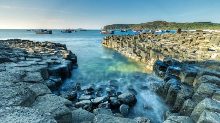
Mourne Coastal Route
Route: Belfast → Newtownards → Greyabbey → Mount Stewart → Portaferry → Strangford → Downpatrick → Dundrum → Newcastle → Annalong → Kilkeel → Rostrevor → Warrenpoint
Distance: Approximately 125 miles, excluding detours
When to Go: May, June and September for mountain walks, coastal scenery and quieter roads, or autumn for beautiful colours in the forests
Best For: Mountain scenery, peaceful coastal roads, historic villages, sandy beaches, ancient castles and outdoor adventures
The Mourne Coastal Route is one of Northern Ireland’s most beautiful and varied road trips, combining the sheltered waters of Strangford Lough with the dramatic peaks of the Mourne Mountains and the picturesque coastline of County Down. Travelling south from Belfast, the route passes through historic villages, beautiful countryside and traditional seaside towns before reaching the spectacular mountains that rise almost directly from the Irish Sea.
This part of Northern Ireland has a wonderfully peaceful atmosphere, particularly around Strangford Lough, where small harbours, quiet country lanes and wooded estates overlook an enormous tidal inlet dotted with islands. Further south, the landscape changes dramatically as the granite peaks of the Mournes dominate the skyline, creating some of the finest mountain scenery in Ireland.
The Mourne Mountains have inspired writers and artists for generations, including C. S. Lewis, whose childhood memories of the surrounding landscapes are often associated with his descriptions of Narnia. The region is also famous for its traditional fishing communities, historic castles and beautiful sandy beaches, with excellent opportunities for walking, cycling, kayaking and sailing.
The main route follows the eastern side of Strangford Lough before crossing the narrow entrance by ferry to the Lecale Peninsula, then continues south through Newcastle and along the Mourne coastline towards Carlingford Lough.
Allow at least three or four days to explore, particularly if you want to enjoy some of the mountain walks or visit the historic attractions around Strangford Lough. Most of the main roads are suitable for motorhomes, although smaller lanes around the lough and some of the mountain viewpoints are narrow, so plan your route carefully if travelling in a larger vehicle.
Belfast and the Ards Peninsula
Begin your Mourne Coastal Route road trip in Belfast, heading east towards Newtownards and the beautiful shores of Strangford Lough.
Newtownards is a historic market town at the northern end of the Ards Peninsula, with traditional streets, independent shops and a prominent landmark overlooking the surrounding countryside.
Scrabo Tower stands high above the town on Scrabo Hill, offering magnificent views across Strangford Lough, the Ards Peninsula and the surrounding farmland. Built during the 19th century, the tower is one of County Down’s most recognisable landmarks, and the surrounding country park has walking trails through woodland and open grassland.
From Newtownards, follow the western shore of the Ards Peninsula south towards Greyabbey, where the road passes through peaceful countryside with beautiful views across the tidal waters of Strangford Lough.
The lough is the largest sea inlet in the British Isles, covering approximately 150 square kilometres, and is internationally important for its wildlife, particularly the thousands of migrating and wintering birds that gather along its shores.
The surrounding landscape is dotted with small islands, sheltered bays and traditional farming communities, making this a particularly rewarding area to explore at a leisurely pace.
Greyabbey and Mount Stewart
Greyabbey is a charming village on the eastern shore of Strangford Lough, known for its attractive Georgian buildings, antique shops and the atmospheric ruins of a medieval Cistercian abbey.
Grey Abbey was founded in the late 12th century and remains one of the most impressive monastic ruins in Northern Ireland, with substantial surviving walls and a peaceful setting overlooking the surrounding countryside.
The village has a lovely collection of independent shops and cafés, making it an excellent place to stop before continuing south.
Nearby Mount Stewart is one of Northern Ireland’s finest historic houses, surrounded by extraordinary gardens and beautiful woodland overlooking Strangford Lough.
The estate was once home to the Londonderry family, and its elegant interiors reflect the family’s political and social influence during the 19th and early 20th centuries.
The gardens are particularly impressive, with formal terraces, ornamental lakes, colourful planting and unusual sculptures, while the surrounding estate has woodland walks and beautiful views across the lough.
Thanks to the mild coastal climate, the gardens support an extraordinary variety of plants from around the world, making Mount Stewart especially rewarding during spring and summer.
Allow several hours to explore the house and grounds, particularly if you enjoy historic gardens and peaceful woodland walks.
Portaferry and Strangford Lough
Continue south along the Ards Peninsula towards Portaferry, a picturesque harbour town standing at the narrow entrance to Strangford Lough.
The road follows the shoreline through peaceful countryside, with frequent views across the water towards the villages and rolling hills of the western shore.
Portaferry has an attractive waterfront, colourful buildings and a long maritime history, while the surrounding coastline is known for its powerful tidal currents.
The waters at the entrance to Strangford Lough are among the fastest tidal streams in the British Isles, creating a fascinating marine environment that supports seals, porpoises and an extraordinary variety of seabirds.
The town is home to Exploris Aquarium, where visitors can learn about the marine life of Strangford Lough and the surrounding Irish Sea.
From Portaferry, take the short vehicle ferry across the Narrows to Strangford village, a crossing that provides beautiful views across the water and is an enjoyable part of the journey.
The Strangford Lough ferry carries cars and other vehicles, although larger motorhomes should check vehicle restrictions, fares and operating arrangements before travelling.
Strangford village is a lovely place to stop after the crossing, with attractive stone buildings, traditional pubs and a small harbour overlooking the lough.
Nearby Castle Ward is another fascinating historic estate, with an unusual 18th-century mansion combining different architectural styles, extensive parkland and beautiful walking trails along the shoreline.
The estate is also famous as a filming location for Game of Thrones, where its historic farmyard was used to represent Winterfell.
Downpatrick and the Lecale Peninsula
From Strangford, continue south-west towards Downpatrick, one of Ireland’s oldest towns and an important centre of early Christianity.
The town is particularly associated with St Patrick, Ireland’s patron saint, who is traditionally believed to have been buried here alongside St Brigid and St Columba.
Down Cathedral stands on a hill overlooking the town, and the nearby grave traditionally associated with St Patrick attracts visitors throughout the year.
The Saint Patrick Centre explores the life and legacy of Ireland’s patron saint through exhibitions and displays, providing an interesting introduction to the region’s religious history.
Downpatrick also has attractive historic streets, traditional pubs and a long-established market-town atmosphere, making it a pleasant place to spend a few hours.
For a coastal detour, explore the Lecale Peninsula, where quiet country roads lead towards beautiful beaches, small fishing villages and historic landmarks overlooking the Irish Sea.
One of the most rewarding places to visit is Ardglass, a traditional fishing harbour with a fascinating collection of medieval tower houses and attractive views along the coastline.
Nearby Killough is another peaceful coastal village, with a sheltered harbour and traditional cottages overlooking the water.
The Lecale coastline is particularly beautiful for walking, with quiet beaches, rocky headlands and wonderful opportunities to spot seabirds and other marine wildlife.
Dundrum Castle and Murlough Bay
Continue south towards Dundrum, a small village overlooking Dundrum Bay, where the Mourne Mountains begin to dominate the landscape.
The village is famous for the ruins of Dundrum Castle, a magnificent Norman fortress standing high above the surrounding countryside.
Built during the late 12th century by John de Courcy, the castle occupies a commanding position overlooking the coast and was an important stronghold during the medieval period.
The surviving walls and circular keep are impressive, while the views across Dundrum Bay towards the Mourne Mountains are among the finest along this route.
Nearby Murlough National Nature Reserve is one of Northern Ireland’s most beautiful coastal landscapes, with an extensive system of sand dunes, woodland and grassland bordering a magnificent sandy beach.
Managed by the National Trust, the reserve is an important habitat for butterflies, birds and rare plants, and its walking trails lead through the dunes towards the beach.
The views across the sand towards the Mourne Mountains are spectacular, particularly when the peaks are reflected in the wet sand at low tide.
Murlough is a wonderful place for a long coastal walk, with plenty of opportunities to enjoy the scenery and the peaceful atmosphere of the surrounding reserve.
Newcastle and the Mourne Mountains
Continue south towards Newcastle, one of Northern Ireland’s best-known seaside towns, where the Mourne Mountains rise dramatically behind a sweeping sandy beach.
The setting is extraordinary, with the mountains appearing to descend almost directly into the Irish Sea, creating one of the most recognisable coastal landscapes in Ireland.
Newcastle has a traditional seaside atmosphere, with a long promenade, independent shops, cafés and restaurants overlooking Dundrum Bay.
The town is also a popular base for exploring the Mourne Mountains, a beautiful granite range that includes Slieve Donard, Northern Ireland’s highest mountain at 850 metres.
The most popular route to the summit begins near Newcastle and follows the Glen River through beautiful woodland before climbing towards the open mountain slopes.
Although the route is well established, the climb is strenuous and exposed, requiring suitable footwear, clothing and preparation for rapidly changing weather.
The views from the summit are magnificent on a clear day, extending across the Irish Sea towards the Isle of Man and the surrounding mountains of County Down.
One of the most distinctive features of the Mournes is the Mourne Wall, a remarkable dry-stone wall built during the early 20th century to enclose the catchment area of the Silent Valley and Ben Crom reservoirs.
The wall stretches for approximately 22 miles across the mountains, crossing numerous summits and creating an extraordinary landmark in the rugged upland landscape.
For visitors who prefer gentler walking, Tollymore Forest Park lies just outside Newcastle and has beautiful trails through woodland, alongside rivers and beneath the foothills of the mountains.
The park is famous for its picturesque stone bridges, ornamental gateways and beautiful forest scenery, and was used as a filming location for Game of Thrones.
Silent Valley and the Mourne Scenic Drive
From Newcastle, continue south along the coast or take an inland detour towards the Silent Valley, one of the most beautiful landscapes in the Mourne Mountains.
The Silent Valley Mountain Park surrounds a large reservoir built during the early 20th century to supply water to Belfast and the surrounding region.
The reservoir lies beneath towering granite peaks, creating a spectacular landscape of mountains, woodland and open water.
Walking trails follow the valley and surrounding hillsides, while the visitor facilities provide an opportunity to learn about the extraordinary engineering project that created the reservoir.
The nearby Ben Crom Reservoir is another impressive sight, surrounded by steep mountain slopes and beautiful upland scenery.
For a memorable drive through the mountains, follow the roads around Hilltown and Spelga Dam, where the landscape opens into remote moorland and dramatic mountain views.
Spelga Reservoir sits high in the Mournes, surrounded by rugged peaks and open countryside, and is a beautiful place to stop for photographs when conditions are suitable.
The mountain roads are exposed and can be affected by fog, strong winds and winter weather, while some sections are narrow and steep, so larger motorhomes should stick to the more suitable main roads and avoid smaller mountain lanes.
Annalong and the Mourne Coast
Return to the coast and continue south towards Annalong, a traditional fishing village overlooking the Irish Sea beneath the eastern slopes of the Mourne Mountains.
The village has a picturesque harbour, stone cottages and a strong maritime heritage, with fishing remaining an important part of the local community.
One of Annalong’s most distinctive historic buildings is its corn mill, which reflects the village’s agricultural and industrial past.
The surrounding coastline is beautiful, with rocky beaches and wonderful views towards the mountains rising behind the village.
Continue south along the coast towards Kilkeel, where the landscape combines rolling farmland, small harbours and spectacular views of the Mourne peaks.
Kilkeel is Northern Ireland’s largest fishing port, and its busy harbour provides a fascinating contrast to the peaceful mountain scenery nearby.
The town has a long fishing heritage, with trawlers landing catches from the Irish Sea, and is a good place to enjoy locally sourced seafood.
Nearby Cranfield Beach is a beautiful sandy stretch overlooking Carlingford Lough, with views towards the Cooley Mountains on the opposite shore.
The beach is popular with families during summer and is a lovely place to enjoy a walk beside the water before continuing towards Rostrevor.
Rostrevor and Kilbroney Forest Park
From Kilkeel, continue west towards Rostrevor, one of the most picturesque villages in County Down, standing on the northern shore of Carlingford Lough beneath the wooded slopes of the Mourne Mountains.
The village has attractive stone buildings, traditional pubs and a peaceful atmosphere, with beautiful views across the lough towards the Cooley Peninsula in the Republic of Ireland.
Rostrevor is particularly famous for Kilbroney Forest Park, where woodland trails climb the surrounding hills and offer spectacular views across Carlingford Lough.
One of the most popular viewpoints is Cloughmore Stone, a huge granite boulder perched high above the village, which local legend claims was thrown across the lough by the giant Finn McCool.
The walk to the stone is steep in places, but the views across the water towards the Cooley Mountains are magnificent, particularly in the late afternoon.
The surrounding forest has a network of walking and mountain biking trails, making Rostrevor a popular destination for outdoor enthusiasts.
The area is also associated with C. S. Lewis, who spent childhood holidays in the region and is said to have drawn inspiration from its beautiful landscapes.
Rostrevor’s position between the mountains and Carlingford Lough makes it one of the most attractive places along the Mourne Coastal Route, and it’s worth allowing time to explore the village and surrounding woodland.
Warrenpoint and Carlingford Lough
Finish your Mourne Coastal Route road trip in Warrenpoint, an attractive waterfront town overlooking Carlingford Lough, where the mountains of Northern Ireland and the Republic of Ireland rise on opposite sides of the water.
The town has a beautiful promenade, traditional buildings and a lively harbour, with lovely views across the lough towards the Cooley Mountains.
Warrenpoint developed as a popular seaside resort during the 19th century, and its Victorian heritage is still visible in the attractive architecture and waterfront gardens.
The surrounding coastline is particularly beautiful for walking, with peaceful paths beside the water and views towards the narrow entrance of Carlingford Lough.
Nearby Narrow Water Castle is another impressive historic landmark, standing close to the River Newry where the waterway widens into the lough.
The 16th-century tower house occupies a strategic position overlooking the water and reflects the area’s long history as an important crossing point between Ulster and the surrounding regions.
For travellers with extra time, the nearby town of Carlingford, across the border in the Republic of Ireland, is a worthwhile extension, with medieval streets, traditional pubs and beautiful views across the lough towards the Mourne Mountains.
Warrenpoint is a lovely place to finish this scenic road trip, bringing together the peaceful coastal landscapes, historic towns and dramatic mountain scenery that make County Down such a rewarding part of Northern Ireland to explore.
Related Post: Belfast in A Day: Itinerary, Map & Tips
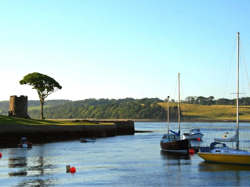
Best Time to Take a UK Road Trip
The best time for a UK road trip is generally between May and September, when the days are longer, attractions are open and the weather is usually at its most favourable for exploring. May, June and September are particularly good months, offering a balance of daylight, milder temperatures and fewer crowds than the peak summer holidays.
However, the UK is a fantastic destination for a road trip throughout the year, and the best time to travel depends on where you’re going and what you want to experience. The climate varies considerably between the mild south-west of England, the mountains of Wales and the exposed Highlands of Scotland, so it’s worth considering the season when planning your route.
Spring: March to May
Spring is a lovely time to explore the UK, particularly from April onwards, when the countryside begins to turn green, wildflowers appear along the roadsides and the days become noticeably longer.
The Cotswolds, Yorkshire Dales and Lake District are especially beautiful at this time of year, with fresh green landscapes, spring flowers and newborn lambs in the fields. In Wales, the valleys and woodlands are full of colour, while the coastal paths of Devon, Cornwall and Pembrokeshire are often quieter than during summer.
May is one of our favourite months for a UK road trip, with plenty of daylight for exploring and generally less traffic outside the bank holiday weekends and school half-term.
Be prepared for changeable weather, particularly in the mountains, where snow and ice can still affect higher routes in early spring.
Summer: June to August
Summer brings the longest days and generally the warmest weather, making it an excellent time for coastal road trips, hiking and outdoor activities.
June is particularly rewarding in Scotland, where the long daylight hours give you plenty of time to explore the North Coast 500, the Isle of Skye and the quieter Highland roads. The landscapes are beautifully green, and you’ll have more flexibility to stop for walks and viewpoints along the way.
July and August are ideal for enjoying the beaches of Cornwall, Dorset, Pembrokeshire and Northern Ireland, with the best chance of warmer sea temperatures and seasonal attractions operating at full capacity.
These are also the busiest months for UK tourism, particularly during the school summer holidays. Popular destinations such as the Lake District, Snowdonia, Cornwall and the Scottish Highlands can become very crowded, with accommodation and campsites booking up well in advance.
If you’re travelling in Scotland, remember that midges can be particularly troublesome between late spring and early autumn, especially in the western Highlands on still, damp days. Carry insect repellent and consider a midge head net if you’re planning to spend time outdoors.
Autumn: September to November
Autumn is another excellent season for a UK road trip, particularly during September and early October, when the roads become quieter after the school holidays and the countryside begins to change colour.
September often brings pleasantly mild weather, while the sea retains some warmth from summer, making it a lovely time to explore the coastlines of Devon, Cornwall, Pembrokeshire and Northern Ireland.
Further inland, the forests and valleys of the Lake District, Peak District, Yorkshire Dales and Eryri become particularly beautiful as the leaves turn shades of gold, orange and red.
Scotland can be spectacular in autumn, with colourful Highland landscapes, quieter roads and beautiful light across the mountains and lochs. However, daylight hours shorten quickly as the season progresses, and higher mountain roads can become more challenging in poor weather.
By November, rain, strong winds and occasional frost become more likely, so allow extra flexibility in your itinerary and check conditions before tackling remote or exposed routes.
Winter: December to February
Winter road trips in the UK can be wonderfully atmospheric, with snow-covered mountains, frosty countryside and quiet coastal landscapes that feel very different from the busy summer months.
The Scottish Highlands, Lake District and mountains of Wales can look spectacular under snow, while historic towns and villages are particularly attractive during the Christmas period.
However, winter driving requires more preparation, especially in remote areas where roads may be affected by snow, ice, flooding or strong winds. Mountain passes can become dangerous or temporarily impassable, and shorter daylight hours mean you’ll have less time for sightseeing.
Some attractions, cafés and seasonal facilities close or operate reduced hours during winter, particularly in rural and coastal areas, so check opening times before travelling.
For a winter road trip, the milder coastal regions of southern England, including Devon, Cornwall and Dorset, are often easier to explore than the mountains of Scotland and Wales, although heavy rain and Atlantic storms can still disrupt travel.
Planning Around UK School Holidays and Bank Holidays
School holidays and bank holiday weekends can make a significant difference to traffic, parking and accommodation availability, particularly in popular tourist regions.
The busiest periods are generally Easter, the late May school half-term and the main summer holidays from late July through August in England and Wales, although Scottish school holidays usually begin and finish earlier.
Bank holiday weekends can also bring heavy traffic to major routes leading towards Cornwall, the Lake District, North Wales and the Scottish Highlands.
If your travel dates are flexible, try to avoid these periods, especially if you’re planning to visit popular attractions or travel in a motorhome. Outside peak periods, you’ll generally find quieter roads, easier parking and more choice of accommodation.
For most of the UK road trips in this guide, we’d choose May, June or September, allowing plenty of time to explore without the pressure of peak summer crowds. Whatever the season, pack for changeable weather, check the forecast regularly and leave enough flexibility in your plans to make the most of the good days.
Driving Tips for a UK Road Trip
Driving is one of the best ways to explore the UK, giving you the freedom to discover small villages, remote beaches and beautiful countryside that can be difficult to reach by public transport. The road network is generally well maintained and signposted, but driving conditions vary considerably between busy motorways, rural country lanes and the narrow mountain roads of Scotland and Wales.
In the UK, vehicles drive on the left and overtake on the right, which can take some getting used to if you’re visiting from overseas. Speed limits are displayed in miles per hour, with a national speed limit of 70mph on motorways and dual carriageways for most cars, and 60mph on single carriageways, unless signs indicate otherwise. Built-up areas generally have a 30mph limit in England, Scotland and Northern Ireland, while many restricted roads in Wales have a 20mph limit. Different limits can apply to motorhomes and other larger vehicles, so check the rules for your vehicle.
Many of the most scenic UK road trips include narrow country lanes, steep gradients and winding roads where you’ll need to slow down and take extra care. In the Scottish Highlands, single-track roads have passing places that allow vehicles travelling in opposite directions to pass safely. Never park in a passing place, and be prepared to give way to oncoming traffic. In Cornwall, Devon and rural Wales, high hedges and stone walls can restrict visibility, while tractors, cyclists and livestock are common on country roads.
It’s also worth allowing more driving time than your satnav suggests, particularly on scenic routes where you’ll want to stop frequently or where narrow roads make progress slower. A journey of 50 miles through the mountains or along the coast can take considerably longer than the same distance on a motorway, so avoid planning too much driving into a single day.
Parking can be challenging in popular destinations, especially during school holidays and summer weekends. Historic towns often have narrow streets and limited parking, while some beach and countryside car parks have height barriers or restrictions on larger vehicles. If you’re travelling in a campervan or motorhome, check parking arrangements in advance and remember that permission to park doesn’t automatically mean overnight stays or camping are allowed.
Fuel stations are widely available across most of the UK, but they can be further apart in remote parts of Scotland and Wales, so it’s sensible to fill up before heading into isolated areas. Electric vehicle charging is becoming more widespread, although charger availability and reliability should be checked when planning longer journeys through rural regions.
Finally, keep an eye on the weather, particularly when travelling through mountainous or exposed areas. Heavy rain can cause localised flooding, while snow, ice and strong winds can make mountain passes and coastal roads dangerous. Check the latest conditions through National Highways for England, Traffic Scotland, Traffic Wales and Trafficwatch NI before setting off on longer journeys.
With a little preparation and a flexible itinerary, driving in the UK is straightforward and incredibly rewarding, especially when you leave yourself time to explore the places you discover along the way.
Driving Documents and Vehicle Requirements
Before setting off on your UK road trip, make sure your driving licence, insurance and vehicle documents are in order, particularly if you’re bringing a vehicle from overseas or hiring a car or motorhome.
Visitors with a valid driving licence issued outside the UK can usually drive during a temporary visit, although the rules depend on where the licence was issued and the type of vehicle. Some drivers may need an International Driving Permit (IDP), so check the official UK government guidance before travelling.
All vehicles must have at least third-party motor insurance, and if you’re bringing your own vehicle, it must be roadworthy and meet the applicable registration and legal requirements. Vehicles designed for driving on the right may also need their headlights adjusted to avoid dazzling oncoming traffic.
Unlike some European countries, the UK doesn’t generally require private motorists to carry items such as reflective jackets, warning triangles or first-aid kits. However, carrying basic emergency equipment is sensible, particularly when travelling through remote areas. Remember that warning triangles must never be placed on a motorway carriageway.
Before a longer trip, check your tyres, including the spare if you have one, along with fluid levels and other essential maintenance. If you’re planning to spend several weeks on the road, consider having your vehicle serviced beforehand and make sure you have suitable breakdown cover. Our long-distance driving tips will help you prepare.
If you’re hiring a car or motorhome, check the insurance excess, mileage allowance, fuel policy and any restrictions on taking the vehicle between UK nations or across international borders. Inspect the vehicle carefully when collecting it, photograph any existing damage and make sure it’s recorded on the rental agreement.
Related Post: Driving in Europe: Everything You Need to Know
More Road Trips to Explore

Portugal Road Trip: The Ultimate 10 Day Itinerary

Europe Road Trip: 28 Epic Routes You Can Actually Drive

European Road Trip: Six Countries in 90 Days
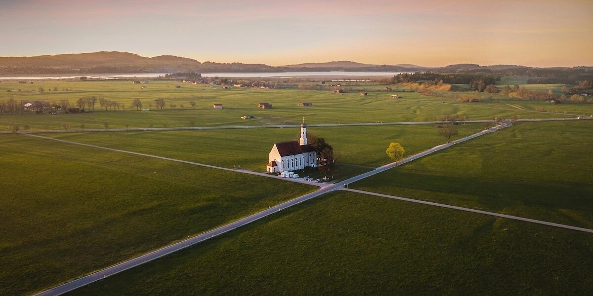
Germany Road Trip: 12 Unmissable Routes

France Road Trip: 13 Amazing Itineraries

Driving in the Alps: Top Tips & Best Routes
Love it? Pin it!


This is one of the most comprehensive UK road trip guides I’ve come across, packed with practical tips and inspiring routes for every type of traveler. Definitely saving this for future adventures!
This article has some great UK road trip ideas! I especially liked the Scotland routes—perfect for a scenic drive. Has anyone tried the North Coast 500?Any tips on best pit stops along the way?