
This post may contain affiliate links, from which we earn an income. Click here to read our affiliate policy.
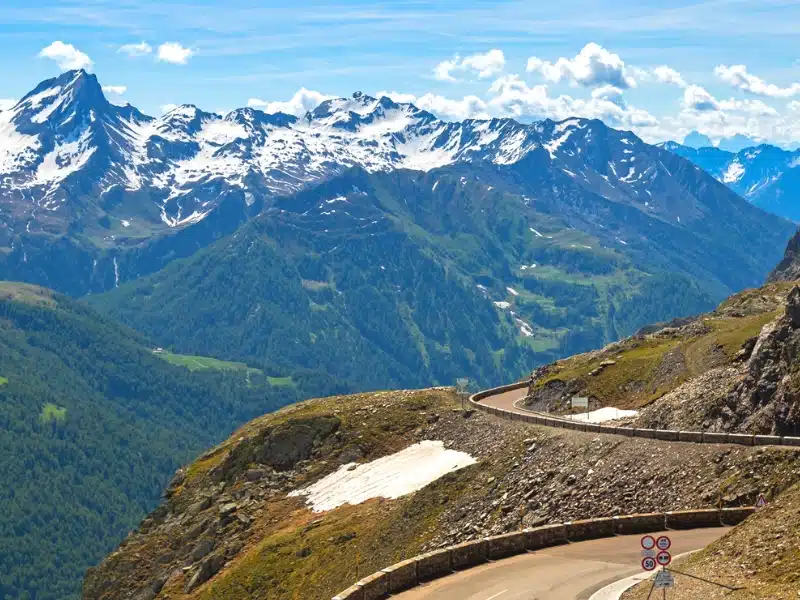
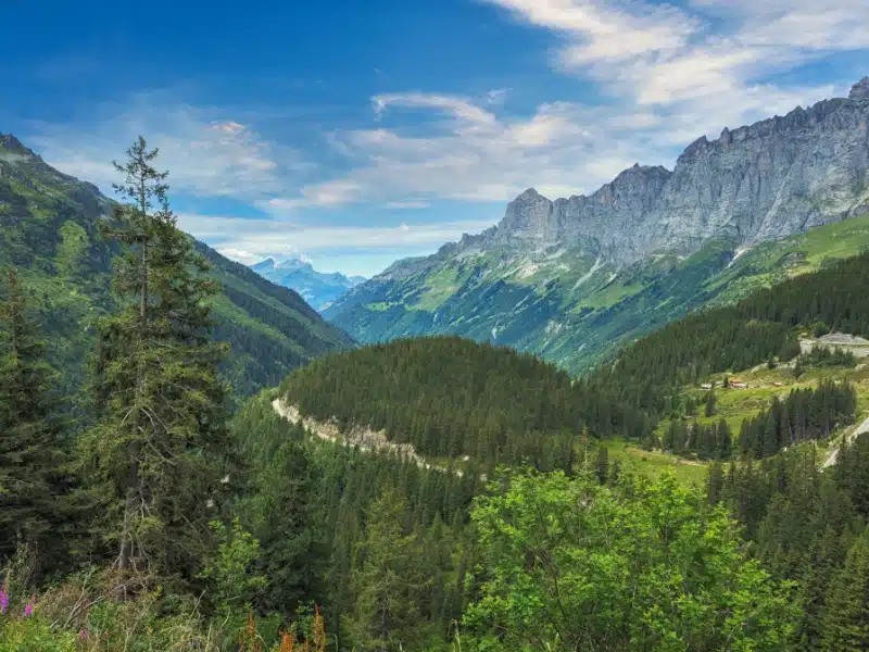
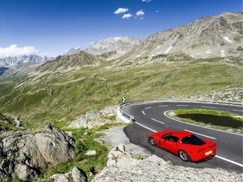
Planning a trip to The Alps? One of the most rewarding ways to experience these magnificent mountains is by driving one of the scenic high Alpine passes. The roads that traverse the Alps are well-known for their twists and turns, high altitudes, and stunning vistas that provide an opportunity to explore some of the most beautiful destinations in Europe.
These incredible high passes provide people with a means of driving through the Alps and moving between Alpine countries. They also provide driving enthusiasts with miles of snaking tarmac across challenging terrain and provide enough adrenalin for even the most daredevil of Alps drivers.
In our driving in Alps travel guide, we share the best Alps driving routes, driving information and tips plus the best places to visit in The Alps, to help you plan your perfect road trip.
Where are the Alps?
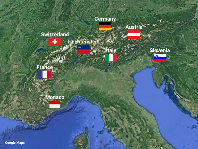
The Alps are a mountain range located in Europe, spanning approximately 750 miles in length and 120-190 miles in width, extending from Nice on the French western Mediterranean to Trieste on the Italian Adriatic and Vienna in Austria.
The highest and most extensive mountain range system that lies entirely in Europe, the Alps were formed over tens of millions of years as the African and Eurasian tectonic plates collided, and covers eight countries: France, Switzerland, Italy, Austria, Germany, Liechtenstein, Slovenia, and the tiny principality of Monaco.
Mont Blanc spans the French–Italian border, and at 4,809 meters (15,778 ft) is the highest mountain in the Alps. The Alpine region area contains 128 peaks higher than 4,000 meters (13,000 ft) above sea level.
Getting to the Alps
Whether you’re taking a road trip in the Alps by car, motorcycle, or campervan, self-driving is absolutely the best way to explore this spectacular mountain range in Europe.
You can stop whenever you want, try new activities, visit places you see along the route and have the freedom to change plans at the last minute.
There are several excellent airports to reach the Alps that have extensive, international flight connections. Choose the right airport for your trip to cut down on driving time, and book flights with Skyscanner for live deals and the best prices. You can’t beat these top five Alps airports for flight connections and convenience, but check out the smaller airports of Innsbruck, Salzburg, and Turin for deals if you’re traveling on a budget.
Are you planning to rent a car in the Alps? As one of the largest car hire aggregator companies in the world, we recommend Rentalcars.com because they have massive purchasing power which enables them to secure the best car rental prices, which benefits you when you’re planning an Alpine roadtrip.
For a real adventure, hire a motorhome or campervan. We recommend Motorhome Republic, an aggregate booking site who pull together all the best deals from a number of rental agencies, to offer you a wide choice of options alongside an excellent English speaking expert motorhome Concierge Team.
Make sure you have travel insurance you can trust when visiting Europe. We recommend True Traveller for their 5-star TrustPilot reviews, variety of cover options, best activities cover as standard, great prices, and excellent service.
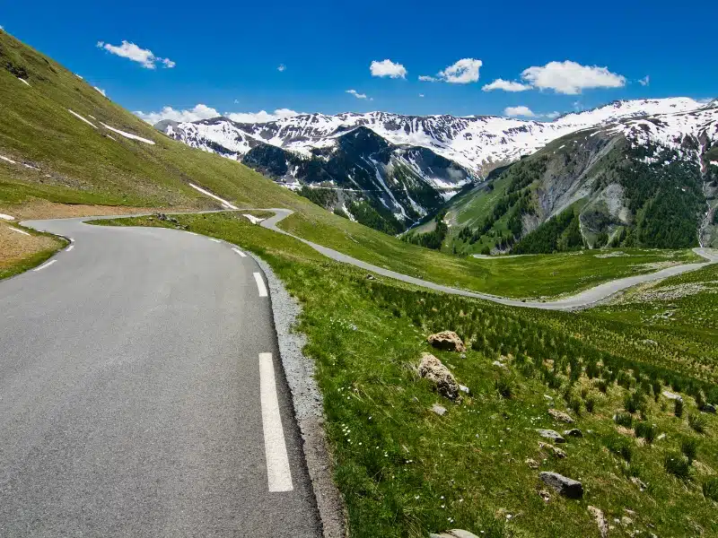
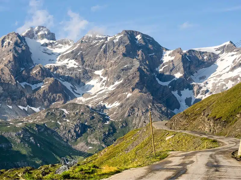
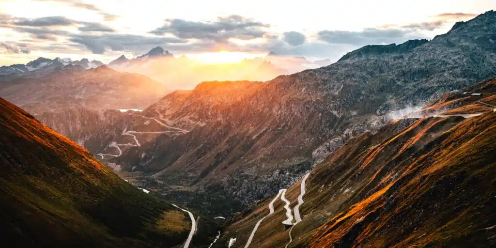
The Best High Passes in the Alps
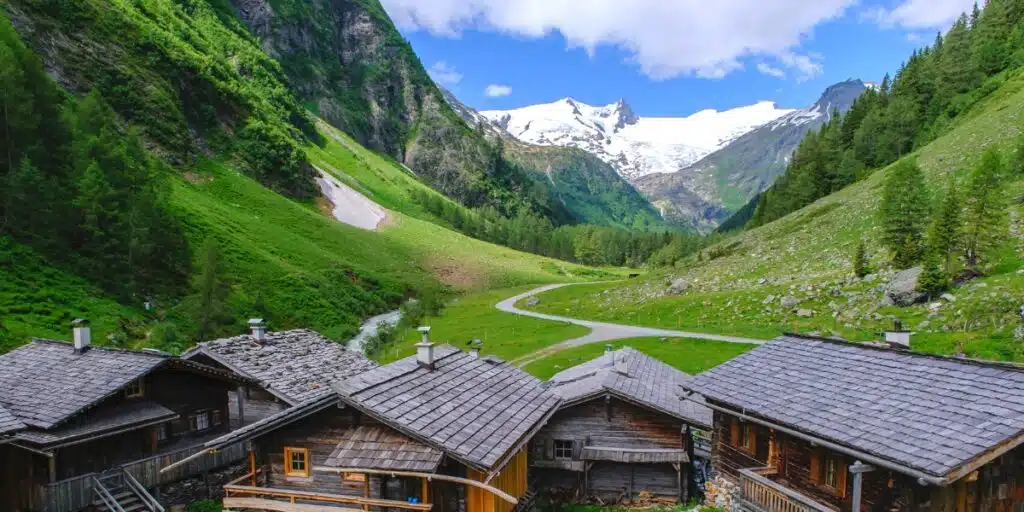
Exploring the Alps will reward you with stunning natural beauty, snow-capped mountain peaks, crystal-clear alpine lakes, and lush forests. Travel lovers can enjoy the huge range of outdoor activities on offer such as skiing, hiking, and rock climbing along the route.
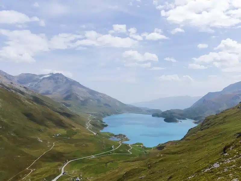
Col de la Bonette
Col de la Bonette is one of the most famous mountain passes in the French Alps, located in the Maritime Alps and Mercantour National Park. It is famous for (supposedly) being the highest paved road pass in Europe, and it offers some of the most stunning views in the region.
Supposedly, because it’s actually not true! Do a quick Google search and you’ll find there is a higher paved road in Europe. The Pico de Veleta in Spain is tucked away between the Sierre Nevada mountains and Almeria, and tops out at a considerably higher 3,369 meters / 11,053 feet.
Col de la Bonette is still one hell of a road though! As drivers climb high into this alpine pass they are treated to panoramic views of the surrounding mountains, valleys, and glaciers. The pass opens in the summer, due to heavy snow in the winter months, and it is a popular destination for outdoor enthusiasts and travelers looking for the classic alpine chalet holiday experience.
The Cime de la Bonette is the highest point of the Col de la Bonette. From the summit, visitors can enjoy a breathtaking 360-degree view of the surrounding landscape, including the snow-capped peaks of the Mercantour National Park and the glistening Mediterranean Sea in the distance.
The Fort de la Bonette, a military fortress that was built during World War II, is perched on a rocky outcrop overlooking the Col de la Bonette and offers visitors a glimpse into the history of the region.
For those who enjoy outdoor activities, Col de la Bonette is home to several hiking trails, including the GR5 and lots of routes in the Mercantour National Park. Cyclists travel from all over the world to challenge themselves on the steep gradients and hairpin bends of the road.
A visit to Col de la Bonette isn’t complete without enjoying the quaint villages that surround the pass. The town of Jausiers is a popular destination, with charming architecture and beautiful gardens where visitors can enjoy traditional French cuisine and local wines.
RELATED POST: Route des Grandes Alpes: An Epic French Road Trip
Don’t forget your road trip essentials! Our free road trip checklists help you remember everything, including road trip snacks, podcasts, and road trip songs for the journey!
Col de l’Iseran
On the touristic French Alps driving route, the Route des Grandes Alpes, the Col de l’Iseran is located in the French Alps and connects the towns of Val-d’Isère and Bonneval-sur-Arc, mainly on the D902 road acrossthe Graian Alps.
At an elevation of 9,068 feet, it is the second highest paved pass in the Alps and offers breathtaking views of the surrounding mountains and valleys. It’s no surprise that this road is known as ‘the king of the Alps’.
A scenic drive along the Col de l’Iseran will allow you to explore the nearby nature reserves, including the Vanoise National Park and the Grande Sassière Nature Reserve. These protected areas are home to a diverse range of flora and fauna, and offer opportunities for hiking, wildlife watching, and experiencing the natural beauty of the region.
For those interested in history and culture, Col de l’Iseran offers several interesting landmarks and monuments. These include the Baroque-style church in Bonneval-sur-Arc, which dates back to the 17th century, and the Fort Saint-Gobain, a historic military fort located near the pass.
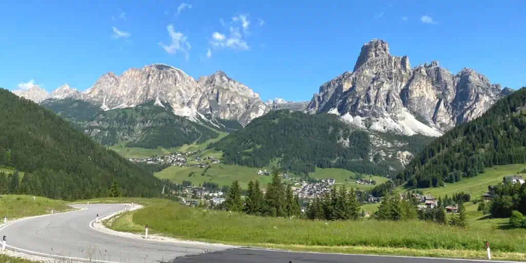
Col du Mont Cenis
Col du Mont Cenis is a mountain pass located in the French Alps, connecting the Maurienne Valley in France to the Susa Valley in Italy. We would recommend stopping at the Colle delle Finestre, the Col de la Madeleine, and the Lac du Mont Cenis, three popular viewpoints along the Col du Mont Cenis.
In addition to stopping at these viewpoints for your Instagram snaps, the Grande Traversée des Alpes and the Tour du Mont Cenis cross the route and are two hiking trails that offer tourists stunning views of the French Alps.
A must-see man-made wonder along the Col du Mont Cenis is Mont Cenis Lake, a beautiful glacial lake located in the French Alps, close to the Italian border. This stunning artificial lake was built on the road between Lyon and Turin following the construction of a hydroelectric dam.
Joining the Col du Mont Cenis on the French side will have you leaving the country surrounded by incredible vistas of pine trees. The drive begins with five, famous hairpin bends; a driving experience that brings tourists to these Alpine passes. Narrower roads and lush greenery will announce your arrival to Moncenisio, a metropolitan city in Turin, Italy.
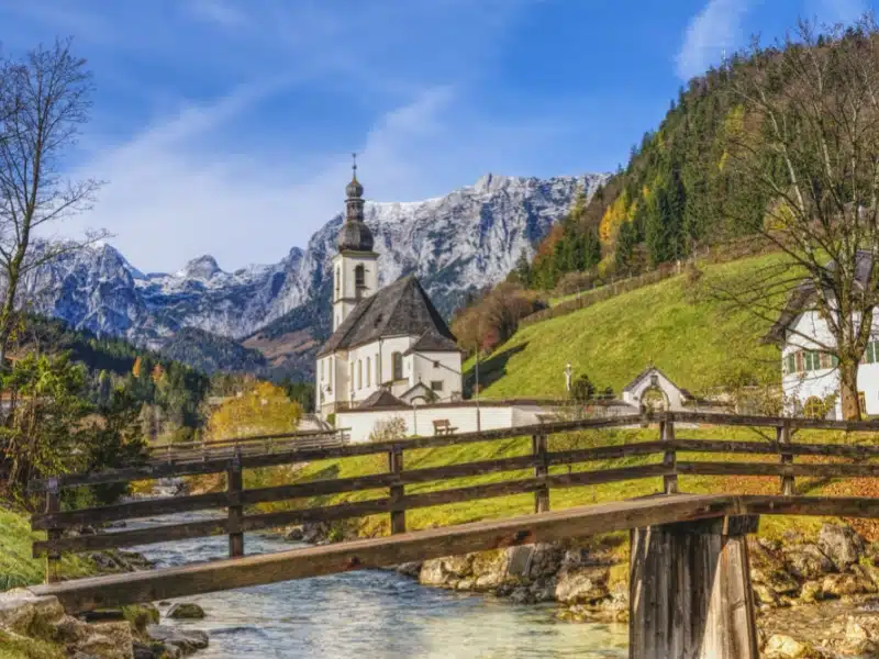
Deutsche Alpenstrasse
The German Alpine Road, also known as the Deutsche Alpenstraße, refers to a spectacular route through southern Germany that explores the Bavarian region’s rich history and beautiful landscape, and crests multiple mountain passes.
Considered one of the most beautiful touring routes in Europe, the Deutsche Alpenstrasse is the oldest tourist road in Germany and winds across Bavaria, closely following the Austrian border. Starting in Lindau and ending in Königssee, you receive unrivaled views of the Bavarian Alps as you pass through Allgäu, the Ammergau Alps, and the Alpine Region of Tegernsee-Schliersee.
If you crave adventure mixed with culture, the German alpine road is for you. Surrounded by snow-capped mountains and alpine lakes dotted with traditional Bavarian villages and historic castles and churches, there is a lot to see and do on this iconic route.
No other route provides such a diverse insight into Bavarian culture. Touring along this Alpine route, you will experience historical landmarks, royal palaces, Alpine culture, and outdoor adventures.
RELATED POST: Deutsche Alpenstrasse: Route, Map & Highlights
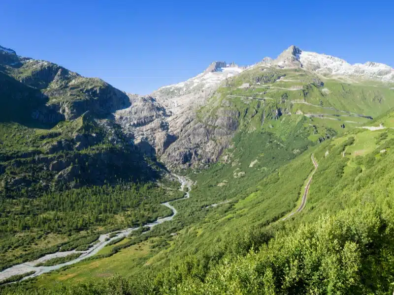
Furka Pass
The Furka Pass on the Grand Tour of Switzerland is a must-visit destination for anyone traveling to the Swiss Alps. Its role in the James Bond movie Goldfinger has made it an internationally recognized destination and, as you drive around the hairpin turns, you’ll feel like you’re in your own, personal action film!
The Furka Pass connects the cantons of Uri and Valais and, with an elevation of 7,972 feet, it is one of the highest mountain passes in Switzerland, and the stunning views of the surrounding peaks and valleys make it one of the best scenic drives in the Alps. Due to heavy snow at this elevation, the Furka Pass opens in summer, from June through October.
The Rhone Glacier, located at the summit of the Furka Pass, is one of the largest glaciers in the Alps and can be accessed via a cable car that runs from the Belvedere Hotel. Visitors can explore the glacier on foot to enjoy stunning views of the surrounding mountains and valleys.
The Furka Steam Railway is a historic railway that runs through the pass and is a popular tourist destination. The railway was built in the early 20th century and was used to transport goods and people across the pass. Today, the railway operates as a tourist attraction, offering visitors the opportunity to ride on a historic steam train and enjoy stunning views of the surrounding landscape.
RELATED POST: The Best of Switzerland in Summer: 17 Amazing Highlights
Looking for the best SIM card deals in Europe for your trip? Check out our guide to the best data SIMs in Europe and get the best deal for your trip to Austria.
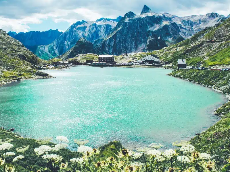
Great St Bernard Pass
The Great St Bernard Pass is a stunning Alpine road that connects Martigny in Switzerland with Aosta in Italy, and is one of the highest paved roads in the Alps, and the highest in Switzerland.
The pass is named after the Great St Bernard Hospice, a monastery that was founded in the 11th century and is at the road’s summit. The hospice was originally established as a refuge for travelers and pilgrims crossing the pass, and it is now home to a community of monks who still provide hospitality and shelter to those driving through the Swiss Alps to Italy.
The road that traverses the Great St Bernard Pass is a marvel of engineering and offers breathtaking views of the surrounding mountains and valleys.
The Great St Bernard Pass offers stunning alpine scenery and an abundance of outdoor activities including hiking, skiing, and snowshoeing. Nearby, the Swiss ski resort of Verbier is a popular destination for snow sports enthusiasts enjoying a quintessential alpine chalet holiday.
More Alps Travel Ideas
Grossglockner High Alpine Road
As one of the best driving roads in Europe, the Grossglockner is a real bucket list driving experience in the Austrian Alps.
The Grossglockner High Alpine Road is actually route 107 which connects Bruck with Heiligenblut via the Fuscher Törl at 2,428m and the Hochtor Pass at 2,504m, making it the highest pass in Austria. The high road has 36 turns which snake between glorious alpine pastures, rocky terrain, and wildflower meadows.
At Heiligenblut take the 8km/5 mile drive up to the observation point at Kaiser-Franz Josephs Höhe, where you’ll get fabulous views of the longest glacier in the Eastern Alps, the Pasterze. Once you’ve had your fill of the views (and it might take a while) pop into the Visitor Centre where you can learn all about the glacial landscapes.
The road is not open 24/7 even in summer. From early May to May 31st, the road opens between 6am to 8pm daily. From 1st June to 31st August, it’s open from 5.30am to 9pm, and from 1st September its 6am to 7.30pm. There is also a toll charge of €40 per car. Find out more at the Grossglockner Hochalpenstrasse website.
RELATED POST: How to Visit Innsbruck in Summer
Looking for the best SIM card deals in Europe for your trip? Check out our guide to the best data SIMs in Europe and get the best deal for your trip to Austria.
Klausen Pass
The Klausen Pass is located in the Swiss Alps and connects the towns of Linthal and Altdorf. The route offers panoramic views of the Uri Alps and the Glarus Alps, as well as the dramatic Klausen Gorge, a narrow canyon that was formed by the Linth River.
At the base of the Klausen Pass, you will find the Benedictine monastery of Disentis, founded in the 8th century and one of the oldest monasteries in Switzerland. We recommend exploring the monastery and its grounds to see the stunning medieval cloister.
Stopping at the town of Linthal is a must when visiting the Klausen Pass! Lintahl is a picturesque Alpine town where visitors can explore the town’s historic buildings, including the Church of St. Maria and the Linth Museum, which documents the history of the region.
For those who enjoy outdoor activities, there are several hiking trails from the Klausen Pass, including the Klausen Pass Panorama Trail, and the Via Alpina, stage 6 of which crosses the route.
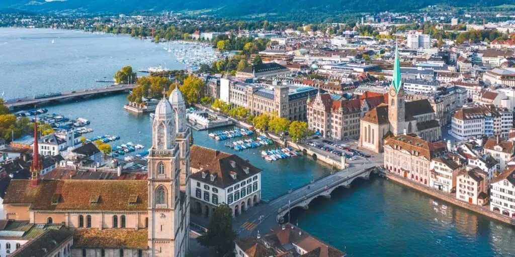
If you are enjoying a stay in Zurich, we’d recommend adding the Klausen Pass to your plans. A day trip driving in the Swiss Alps will allow you to experience some of Switzerland’s best Alpine scenery.
RELATED POST: One Day in Zurich – Itinerary, Map, Tips & Guide
Nockalm Road
The Nockalm Road is a scenic mountain road located in the Nockberge Biosphere Park in Carinthia. The road spans 22 miles from Innerkrems to Ebene Reichenau and snakes through the picturesque Nockberge Biosphere Reserve, a UNESCO-protected area.
This site is a protected reserve meaning there are no ski resorts in the region, offering visitors miles of uninterrupted idyllic Alpine scenery. This toll road costs €19 per car, per day.
The Nockalmstrasse offers stunning views of the surrounding mountains and valleys and it winds its way along 52 turns and numerous more gentle bends through the Nock Mountains, one of the most interesting and oldest low mountain ranges in Europe which form a unique area in the Alpine region because of their geomorphological characteristics. The gentle hills – known as ‘nocken’ give the mountains their name.
There are plenty of designated viewpoints for drivers to pull over and take in the scenery including the Kaiserburg, the Innerkrems, and the Turracher Höhe.
Hiking is a popular activity in the Alps and the Nockalm Road has several hiking trails that lead from the road, including the Nockalm Trail and the Reichenau Trail. Visitors can also enjoy cycling, fishing, and swimming in the nearby lakes and streams.
The town of Innerkrems is a popular destination for visitors to the Nockalm Road, with its picturesque architecture and traditional Austrian charm. The town is a great place to stop and indulge in Austrian cuisine and wine.
RELATED POST: Best Cities in Austria for an Amazing Visit!
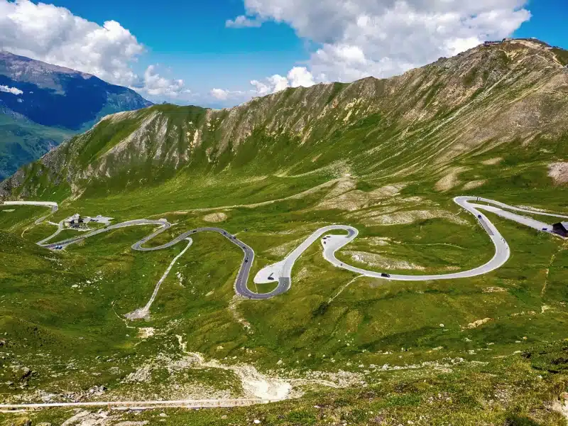
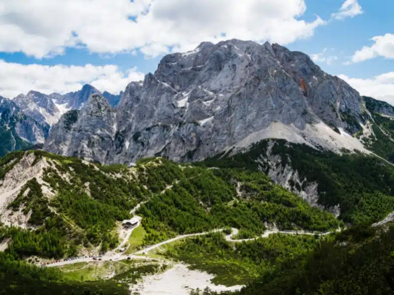
Stelvio Pass
One of the best driving roads in Europe, the Stelvio Pass runs for 47km between Bormio and Prato Allo Stelvio in South Tyrol, close to the border with Switzerland, and is the highest paved mountain pass in the Eastern Alps, and the second highest in the Alps, after the Col de l’Iseran.
With 60 hairpin bends, 48 of them snaking their way across the imposing peaks of the Ortles-Cevedale chain, the iconic Stelvio Pass is both breathtaking and exacting and does not suffer fools gladly. With switchback 180-degree corners and low concrete barriers, this is a road where you need to pay attention!
On the west side, on the way up from Bormio there are several tight tunnels. Large vehicles can’t pass in the tunnels so there is a traffic light before and after the most critical tunnel with very long wait periods – be patient, it will be worth it!
From the summit, where the famous Ortler view is revealed, the Trafoi windings lead down with superb views of the peaks before descending into the main valley, with the Austrian Zillertal peaks in the main Alpine chain making a fine view.
If you’re looking for a fabulous place to stay, the Hotel Bagni Vecchi on the Italian side is just before the SS38 starts its winding ascent. The hotel is a luxury spa with an outdoor pool overlooking the nearby mountains and makes a great place for the night before, or the night after driving the Stelvio Pass.
RELATED POST: Stelvio Pass: The Best Mountain Road in Italy?
Susten Pass
The Susten Pass, along with the Furka Pass and Grimsel Pass, forms a trio of mountain passes around the village of Andermatt in the heart of the Bernese Highlands, known as the “Big 3” passes of the central Swiss Alps. Each of the passes has its own unique characteristics and together they form an amazing driving experience that is truly unforgettable.
The Susten Pass, considered to be Switzerland’s best mountain pass, has glorious mountain views with 26 epic tunnel and bridge combinations. It’s the most picturesque and eclectic of these three awesome passes – one minute you’re driving through a forest, and the next looking up at the Alps in wonder, before roaring through a tunnel. One of the Susten Pass tunnels even has a waterfall running over it!
Near Innertkirchen, the Susten Pass meets the Grimsel Pass, which in turn connects to the Furka Pass, which climbs the mountains on the opposite side of the valley. Thanks to its lack of blind corners and generally good visibility, Grimsel is one of the gentler Alpine passes, even though it is surrounded by a wild and rugged landscape.
RELATED POST: Most Beautiful Places In Switzerland That You Must Visit!
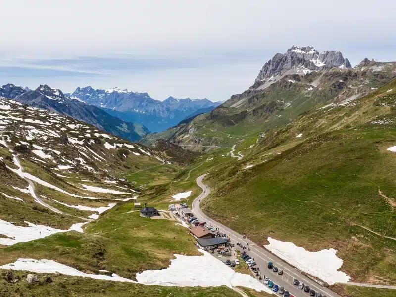
Timmelsjoch High Alpine Road
The Timmelsjoch High Alpine Road is the name of a scenic drive through the Timmelsjoch Pass or Passo del Rombo which is located in the Ötztal Alps, connecting the Austrian state of Tyrol and the Passeier Valley in the Italian province of South Tyrol.
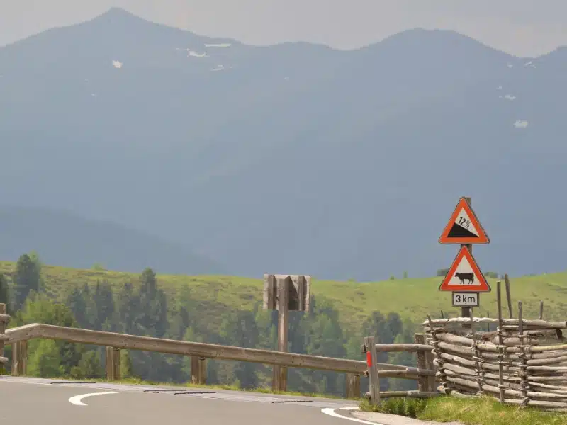
At an elevation of 8,231 feet, the SS44bis is one of the highest mountain passes in the Eastern Alps and offers breathtaking views of the surrounding snowy peaks and valleys. The twisting road is fully paved and features 60 turns and 30 hairpin turns, with a 12.7% gradient through some of the inclines.
The Timmelsjoch Pass is open to traffic daily between 7am to 8pm during the summer months until October, weather permitting, and offers a range of hiking and cycling opportunities. One of the more popular hiking trails takes you to the summit of Hochfirst Mountain.
The Timmelsjoch Experience is a museum located at the summit of the pass that showcases the history and culture of the region. Visitors can explore the exhibits and learn about the history of the Timmelsjoch Pass and its role in connecting the Tyrol and South Tyrol regions.
Vršič Pass
The Vršič Pass is a stunning mountain pass located in the Julian Alps of northwestern Slovenia, connecting the towns of Kranjska Gora and Trenta. With an elevation of 5,285 feet, the Vršič Pass is the highest road in Slovenia and has 50 serpentine bends, 24 on the side of Kranjska Gora and 26 on the Trenta side.
When discussing the Vršič Pass, it is important to commemorate its history. The road was built by Russian prisoners of war in 1916. 300 of these prisoners died during an avalanche while working on the pass.
A Russian Chapel was built near the summit of the pass in memory of these Russian prisoners and, today, the pass is not only a popular tourist destination but a testament to the lives that were tragically lost.
Alongside discovering the Vršič Pass’ history, we would highly recommend stopping at the Isonzo river. The Isonzo river is a beautiful and historically significant river that flows through western Slovenia and northeastern Italy. It is approximately 86 miles long and is known for its crystal-clear waters.
The Isonzo river played a significant role in World War I, serving as the site of 12 battles between the Italian and Austro-Hungarian armies, collectively known as the Battles of the Isonzo. Visitors to the Isonzo river today enjoy rafting, kayaking, and fishing.
Best Time for Alps Travel
March to May
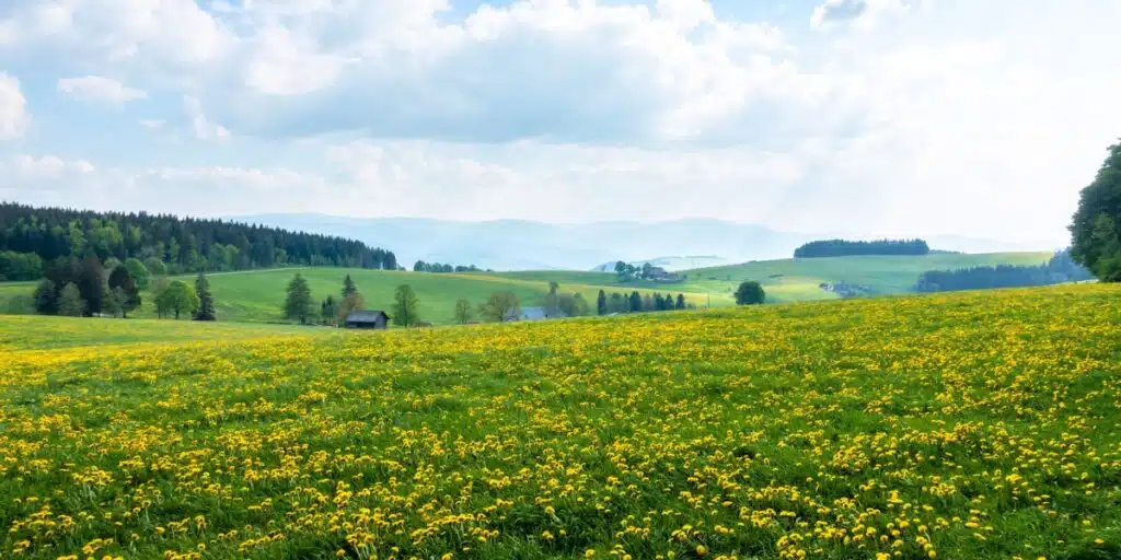
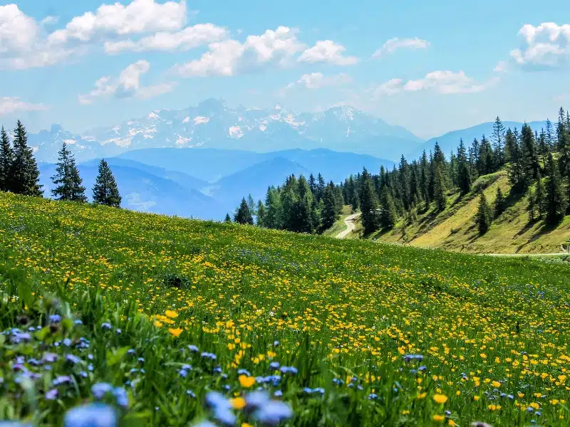
Spring is a fantastic time to visit the Alps, with temperatures warming up across the region. Blooming wildflowers, vibrant greenery in the mountains and cows heading out to pasture mean spring is a fantastic time to experience the Alps but many of the high passes will be closed until the snow recedes in late May.
June to August
Driving to the Alps in summer means you’ll enjoy beautiful weather and the prospect of outdoor adventures and extreme activities. This is when locals and visitors alike head to the mountains and lakes, meaning heavier crowds and more traffic.
The high mountain passes will be open and there will still be snow on the highest peaks making for perfect driving over the Alps conditions, complete with incredible views.
September to November
Autumn is a fantastic time in the Alps. The grapes and crops are being harvested, food festivals celebrate the bounty of the land, and you might enjoy an Indian summer, with the fall colors of the vines aflame.
Don’t leave it too late though, as many of the high passes will start to close as the weather changes – this usually happens in late September to early October, but varies greatly depending on the year.
December to February
The winter months in the Alps are very cold, and most people visit during the months of December to March for family ski holidays in catered chalets. It’s not the best time for an Alpine road trip, as the spectacular mountain passes will be closed due to dangerous weather conditions.
Driving in the Alps
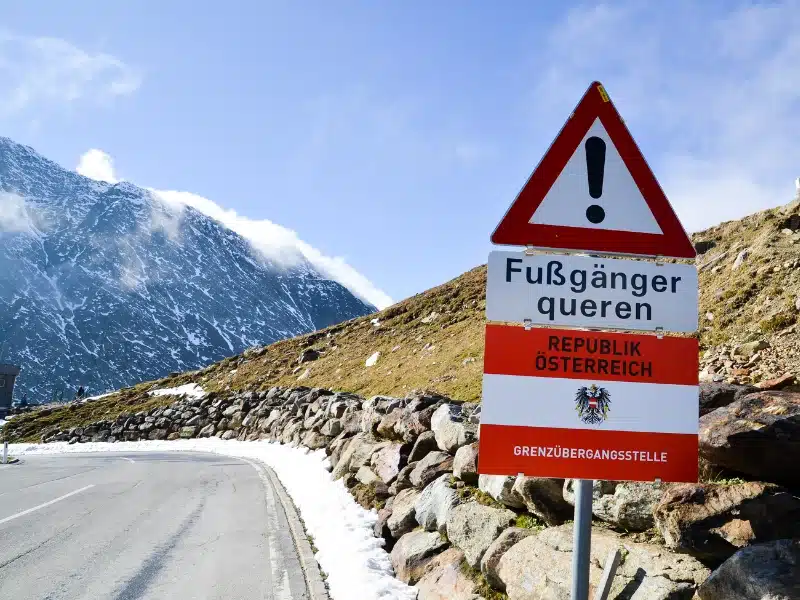
The Alps cover eight different countries, which means eight different sets of driving rules! Many rules are the same across Europe, but each country has its own driving and road laws which you need to be aware of, as you may well pass through more than one country on your Alps road trip.
Driving Rules in the Alps
All of the countries in the Alps drive on the right, the same side as the USA, China, Russia, and Canada. Just be aware that the roads are a lot narrower!
You may need an international driving permit (IDP), depending on where your driving license was issued. You can check whether you need an IDP for driving in the Alpine countries of Europe with the International Driving Permit Organisation.
Under EU law, seat belts must be used in all vehicles. Children over 1.35 m can use an adult seat belt. Those under 1.35m must use equipment appropriate to their size and weight when traveling in a car, like a car seat or booster cushion.
It is illegal to use your phone at the wheel in all EU and European countries. In France and Spain, you may not even use it as a satellite navigation device or with hands-free equipment.
There are general speed limits across Europe, which range from 120 to 130 km/h on motorways, and from 80 to 90 km/h on country roads. You can find a list of the most up-to-date speed limits here.
Speed cameras are common in Europe, and may be fixed or mobile. Both types of speed cameras can be visible or hidden, and it’s easy to be caught out, even if you’re over the limit by just a few kilometers an hour.
If you get caught, you can’t avoid speeding fines. If you’re driving your own car there is a data sharing protocol in place which means you’ll be tracked down, and if you’re hiring a car, any speeding fines will end up back with the car hire company, who will simply deduct the fine from the credit card they hold on file.
Most EU countries have different alcohol limits set in their drink-driving legislation which may be different or lower than your home country. It’s best not to drink any alcohol if you’re planning on driving anywhere afterward.
Most European countries, especially those with mountains, have rules about snow tires, snow chains and snow socks. Make sure you check these rules if you’re taking a road trip of the Alps in colder weather.
Some European countries have requirements regarding road safety equipment and may expect you to carry a warning triangle, high visibility vest, and first aid kit as a minimum.
Other than Germany, Lichtenstein and Monaco, all the Alpine countries have toll roads. It’s worth checking at the tolls.eu website before you set off whether toll collection is digital and requires pre-registration, or you’re required to pay by cash or card at toll booths.
Member states of the European Union have a standardized set of road signs, but they may differ from your home country. Check what the main EU road signs look like here.
Check individual country driving laws and rules with the government of each country here:
Find out more about driving in Europe with our comprehensive guide. We cover toll roads, low emission zones, urban access regulations, quirky country-specific rules, car hire, insurance, equipment, and documentation in our driving in Europe guide.
Mountain Driving Tips
Before you hit the road, make sure your vehicle is prepared for driving in the Alps. Check all your fluids and tires, but best of all, have a full service before you go.
Check the local weather before leaving, and if the forecast is snow or ice, consider waiting it out, unless you’ve come prepared with winter tyres or snow chains or you’re in a 4WD vehicle, and have some experience driving in these conditions.
Mountain roads are not difficult to drive, especially the well-maintained roads of Europe, but you do need to adapt your driving style and speed for steep inclines and declines, hairpin bends, and narrow roads.
As you approach a steep incline, steadily increase your speed as long as it’s safe to do so. This will give you some power for the climb.
When climbing or negotiating tight turns, use a low gear. This will reduce your speed but give you more power to get up the incline. If it sounds like your engine is laboring, drop it down another gear, but be gentle with the clutch – you’re aiming to balance revs with road speed
As you drop in altitude, don’t ride the brake, shift down a gear instead. If you notice the tell-tale overheating brake smell, pull over and let the car cool down for ten minutes, before gently pumping the brakes to make sure they’re working before heading off again.
Don’t overtake unless you have a clear view of the road ahead. Mountain passes generally have lots of areas of poor visibility and overtaking in these areas puts you and other drivers at risk.
Are you looking for more road trip inspiration? Check out these top posts…
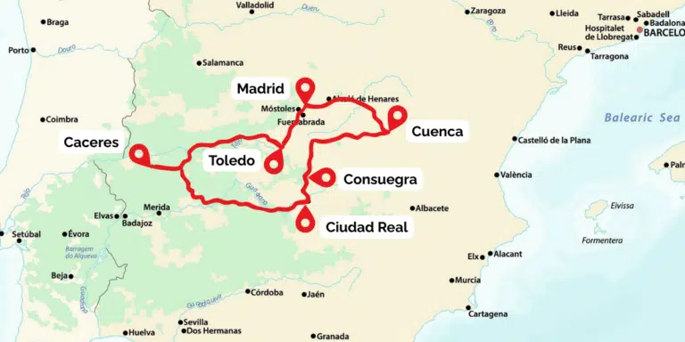
Road Trip from Madrid: 7–10 Days Central Spain Loop
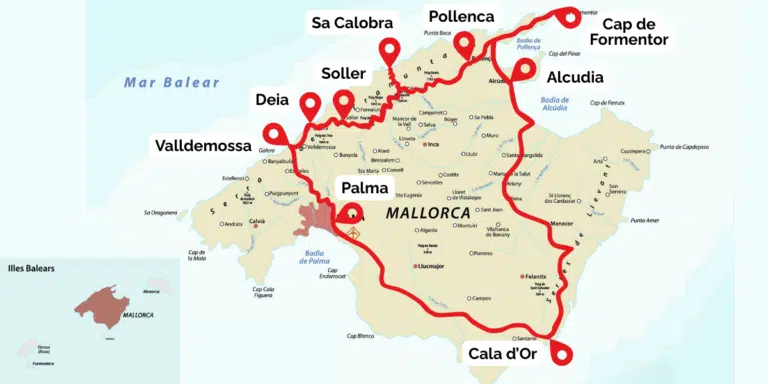
Mallorca Road Trip: 7–10 Day Island Loop from Palma
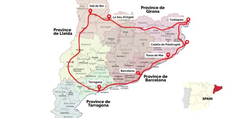
Catalonia Road Trip: 7–10 Day Costa Brava & Pyrenees Loop from Barcelona
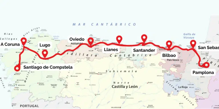
Northern Spain Road Trip: 7–10 Day Itinerary, Route and Tips
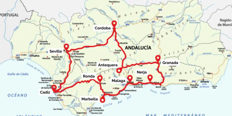
Andalucia Road Trip: The Perfect 10-14 Day Itinerary
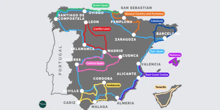
Spain Road Trip: 10 of the Best Routes, Regions, and Island Drives
Love it? Pin it!
I truly appreciate the detailed guidance — it made my planning for the German driving license and EU license process smooth and stress-free. Big thanks to the author and the amazing team for their clear and reliable support!I recommend this website, their services and guidance is exceptional