This post may contain affiliate links, from which we earn an income. Click here to read our affiliate policy.
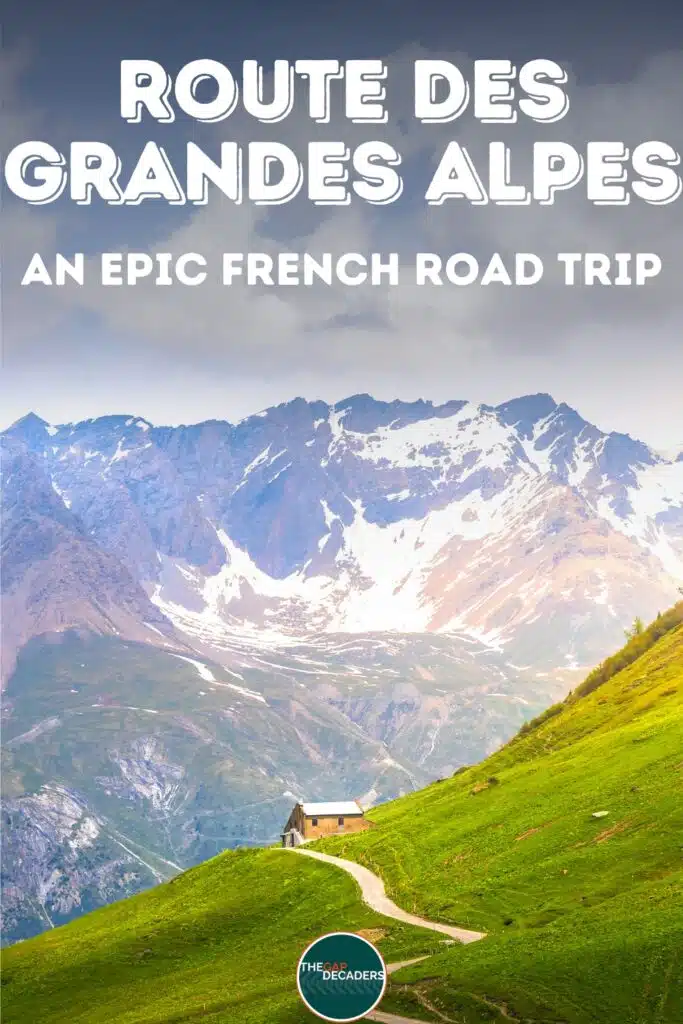
7–10 days crossing the French Alps from the Riviera to Lake Geneva
The Route des Grandes Alpes is one of France’s great road trips, not because it is long, but because it is relentlessly scenic. It links the French Riviera to Lake Geneva via a chain of high mountain passes, shifting from Mediterranean light to Alpine valleys, glacial lakes, and proper high-altitude driving in a way that feels like several holidays stitched into one.
This is a route built around the journey. You are not simply driving between places, you are climbing and descending landscapes, stopping for viewpoints that do not need a marketing campaign, and realising halfway through the week that your concept of “a quick coffee stop” has quietly turned into “a long lunch with mountain views”.
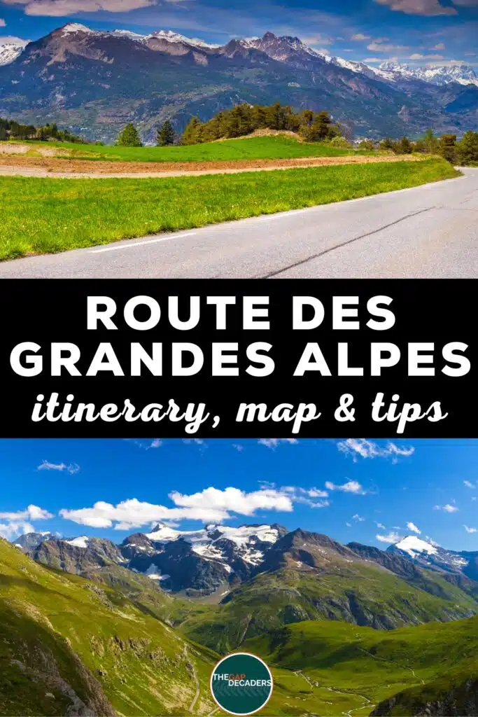
The classic Route des Grandes Alpes runs between Menton and Thonon-les-Bains, crossing a core set of major cols and passing through a mix of small villages, resort towns, and valley hubs that make practical overnight bases. It is completely doable in a week, and far better in ten days if you want time for walks, lakes, spas, and the occasional no-driving afternoon.
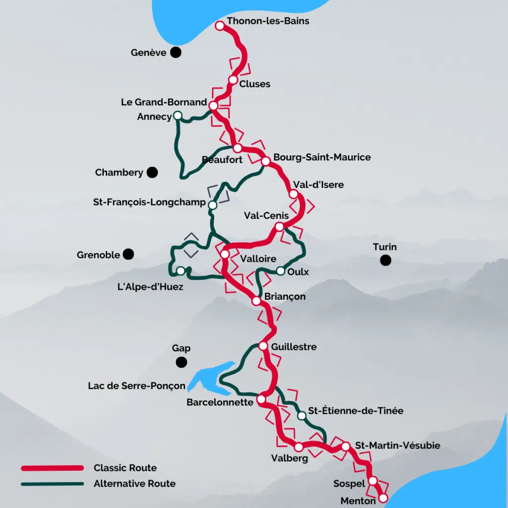
Route: Menton – Sospel – St Martin-Vésubie – Barcelonnette – Briançon – Val-Cenis – Bourg-Saint-Maurice – Le Grand-Bornand – Thonon-les-Bains
Distance: ~720 km
Duration: 7–10 days
Best time to go: June–early October
Best for: Mountain passes, Alpine scenery, hiking and lakes, memorable driving roads, slow road travel with big views
A quick note on timing: there is a reason people say this is a “summer only” road trip. The Route des Grandes Alpes is typically fully open from June to early October, with the highest passes sometimes opening later depending on snowfall. If you are travelling early or late in the season, build in flexibility, expect occasional closures and detours, and always check the weather before setting off.
Because many of the high passes are closed outside the summer season, this route doesn’t always plot cleanly in Google Maps during winter. We’ve shown the full route above instead, with individual stages becoming easier to map once the passes reopen.
Planning tools we actually use for French road trips
Getting to the Route des Grandes Alpes
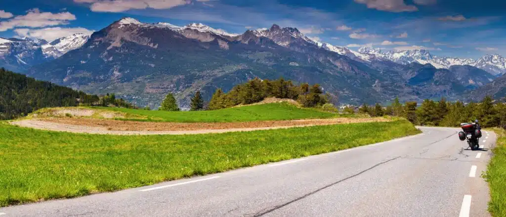
The Route des Grandes Alpes can be driven either north to south or south to north, and it works equally well in both directions.
To start in Menton, the most convenient arrival point is Nice Côte d’Azur Airport. From there, it’s around an hour’s drive along the coast before the route heads inland into the Alpine foothills.
To start in Thonon-les-Bains, Geneva Airport is the easiest option. The drive takes roughly 1 hour 10 minutes and follows the shores of Lake Geneva, making for a gentle lead-in before the road begins to climb.
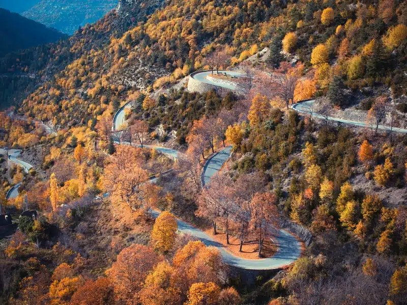
Day 1: Menton to Sospel
Route highlights: Col du Castillon (2,306 ft / 703 m), Viaduc du Caréï, Viaduc du Caramel
Driving notes: First alpine foothills, 10+ switchbacks, narrow sections, but good road surface
Distance and time: ~23 km, around 1 hour without stops
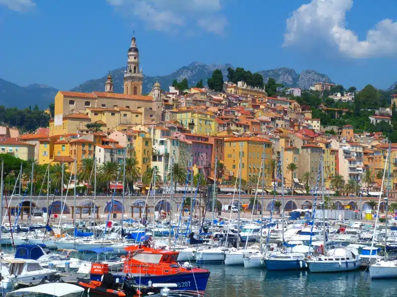
Start in Menton, the lemon-bright edge of France, where Italy is close enough to feel like a day trip. It is a great launch point because the contrast is immediate: you begin with the sea, palm trees, and pastel buildings, then climb inland within the first hour and find yourself in a completely different France.
Before you leave, it is worth finding the traditional “zero kilometre” marker on the Esplanade Francis-Palmero. It is a small detail, but it sets the tone for the trip. This route has a sense of tradition, and you feel part of it from the start.
The drive to Sospel is short, but it introduces the rhythm of the coming days: tighter roads, sharper bends, and constant glimpses into steep valleys. In Sospel, keep things relaxed. Walk the old town, cross the Pont Vieux over the Bevera, and take in the cathedral and small squares. This is not a big sightseeing day; it is an arrival day with a mountain edge.
Day 2: Sospel to St Martin-Vésubie
Route highlights: Col de Turini (5,272 ft / 1,607 m), Notre Dame de la Menour detour
Driving notes: Tight hairpins, forested climbs, technical sections, popular with cyclists and motorbikes
Distance and time: ~52 km, 1.5–2 hours without stops
Leave Sospel heading north on the D2566, climbing steadily into thicker forest and sharper bends. Not far out of town, the short detour to Notre Dame de la Menour is worth considering. The small church sits on a ridge and is reached via a path and staircase, offering wide views back across the valley and a moment of calm before the road tightens.
Col de Turini is the day’s headline climb. At 5,272 feet / 1,607 metres, it’s famous for its narrow roads, hairpin bends, and long association with the Monte Carlo Rally. The forested setting means views appear in flashes rather than sweeping panoramas, but the driving itself is engaging and technical.
The pass also has pop-culture credentials, featuring in Top Gear’s search for the world’s greatest driving road, but even without that, it earns its reputation simply by being fun to drive.
Descending toward St Martin-Vésubie, the atmosphere shifts again. The village sits within Mercantour National Park and feels quietly Alpine rather than resort-like. It’s a good place to slow down, wander the centre, and enjoy a relaxed dinner before tomorrow’s longer stage.
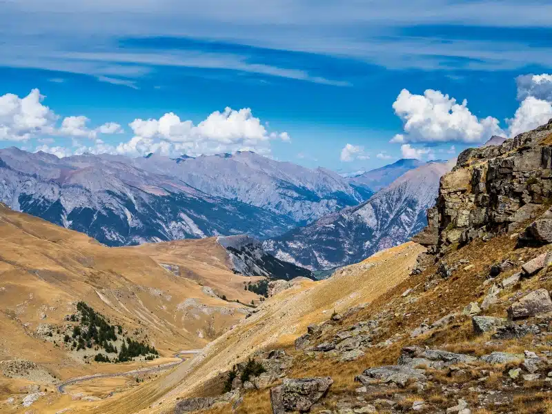
Day 3: St Martin-Vésubie to Barcelonnette
Route highlights (classic): Valberg, Col de Valberg (5,486 ft / 1,672 m), Col de la Cayolle (7,673 ft / 2,339 m)
Route highlights (high option): Col de la Bonette and Cime de la Bonette loop (up to 9,209 ft / 2,807 m)
Driving notes: Long mountain day, narrow balcony roads, weather-dependent at higher elevations
Distance and time: ~116–135 km, 3–4 hours depending on route
Today is the first genuinely strategic day of the trip. Shortly after leaving St Martin-Vésubie on the D2205, you begin climbing toward Col de la Colmiane, also known as Col Saint-Martin. It’s not especially high, but it acts as a gateway into higher Alpine terrain and sets up the first major decision of the route.
After passing Saint-Sauveur-sur-Tinée, the road splits, and this is where you need to choose how ambitious you want the day to be.
The classic Route des Grandes Alpes continues toward Valberg and then on to Col de la Cayolle. This option delivers a continuous sense of movement through changing landscapes, with open views, narrow balcony sections, and a rewarding descent through the Gorges du Bachelard. It’s scenic throughout and feels balanced rather than extreme, making it a strong choice if you want drama without committing to the highest altitude.
The alternative is the big one: Col de la Bonette. If the road is open and the weather is stable, this route pushes you into high Alpine territory very quickly. As you climb, the scenery becomes more exposed and expansive, with long views across ridges and valleys. Adding the optional Cime de la Bonette loop takes you to the highest point of the entire route, delivering a 360-degree panorama that feels vast even by Alpine standards.
Neither route is objectively better. The right choice depends on conditions, traffic, and how you’re feeling that morning, but today marks the transition into the high-Alpine heart of the route.
Whichever option you choose, Barcelonnette is a welcoming endpoint. The town has a relaxed mountain-hub feel, an attractive centre, and enough life to make the evening easy without feeling busy. After a day of real decisions and serious scenery, it’s a good place to decompress.
Day 4: Barcelonnette to Briançon
Route highlights: Col de Vars (6,926 ft / 2,111 m), Guillestre stop, Col d’Izoard (7,743 ft / 2,360 m), Casse Déserte
Driving notes: Classic high-pass chain, exposed scenery near summits, steady but demanding day
Distance and time: ~100 km, around 3 hours without stops
Leave Barcelonnette on the classic route toward Col de Vars, a steady climb that eases you into the day. The road is well paved, and the ascent feels measured rather than dramatic, giving you time to enjoy the widening views.
Guillestre sits at a natural junction point and makes a good stop to break the drive. If you want a short detour with substance, Fort Queyras offers panoramic views and a strong historical counterpoint to the scenery.
From Guillestre, the route climbs toward Col d’Izoard, one of the most iconic passes on the Route des Grandes Alpes. The approach is scenic, but the real shift happens near the top, where the Casse Déserte landscape takes over. Pale scree slopes and weathered rock formations create an almost lunar feel, and it’s easy to see why this stretch is so closely tied to Tour de France mythology.
Descending toward Briançon, the road relaxes slightly, and the town’s fortifications come into view. Briançon has real presence: a proper town rather than a village, with history, shops, and a sense of place that makes it a strong overnight stop.
After Col de Vars and Col d’Izoard, a stop at Les Grands Bains du Monêtier just outside Briançon is a welcome reward. The outdoor thermal pools, fed by naturally warm alpine water, are ideal for easing tired muscles before the next day’s drive north.
Day 5: Briançon to Val-Cenis
Route highlights (classic): Col du Lautaret (6,752 ft / 2,058 m), Col du Galibier (8,668 ft / 2,642 m), Col du Télégraphe (5,138 ft / 1,566 m)
Route highlights (west option): L’Alpe d’Huez, Col de la Croix de Fer (6,775 ft / 2,065 m)
Route highlights (east option): Col de l’Échelle, Oulx (Italy), Col du Mont-Cenis (6,840 ft / 2,085 m)
Driving notes: Choose route based on weather, traffic, and appetite for altitude or mileage
Distance and time: ~104–203 km, 3–5 hours depending on route
Straight out of Briançon, you’re faced with one of the defining choices of the trip. The classic route via Lautaret, Galibier, and Télégraphe is the most famous and delivers big scenery and high altitude in quick succession. Galibier in particular feels like a milestone, exposed, expansive, and undeniably Alpine.
The western alternative via L’Alpe-d’Huez and Col de la Croix de Fer is longer and more demanding, but offers variety and a different style of mountain driving. It’s best suited to confident drivers with plenty of daylight.
The eastern alternative dips briefly into Italy via Oulx before returning to France over Mont Cenis. It’s a gentler option in terms of traffic and offers a change of cultural flavour, as well as a high plateau feel rather than constant climbing.
Whichever route you choose, Val-Cenis is a sensible place to end the day. In summer, the resort has a relaxed feel and enough facilities to make the evening straightforward.
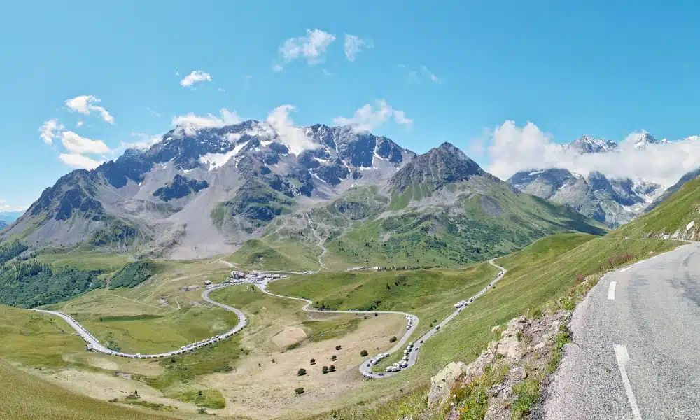
Day 6: Val-Cenis to Bourg-Saint-Maurice
Route highlights (classic): Col de l’Iseran (9,068 ft / 2,764 m), Bonneval-sur-Arc area, Val d’Isère
Route highlights (alternative): St-François-Longchamp, Col de la Madeleine (6,555 ft / 1,998 m)
Driving notes: The highest driving day of the route, colder temperatures likely, check pass status
Distance and time: ~86–138 km, 3–4 hours depending on route
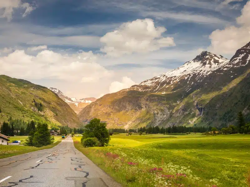
Today brings the highest point of the entire route. If conditions allow, Col de l’Iseran is a standout moment, with long, open climbs and a genuine sense of altitude. Temperatures can drop quickly near the summit, even in summer, so keep layers handy.
The surrounding landscapes feel bigger and wilder here, especially near Bonneval-sur-Arc, one of the most attractive villages in the region. Val d’Isère makes a practical stop for coffee or lunch, and in summer it’s geared toward hiking and cycling rather than ski crowds.
If weather or closures affect the Iseran, the alternative via Col de la Madeleine is a strong backup. You still get a classic Alpine climb and wide views, without committing to the very highest terrain.
Bourg-Saint-Maurice is not a storybook town, but it is extremely well positioned and makes logistical sense as a base.
Day 7: Bourg-Saint-Maurice to Le Grand-Bornand
Route highlights: Cormet de Roselend (6,453 ft / 1,967 m), Lac de Roselend, Beaufort village
Optional detour: Annecy and Lake Annecy
Driving notes: Scenic lake and valley driving, gentler rhythm after high passes
Distance and time: ~98–132 km, around 3 hours without long stops
The day begins with Cormet de Roselend, a pass that combines satisfying driving with immediate scenery thanks to Lac de Roselend. The lake is an easy stop, and the Chapelle de Roselend adds a small but memorable historical note.
Beaufort is an obvious place to pause. It’s compact, attractive, and famous for its cheese, which makes it dangerously easy to linger longer than planned.
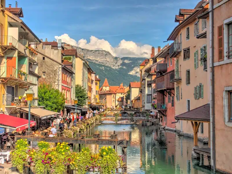
From here, you can stay on the classic route via Col des Saisies and Col des Aravis, or detour toward Annecy if you want a lakefront town and a change of pace. Annecy’s canals and old town feel very different after several days of mountain villages and can be a refreshing contrast.
Le Grand-Bornand makes a strong final alpine base, traditional without feeling dated, and lively enough for a relaxed evening.
Day 8: Le Grand-Bornand to Thonon-les-Bains
Route highlights: Col de la Colombière (5,208 ft / 1,618 m), Cluses stop, Col des Gets (3,839 ft / 1,170 m)
Driving notes: Final Alpine passes, gradually descending terrain, busier valley roads near the lake
Distance and time: ~92 km, 2.5–3 hours without stops
Col de la Colombière is a fitting final pass, scenic and satisfying without the intensity of the higher cols earlier in the trip. From here, the route begins to unwind, with wider valleys and a noticeable shift in atmosphere.
Cluses is a useful lunch stop if you want to break up the drive, and the final approach to Lake Geneva feels deliberately gentle after a week of climbs and descents.
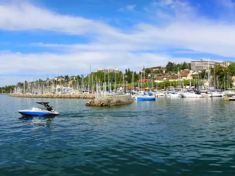
Thonon-les-Bains is a calm place to finish, with lakeside walks, beaches, and an unhurried end to the journey. After days of high passes and narrow roads, arriving at the water feels like a natural full stop rather than a finale that needs drama.
Where to Stay on a Route des Grandes Alpes Road Trip
For a 7–10 day Route des Grandes Alpes road trip, choosing the right overnight bases matters more than chasing standout hotels. Distances can look short on paper, but mountain roads take time and energy, so fewer moves and car-friendly accommodation make the trip far more enjoyable.
All of the locations below work well as logical stopping points on the route and offer straightforward access, parking, and an easy end to long driving days.
Menton: optional start night
Luxury: Hôtel Riva Art & Spa, a relaxed seafront hotel that makes a comfortable final night by the Mediterranean before heading into the mountains.
Mid-range: Hôtel de Londres, central, traditional, and well placed for a low-stress start to the route.
Budget: ibis Budget Menton Bord de Mer, simple and practical with easy access for an early departure.
Sospel: first Alpine base
Mid-range: Domaine du Paraïs B&B, friendly, well reviewed, and easy to reach by car.
Budget: Camping le Mas Fleuri, a peaceful option if you’re travelling with camping gear or a campervan.
St Martin-Vésubie: Mercantour National Park base
Luxury: Pure Montagne Resort and Spa, ideal if you want a restorative night before the longer mountain stages.
Mid-range: La Bonne Auberge, centrally located and well-suited to a one-night stop.
Budget: La Ribambelle, simple and characterful with a local feel.
Barcelonnette: mid-route comfort base
Luxury: Villa Morelia in Jausiers, a refined villa-style stay just outside town with space to properly unwind.
Mid-range: Le Grand Hotel, central, practical, and a solid choice after a long driving day.
Budget: Hôtel du Cheval Blanc, straightforward and well located for exploring the town on foot.
Briançon: historic town base
Luxury: Hôtel Restaurant de la Chaussée, a traditional hotel that fits the historic feel of the town.
Mid-range: Hôtel Vauban Briançon Serre Chevalier, comfortable and well placed near the old town.
Budget: Auberge de la Paix, simple and good value for a short stay.
Val-Cenis: central Alpine base
Luxury: Résidence Les Balcons de Val Cenis Le Haut in Lanslevillard, spacious and well-suited to road trippers needing an easy arrival.
Mid-range: L’Outa Hotel, practical, friendly, and well located for the following day’s drive.
Budget: Auberge La Turra, straightforward and reliable for an overnight stop.
Bourg-Saint-Maurice: practical mountain hub
Luxury: Montagn’Arcs, comfortable and well set up for travellers with a car.
Mid-range: Base Camp Lodge Hotel, modern, relaxed, and ideal for breaking up the northern stages.
Budget: La Case à Kio in Les Chapelles, a quieter option just outside town with easy road access.
Le Grand-Bornand: final Alpine base
Luxury: Chalet-Hôtel Inarpa in La Clusaz, a polished mountain stay that still feels relaxed in summer.
Mid-range: Chalet-Hôtel Les Fermes de Pierre and Anna, traditional chalet-style accommodation with good access.
Budget: La Marmotte qui Papote, characterful and informal, suited to a final night in the mountains.
Thonon-les-Bains: finish on Lake Geneva
Luxury: Hôtel Royal in Évian-les-Bains, a classic lakeside hotel that makes a fitting end to the journey.
Mid-range: Résidence Les Baladines, practical and well placed for exploring the town and lakeshore.
Budget: ibis Thonon Centre, dependable, central, and easy if you’re heading onward the next day.
Booking Tips for the Route des Grandes Alpes
Road Trip Tips for the Route des Grandes Alpes
If you want to continue your journey, this route links naturally with our France road trip guide, and pairs well with the Route Napoléon and our guide to driving in the Alps.
More French Road Trips to Explore
South of France Road Trip: The Ultimate 10 Day Driving Route
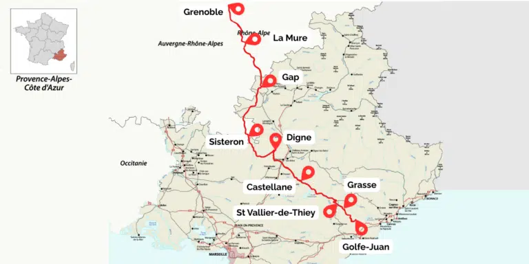
Route Napoléon: Following Napoleon Through the French Alps
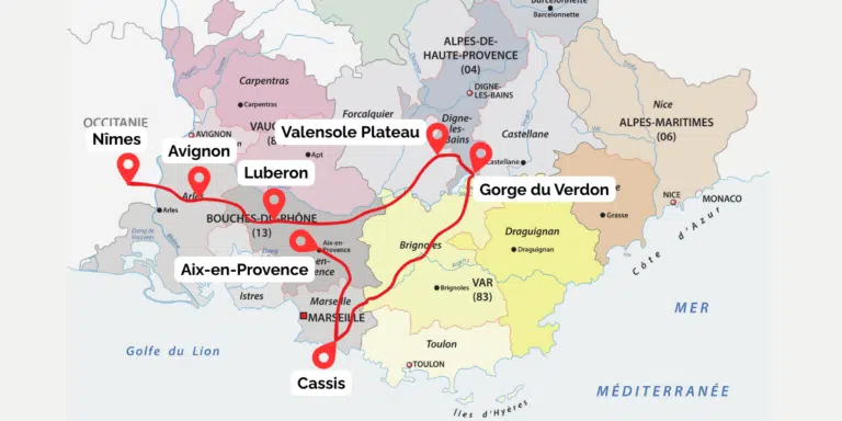
Provence Road Trip: The Best of Southern France by Car
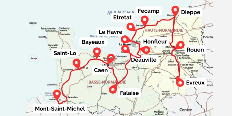
Normandy Road Trip: A Classic 7 Day Itinerary by Car
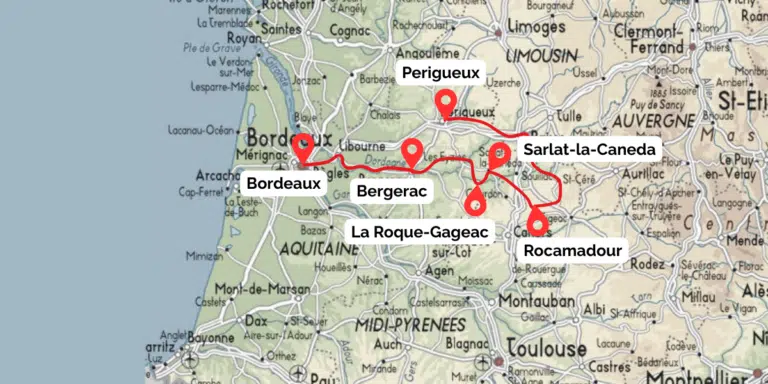
Dordogne Road Trip: The Best of Southwest France by Car
Loire Valley Châteaux Road Trip: The Best of Classic France by Car
Love it? Pin it!