
This post may contain affiliate links, from which we earn an income. Click here to read our affiliate policy.
France is one of the easiest countries in Europe to explore by motorhome, with an enormous network of aires and campsites, excellent roads and an almost endless choice of places to visit.
We’ve travelled through France many times over the years, but this remains one of our favourite routes. It takes you from the vineyards of Burgundy to the Mediterranean, before heading west through Provence, the Cévennes and Occitanie and finishing among the villages and river valleys of the Dordogne.
Along the way you’ll drive the spectacular Route Napoléon, explore the Gorges du Verdon, visit some of Provence’s most beautiful towns and villages, see the medieval city of Carcassonne and discover some fantastic roads that are every bit as memorable as the places they connect.
The complete route covers around 3,000km with approximately 36 hours of driving. You can comfortably travel it in two weeks, but if you have three, we’d use the extra time to slow down rather than add more destinations.
We’ve included our interactive route map, recommended campsites and aires, motorhome parking and practical information for each stage, so you can follow the whole itinerary or use the sections that work for your own France motorhome road trip.
France Motorhome Itinerary Key Facts
Route: The Gap Decaders’ France motorhome itinerary is a 2–3 week route through Burgundy, Lyon, the Route Napoléon, Provence, the Cévennes, Occitanie and the Dordogne.
Distance: The complete motorhome route covers around 3,000km, with approximately 36 hours of driving.
Best time: Spring, early summer and September are ideal for this route, avoiding the busiest summer period while still offering good conditions for touring and sightseeing.
First-hand experience: The Gap Decaders have travelled extensively through France by motorhome and overland vehicle since 2018, and this itinerary is based on a route we’ve driven ourselves.
Enjoy The Gap Decaders? Add us as a preferred source on Google.
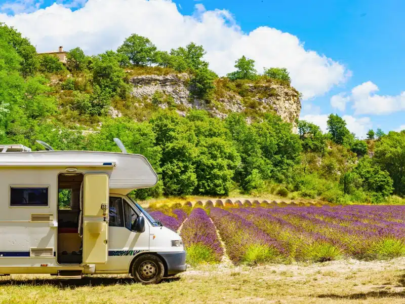
France Motorhome Route at a Glance
Distance: 3,004km
Driving time: Around 36 hours
Duration: 2–3 weeks
Best for: A two to three week France motorhome road trip, with a mixture of cities, mountains, Mediterranean coast, Provence and rural France.
Route: Calais → Dijon → Lyon → Route Napoléon → Gorges du Verdon → Cassis and the Calanques → Aix-en-Provence → Gordes → Fontaine-de-Vaucluse → Goudargues → Saint-Jean-du-Gard and the Cévennes → Pézenas → Béziers → Gorges d’Héric → Carcassonne → Dordogne → La Roque-Gageac → Rocamadour and Gouffre de Padirac → Marcilly-en-Villette → Calais
The route travels from Calais to Dijon and Lyon before picking up the Route Napoléon towards the Gorges du Verdon. From there, you’ll head to the Mediterranean at Cassis, travel through Provence and the Cévennes, cross into Occitanie for Béziers, Pézenas and Carcassonne, then finish with the Dordogne and Rocamadour before heading north to Calais.
Although you can complete the route in two weeks, we’d recommend three if you have the time. The itinerary is designed to be flexible, so it’s easy to miss a stop, stay somewhere longer or use the interactive map to create a shorter version.
France Motorhome Route Map
Our interactive map shows the complete France motorhome itinerary, including the suggested route, places to visit and our recommended campsites and aires.
You don’t need to follow the route exactly as we’ve driven it. Use the map to shorten the journey, skip somewhere that doesn’t appeal or add your own detours along the way.
All our recommended overnight stops and parking places are included, and we’ll also link to Park4Night throughout the itinerary so you can check recent reviews and current information before you arrive.
How Long Do You Need for This France Motorhome Itinerary?
We’ve designed this route to take between two and three weeks.
In two weeks, you’ll need to keep moving fairly regularly and there won’t be much room for spontaneous extra nights. It’s perfectly doable, but you’ll spend part of most days either driving or sightseeing.
Three weeks changes the pace completely. You can spend a couple of nights beside the Mediterranean, linger in Provence, have a day when you don’t move the motorhome and stay longer when you find somewhere you particularly like.
If you only have ten days or so, we wouldn’t try to squeeze the entire route in. Pick one section instead. The Route Napoléon, Gorges du Verdon and Provence work particularly well together, as do Carcassonne and the Dordogne.
RELATED POST: Motorhoming in France: Your Complete Touring Guide
Day 1: Calais to Dijon
Distance: 578km
Driving time: 5 hours
You’ll need an early start from Calais today. It’s the longest driving day of the itinerary, but getting the miles under your belt means you’ll arrive in Dijon with enough time to explore before settling down for the night.
Once you’ve parked up, head into Dijon’s compact historic centre, where medieval half-timbered houses sit alongside elegant Renaissance buildings and grand squares.
One of the easiest ways to explore is to follow the Owl’s Trail, or Parcours de la Chouette. The walking route leads you around the main sights of the old town and is a good way to get your bearings without having to plan your own route.
Dijon is, of course, synonymous with mustard, and there are plenty of mustard shops around the centre. It’s also the capital of Burgundy, so we’d suggest finding a table along one of the cobbled streets and celebrating the first proper day of your French road trip with a glass of local wine.
Insider Tip: Park at Parc des Carrières Bacquin, around a 15-minute walk from the centre of Dijon. It’s a convenient option for exploring the city without taking your motorhome into the historic centre.
Where to Stay in Dijon
Stay at the Plombières-lès-Dijon Camping-Car Park site just outside Dijon. The city is a 10 minutes bus ride away.
Camping-Car Park operates a network of commercial motorhome aires across France. You’ll need an account and their Pass’Etapes card/app system to access the aire, and booking ahead can be useful during busy periods.
Park4Night: Camping-Car Park Dijon #655213
Coordinates: N 47°19’51.2652” E 4°59’18.0996”
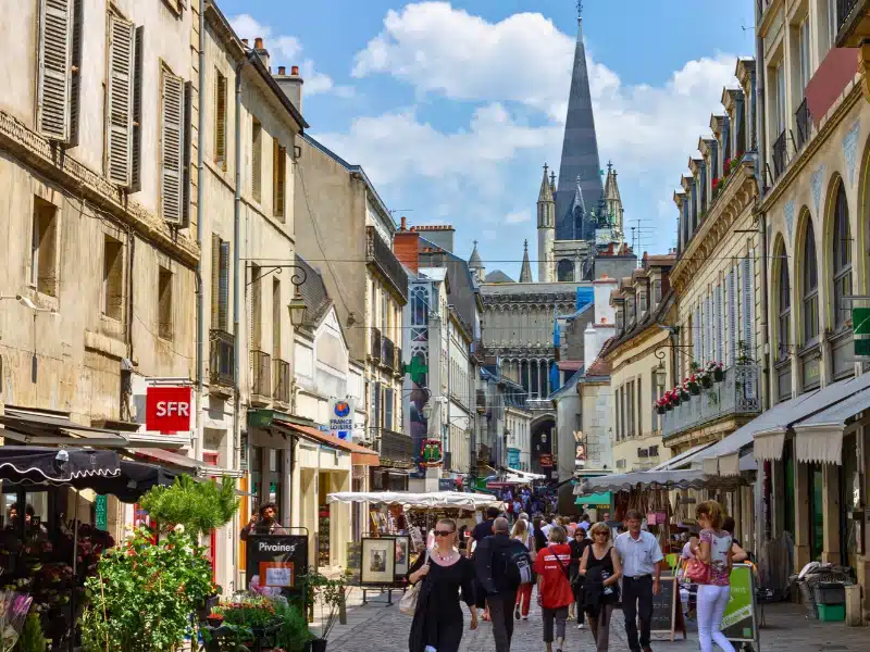
Day 2: Dijon to Lyon
Distance: 198km
Driving time: 2 hours
It’s a much easier driving day today as you continue south through Burgundy towards Lyon, France’s third-largest city, sitting at the confluence of the Rhône and Saône rivers.
Aim to arrive around lunchtime so you have the afternoon and evening to explore. Lyon has a fantastic historic centre, excellent museums and a reputation as one of France’s great food cities.
Spend some time wandering through Vieux Lyon and the narrow traboules, the covered passageways that run through buildings and courtyards in the old town. You can also take the funicular up to the Basilica of Notre-Dame de Fourvière for views across the city.
In the evening, find a traditional bouchon Lyonnais, the small restaurants specialising in the hearty local dishes for which Lyon is famous.
Insider Tip: Lyon has a low emission zone, so make sure you’ve sorted your Crit’Air sticker before travelling. Don’t buy it from one of the many commercial websites charging inflated prices. Order it directly from the official French government website.
Where to Stay in Lyon
Camping des Barolles in Saint-Genis-Laval is a convenient base for visiting Lyon without taking the motorhome into the city. The campsite offers showers, fresh water, and grey and black disposal included in the price of parking. It’s open all year and public transport connects Saint-Genis-Laval with central Lyon.
Park4Night: Camping des Barolles #17726
Coordinates: N 45° 41.223′, E 4° 47.173′
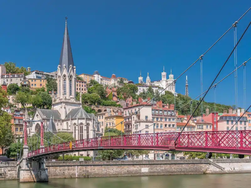
Days 3 and 4: Route Napoléon and the Gorges du Verdon
Distance: 330km
Driving time: 4 hours 30 minutes
Today takes you deeper into southern France and Provence, and you’ll notice the landscape and climate changing as you head south.
You could follow the A7 Autoroute du Soleil directly south from Lyon, but we’d take a much more interesting route. Head towards Grenoble before picking up the N85 to Gap, part of the historic Route Napoléon.
The road follows the route taken by Napoleon in 1815 after returning from exile on Elba and heading north towards Paris. You’ll see statues and markers featuring the Imperial Eagle along the way.
More importantly for a road trip, it’s a spectacular drive. There are sweeping bends, switchbacks and some fantastic mountain scenery as you climb towards Col Bayard, the highest point on this section of the route at 1,246 metres.
From here, continue south into Provence and through Sisteron, whose dramatic citadel sits high above the Durance River.
Take exit 18 for the D6 and cross the Valensole Plateau. If you’re travelling in late June or July, this is one of the highlights of the route, when the plateau’s lavender and sunflower fields should be in bloom.
You’re ultimately heading for Lac de Sainte-Croix in the Parc Naturel Régional du Verdon, close to the Gorges du Verdon.
Visit Moustiers-Sainte-Marie
If you have time, take the D952 from Riez to Moustiers-Sainte-Marie. It’s one of Provence’s loveliest villages, sitting beneath towering limestone cliffs with the tiny Chapelle Notre-Dame de Beauvoir high above the village.
It’s firmly on the tourist trail, but we’d still make the detour. There are regular markets, cafés and shops to explore, and the setting alone makes it worth stopping.
There is designated motorhome parking on Chemin de Quinson, with motorhome services, around a ten-minute uphill walk from the village. This is a Camping-Car Park location where you can park for a few hours or stay overnight.
Explore the Gorges du Verdon
Day 4 is all about staying put and exploring the Gorges du Verdon and Lac de Sainte-Croix.
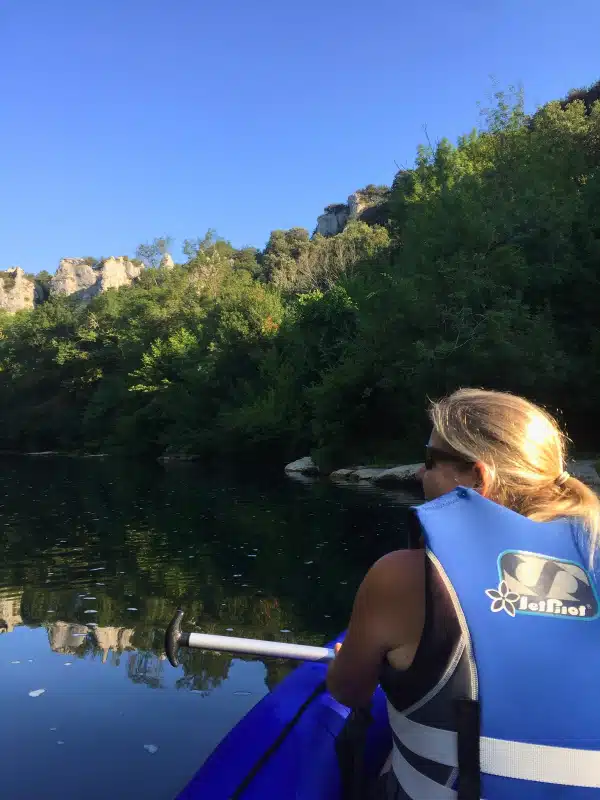
There’s plenty to do on and around the lake, including kayaking and paddleboarding, with equipment available to hire locally. Getting out on the water is also one of the best ways to explore the entrance to the gorge, where the striking turquoise water runs between the towering limestone cliffs.
If you’d rather stay on dry land, there are plenty of opportunities for hiking, climbing and horse riding around the Parc Naturel Régional du Verdon. You can also hire electric bikes locally and use the day to explore the area around the lake.
Where to Stay at Lac de Sainte-Croix
Stay for two nights at Camping La Source, a family-run campsite with direct access to Lac de Sainte-Croix and the nearby village. That gives you tomorrow free to explore the lake and Gorges du Verdon rather than packing up and moving again.
Insider Tip: If you’re driving to the campsite from Moustiers-Sainte-Marie, DO NOT take the D952. It becomes one-way and you’ll get stuck when the road narrows. Take the D957 instead.
Park4Night: Camping la Source #9420
Coordinates: N 43°46’30.4536” E 6°12’27.5976”
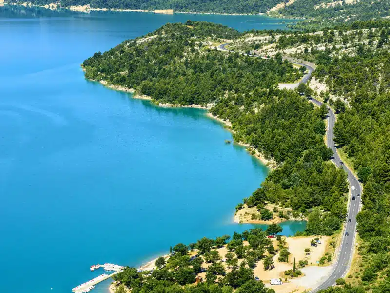
Days 5 and 6: Gorges du Verdon to Cassis and the Calanques
Distance: 131km
Driving time: 2 hours
After a couple of days around Lac de Sainte-Croix and the Gorges du Verdon, you’re heading south to the Mediterranean and the colourful seaside town of Cassis.
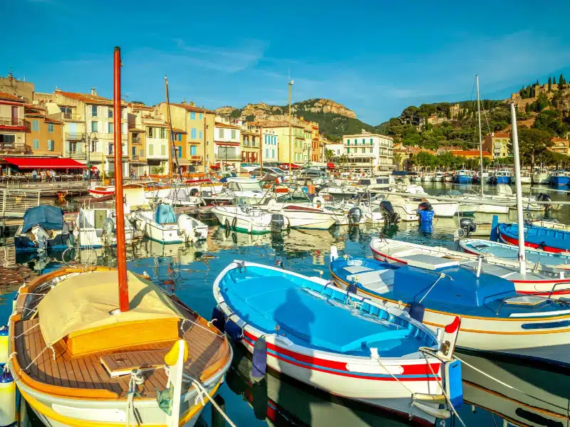
Cassis was once a fishing village and still has a lovely harbour surrounded by pastel-painted buildings, along with a small beach right in the centre of town.
The big draw here is the Calanques, the dramatic limestone inlets that cut into the coastline between Cassis and Marseille, creating deep coves, beaches and brilliantly clear turquoise water.
Take the Scenic Route Through Sainte-Baume
It’s an easy driving day, so if you have time we’d leave the quickest route behind and travel through the Parc Naturel Régional de la Sainte-Baume.
The limestone ridge of the Massif de la Sainte-Baume dominates the landscape, and the route takes you past caves, forests and small Provençal villages on the way towards the coast.
Explore the Calanques by Kayak
Give yourself a full day in Cassis because this is one place where it’s worth leaving the motorhome parked up.
Pack a picnic, hire a kayak and head for Calanque d’En-Vau, one of the most spectacular of the Calanques, with turquoise water, a small beach and excellent snorkelling.
You don’t need to be an experienced kayaker, although you do need to be comfortable swimming and prepared for around 60 to 90 minutes of paddling each way.
You can also hike into the Calanques, but we think the best way to experience them is from the sea. Some of the small coves and beaches are also much easier to reach from the water.
Insider Tip: Take a picnic and snorkelling gear with you when you kayak to Calanque d’En-Vau. Once you arrive, you’ll probably want to stay for a while before tackling the paddle back to Cassis.
Where to Stay in Cassis
Stay for two nights at Camping Les Cigales, around a 20-minute walk or ten-minute cycle from Cassis town centre and the beach.
Park4Night: Camping Les Cigales #5460
Coordinates: N 43°13’26.3964” E 5°32’30.588”
Day 7: Cassis to Aix-en-Provence
Distance: 50km
Driving time: 40 minutes
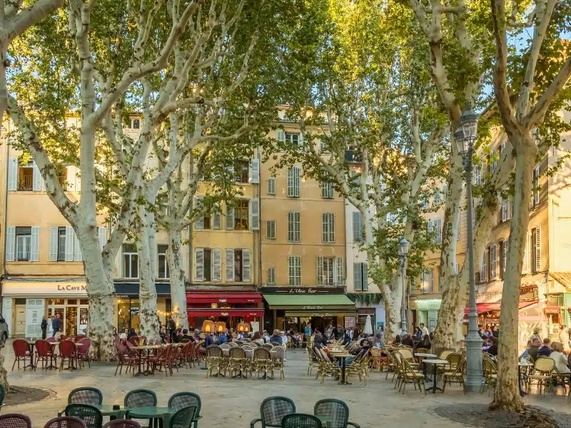
Today is a short hop inland to Aix-en-Provence, one of Provence’s most elegant cities. There’s no need to rush away from Cassis, as Aix is at its best later in the afternoon and early evening when the streets, squares and café terraces come to life.
Once you’re in the centre, Aix is a lovely city to explore on foot. Leafy boulevards and public squares are lined with elegant 17th and 18th century buildings, and fountains seem to appear around every corner. There’s a reason Aix is known as the City of a Thousand Fountains.
Make time for Cours Mirabeau, the broad tree-lined avenue through the heart of the city, before wandering into the narrow streets and squares of the old town.
Insider Tip: While you’re in in Aix, try the typical Occitanie drink of citron pressé. Like a DIY lemonade, you are served the freshly squeezed juice of a locally grown lemon with a jug of still water and sugar. Mix to your taste and enjoy!
Where to Stay in Aix-en-Provence
Stay at Camping Arc en Ciel, a family run riverside site, which is around a 15-minute cycle ride or a short bus journey from the historic centre.
Park4Night: Camping Arc en Ciel #13283
Coordinates: N 43°30’46.0728” E 5°28’18.372”
Day 8: Aix-en-Provence to Fontaine-de-Vaucluse via Gordes
Distance: 73km
Driving time: 1 hour
Today you’re heading towards Fontaine-de-Vaucluse on the edge of the Luberon, but we’ll make a detour to Gordes on the way.
Gordes sits high in the Monts de Vaucluse and is officially one of Les Plus Beaux Villages de France. Its narrow streets are packed with small galleries, shops and cafés, but the real reason for coming is the setting and the views across the surrounding countryside.
The road up to Gordes is long and winding, but don’t let that put you off in a larger motorhome. We’ve driven it in a 9m, 5 tonne tag axle without a problem.
Visiting Gordes by Motorhome
There’s designated motorhome parking with services off the D15, around a five-minute walk from the centre of Gordes.
It fills quickly, particularly in the main season, so we’d aim to arrive reasonably early rather than hoping to find a space later in the day.
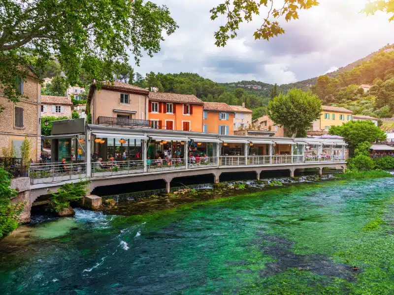
From Gordes, continue to Fontaine-de-Vaucluse, where the River Sorgue emerges from a huge spring beneath a limestone cliff more than 230 metres high.
The source is the largest spring in France and one of the largest in the world. Its underground network extends hundreds of metres beneath the surrounding limestone, and despite years of exploration, its full depth and structure are still not completely understood.
In summer, when the water level is lower, you can walk much closer to the enormous cave mouth from which the spring emerges.
Where to Stay in Fontaine-de-Vaucluse
Stay at the Camping-Car Park aire a few minutes’ walk from the centre of Fontaine-de-Vaucluse, with direct access to the river.
Park4Night: Aire de Fontaine-de-Vaucluse #8479
Coordinates: N 43°55’12.72” E 5°7’28.884”
Day 9: Fontaine-de-Vaucluse to Goudargues
Distance: 94km
Driving time: 1 hour 30 minutes
Today you’re heading west into the Gard department and the small village of Goudargues on the River Cèze.
Goudargues is a laid-back sort of place, with its main street running alongside a pretty canal, a handful of restaurants and ice-cream shops and a village square where you’ll often see locals playing boules in the evening.
There isn’t a long list of sights to tick off here, and that’s rather the point. Spend the afternoon relaxing by the water before heading out for something to eat and an evening watching village life go by.
Cycle to La Roque-sur-Cèze
If you’re feeling energetic or have e-bikes, cycle to La Roque-sur-Cèze, another of Les Plus Beaux Villages de France, around 30 minutes from Goudargues.
Nearby are the Cascades du Sautadet, where the River Cèze has carved a series of dramatic channels, waterfalls and potholes through the limestone. Swimming is prohibited but you’ll still see lots of people in the water!
Insider Tip: If you’ve brought bikes or e-bikes, use them today. La Roque-sur-Cèze and the Cascades du Sautadet make an easy excursion from Goudargues without having to move the motorhome.
Where to Stay in Goudargues
Stay at Camping Paradis Les Amarines, right in the centre of Goudargues and with direct access to the shallow River Cèze. It’s a great location for leaving the motorhome parked up and exploring the village and surrounding area on foot or by bike.
Park4Night: Camping Paradis Les Amarines #38181
Coordinates: N 44°13’13.0764” E 4°28’45.3”
Day 10: Goudargues to Saint-Jean-du-Gard
Distance: 76km
Driving time: 1 hour 20 minutes
Today you’re heading into the Cévennes, one of the wildest and least populated areas of southern France. It’s another relatively short driving day, leaving plenty of time to explore once you arrive in Saint-Jean-du-Gard.
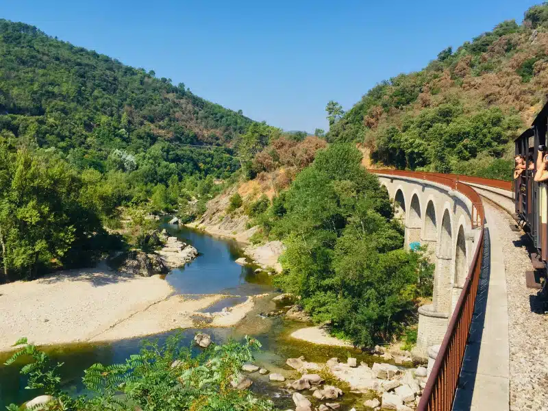
The big reason for coming here is the Train à Vapeur des Cévennes, the heritage steam railway that runs between Saint-Jean-du-Gard and Anduze. It’s easy to park even a large motorhome at the station.
The train follows the Gardon valley, crossing viaducts and passing through tunnels on a wonderfully scenic journey through the Parc National des Cévennes. You don’t need to be remotely interested in steam trains to enjoy this one. The landscape and route make it well worth doing.
Visit La Bambouseraie
The train stops at La Bambouseraie en Cévennes, an extraordinary botanical garden near Anduze that’s famous for its towering bamboo groves.
You can combine the railway and gardens in the same day, getting off to explore La Bambouseraie before continuing your journey.
Visit Maison Rouge
Back in Saint-Jean-du-Gard, Maison Rouge, the Museum of the Cévennes Valleys, is also worth making time for.
Even if museums aren’t normally your thing, we’d recommend this one. It’s housed in a beautifully restored former silk mill and tells the story of life in the Cévennes, including its farming traditions, industries and the importance of silk production to the region.
Where to Stay in Saint-Jean-du-Gard
Stay at Camping Le Petit Baigneur, beside the River Gardon and around a ten-minute cycle from the railway station.
Park4Night: Camping Le Petit Baigneur #184024
Coordinates: N 44°6’44.1792” E 3°51’37.9512”
Days 11 and 12: Saint-Jean-du-Gard to Pézenas
Distance: 115km
Driving time: 1 hour 50 minutes
Today you’re heading south into Hérault, part of the historic Languedoc region, where the landscape changes again as you travel towards Pézenas.
There’s no need to drive straight there because two of the best stops on this part of the route are Pont du Diable and Saint-Guilhem-le-Désert.
Stop at Pont du Diable
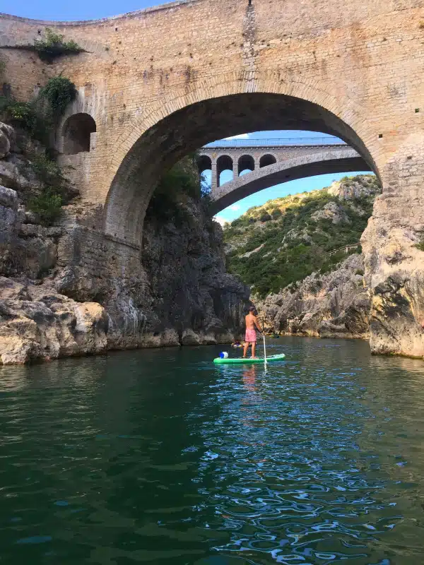
Pont du Diable crosses the Hérault River at the mouth of the gorge close to Saint-Guilhem-le-Désert. The medieval stone bridge is a UNESCO World Heritage Site and makes a great stop for a few hours.
There’s a beach beside the river, and you can swim, paddleboard or kayak here, with equipment available to hire locally.
There is designated motorhome parking with free services at Pont du Diable, from where you can walk to the river and beach or use the local shuttle to reach the surrounding villages.
Visit Saint-Guilhem-le-Désert
From Pont du Diable, make time for nearby Saint-Guilhem-le-Désert, another of Les Plus Beaux Villages de France.
The medieval village sits in the Hérault valley and is home to the Romanesque Abbey of Gellone, which forms part of the UNESCO-listed Routes of Santiago de Compostela in France.
Insider Tip: Don’t rush this part of the route. There’s lots to do and see here. If you get caught up in the mood, spend the night in the car park; it’s allowed for an extra few euros.
Spend Day 12 in Pézenas
Stay put the following day and enjoy Pézenas at a slower pace.
The historic centre is made for wandering, with narrow streets, small squares, independent shops and plenty of places to stop for coffee or lunch.
If you’re here on a Saturday, don’t miss the farmers’ market, which fills the historic centre with stalls selling local produce, food and wine.
During July and August, there are also wine evenings every Wednesday and Friday, with local producers offering tastings of regional wines and food in the old town. They’re a lovely way to spend a summer evening in Pézenas.
Where to Stay in Pézenas
Stay for two nights at Camping Saint Christol, on the outskirts of Pézenas, giving you a full second day without having to move the motorhome.
Park4Night: Camping Saint Christol #25831
Coordinates: N 43°27’58.7376” E 3°25’26.3532”
Day 13: Pézenas to Béziers
Distance: 28km
Driving time: 30 minutes
It’s a very short drive today to Béziers, so you’ve got plenty of time to explore one of the less touristy cities in this part of southern France.
Béziers is perhaps best known for Les Neuf Écluses de Fonseranes, the famous staircase of nine locks on the Canal du Midi. It’s a remarkable piece of engineering and a fascinating place to watch boats making their way along the canal. There is a large car park suitable for motorhomes right by the nine locks.
If you’ve brought bikes, this is also a great place to get them out. You can cycle alongside the Canal du Midi on the towpaths beneath the distinctive rows of plane trees.
Explore Béziers
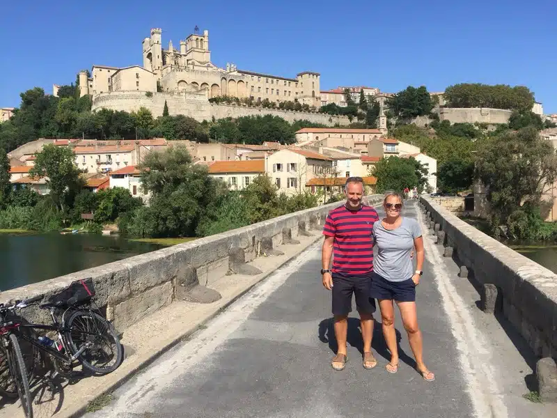
There’s more to Béziers than the canal. Head into the historic centre to see the impressive Saint-Nazaire Cathedral and then down towards the River Orb and the Pont Vieux, the city’s medieval bridge.
With such a short drive today, there’s no need to rush. You can easily spend the afternoon exploring before heading back to the motorhome.
Where to Stay in Béziers
Stay at the Sauclières Motorhome Aire, a well-managed aire around ten minutes by bike from the Nine Locks.
Park4Night: Sauclières Motorhome Aire #214261
Coordinates: N 43°19’51.7224” E 3°13’38.6688”
Days 14 and 15: Béziers to the Gorges d’Héric
Distance: 50km
Driving time: 1 hour
From Béziers, you’re heading north into the Haut-Languedoc and the Gorges d’Héric, beneath the Caroux mountains.
This is a lovely driving day that takes you away from the busier tourist routes and deep into the Occitanie countryside. The road criss-crosses the River Orb and passes through small villages along the way.
Take the D14 for the best route and don’t be in too much of a hurry. This is wine country, so there are plenty of opportunities to stop at a local cellar as you travel.
Explore the Gorges d’Héric
Stay put on Day 15 and follow the path from the car park into the gorge.
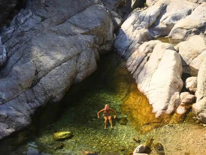
For around 5km, the route follows the gorge past enormous boulders, small beaches and deep pools of clear mountain water. On a hot day, take your swimmers, a towel, food and plenty of water and make a day of it.
If you want something more energetic, hike the Sentier des Gardes towards the Caroux plateau for superb views across the surrounding mountains and Haut-Languedoc.
Insider Tip: There’s a small snack bar at the top of the car park where you can enjoy a beer in the early evening. Ask nicely and the staff may also be able to arrange fresh baguettes or croissants for you the following morning.
Where to Stay at the Gorges d’Héric
Stay for two nights at the Gorges d’Héric car park, where there are motorhome services and overnight parking is available for a small fee, paid at the snack bar. Head for the bottom corner of the car park, which we’ve found to be the shadiest and quietest spot to stay. There is also a Vival in Mons which has an excellent selection of local produce.
Park4Night: Gorges d’Héric Car Park #247041
Coordinates: N 43°34’23.6352” E 2°58’5.7036”
Days 16 and 17: Gorges d’Héric to Carcassonne
Distance: 97km
Driving time: 1 hour 40 minutes
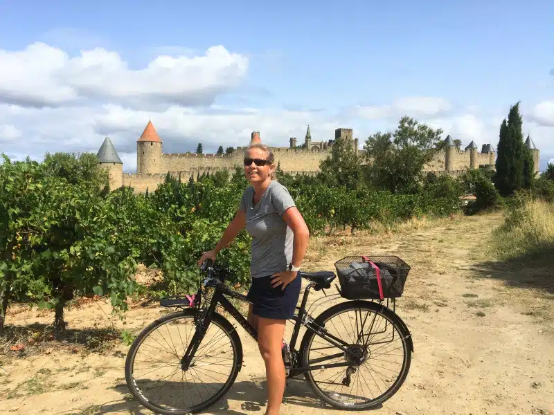
Today you’re heading south-west to Carcassonne in the Aude department, home to the enormous UNESCO-listed La Cité, the fortified medieval citadel that dominates the city.
La Cité is free to enter, although you’ll need to pay to visit some of the historic buildings inside. Simply wandering its cobbled streets and squares is part of the experience.
It does get extremely busy in peak season and can feel a little Disneyesque in places, but go prepared for that and enjoy the sheer scale of the fortifications, ancient buildings and extraordinary restoration. Visit early if you can, before the worst of the crowds arrive.
Explore Carcassonne Beyond La Cité
Stay for a second day because there’s more to Carcassonne than its famous citadel.
The surrounding countryside is filled with vineyards and the ruins of medieval castles perched on rocky outcrops, giving you plenty of options if you want to explore further afield.
Carcassonne also has a lovely ‘new town’, although new is relative here. The Bastide Saint-Louis was established outside the walls in the 13th century and is a great place for a wander away from the busiest parts of La Cité.
Head to Place Carnot for breakfast before exploring the surrounding streets. If you’re here on a Saturday morning, there’s also a local farmers’ market.
Insider Tip: If you prefer tranquillity to crowds and want some great photos, see La Cité by bike. Some of the best views of its turrets and fortified walls are from outside. Cycle up Chemin des Anglais, which takes you behind and around La Cité and gives you a completely different perspective on the citadel.
Where to Stay in Carcassonne
Stay for two nights at the Carcassonne Aire de Camping-Car beside the municipal campsite on the outskirts of the city.
You can walk everywhere from here, and there’s a designated path, which is lit at night, leading to La Cité.
Park4Night: Aire de Camping-Cars Carcassonne #36930
Coordinates: N 43°11’59.2404” E 2°21’9.8172”
Day 18: Carcassonne to La Roque-Gageac
Distance: 265km
Driving time: 3 hours
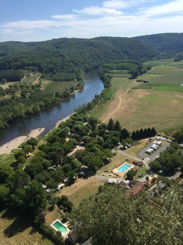
Today you’re heading north into the Dordogne to La Roque-Gageac, another of Les Plus Beaux Villages de France and one of the most striking villages in the region.
La Roque-Gageac sits between a towering limestone cliff and the Dordogne River, with golden stone houses squeezed along the narrow strip of land between the two.
It’s also at the eastern end of the Valley of the Five Châteaux, making it a great base for exploring some of the Dordogne’s best-known castles.
Explore the Dordogne Valley
Two of the big hitters are Château de Beynac and Château de Castelnaud, sitting on opposite sides of the Dordogne and both well worth visiting.
If gardens are more your thing, head to the nearby Marqueyssac Gardens. As well as fantastic views across the Dordogne Valley, they’re famous for their extraordinary sculpted box hedging. And we’re not joking when we say the hedging alone is worth seeing!
Insider Tip: If it’s hot and you fancy a swim, cut through the campsite next door to the aire and take a dip in the Dordogne from their river beach.
Where to Stay in La Roque-Gageac
Stay at the Camping-Car Park aire on the edge of La Roque-Gageac, giving you an easy base for exploring the village and surrounding Dordogne Valley.
Park4Night: Camping-Car Park La Roque-Gageac #21344
Coordinates: N 44°49’28.2036” E 1°10’10.38”
Day 19: La Roque-Gageac to Rocamadour and Gouffre de Padirac
Distance: 57km
Driving time: 1 hour 10 minutes
Your last full day is a busy one, so make an early start. You’re heading first to Rocamadour, one of France’s most extraordinary villages, before continuing to the Gouffre de Padirac.
Explore Rocamadour
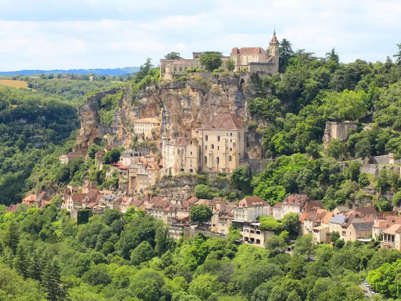
Rocamadour seems to cling impossibly to the side of a limestone cliff and is famous for its religious buildings and its goat’s cheese.
Explore on foot, following the cobbled streets from the bottom of the village towards the top and passing churches, monasteries and châteaux as you climb.
There’s a large field for motorhome parking on the opposite side of the gorge, where you can also stay the night if you want to extend your time here. From the parking, it’s around a 15-minute walk into Rocamadour.
Visit the Gouffre de Padirac
From Rocamadour, it’s around a 30-minute drive to the Gouffre de Padirac.
This enormous underground chasm leads into a remarkable cave system with an underground river running through it. It’s one of those places where photographs don’t really prepare you for the scale of what you’ll see.
Book your tickets in advance, especially during the busier months. There’s plenty of motorhome parking at the attraction and staff will direct you to the appropriate parking area when you arrive.
Where to Stay Near Padirac
Stay at Camping Roca d’Amour, around 900m from the Gouffre de Padirac.
Park4Night: Camping Roca d’Amour #4329
Coordinates: N 44°51’5.4036” E 1°44’38.22”
Day 20: Padirac to Marcilly-en-Villette
Distance: 387km
Driving time: 4 hours 15 minutes
Today you start the journey north towards Calais, but there’s still plenty of France to enjoy before the road trip is over.
It’s a longer driving day, taking you north from the Dordogne through rural central France towards the Loire and Orléans. After the busy sightseeing days around Carcassonne, the Dordogne and Rocamadour, this is a chance to slow the pace a little and simply enjoy the drive.
You don’t need to cover the whole distance in one go. Stop for lunch in one of the small towns along the way, find a boulangerie and take your time. You’re only positioning yourself for the final run to Calais tomorrow.
Make a Stop Along the Way
If you want to break up the journey with some sightseeing, the Pans de Travassac are an unusual option. These former slate quarries have left behind enormous vertical walls of slate and offer a fascinating glimpse into an industry that shaped this part of France.
Another option is the Jardins de Colette, landscaped gardens inspired by the life and work of the French writer Colette.
Neither needs to become the focus of the day. Pick one if it appeals, or simply enjoy a leisurely journey north.
By the time you reach Marcilly-en-Villette, you’ll be just south of Orléans and well placed for tomorrow’s final drive to Calais.
Have More Time? Visit Orléans
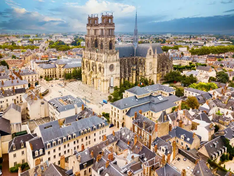
If you’re not in a hurry to reach Calais, Orléans makes a worthwhile addition to the route and you could easily spend the afternoon and evening here before continuing north the following day.
Sitting on the banks of the Loire, Orléans has an attractive historic centre and strong connections with Joan of Arc, who helped lift the siege of the city in 1429. At its heart is the impressive Sainte-Croix Cathedral, along with the old streets around Place du Martroi and the Hôtel Groslot.
It’s also a good city to explore by bike, particularly if you’ve been carrying them throughout the trip.
Where to Stay Near Orléans
Stay at the rural municipal aire in Marcilly-en-Villette, south of Orléans. It’s a peaceful overnight stop on the route after a longer day on the road and leaves you with a straightforward final leg to Calais in the morning.
Park4Night: Aire de Camping-Car Marcilly-en-Villette #461
Coordinates: N 47°45’42.12” E 2°1’28.128”
For an overnight stop with easy access to the city, the motorhome aire at La Chapelle-Saint-Mesmin is around 5km from central Orléans. A traffic-free cycle route follows the Loire into the city, making this a good alternative to the quieter rural aire at Marcilly-en-Villette if you want to explore Orléans before continuing to Calais.
Park4Night: La Chapelle-Saint-Mesmin Aire #2708
Coordinates: N 47°53′7″, E 1°50′25″
Day 21: Marcilly-en-Villette to Calais
Distance: 451km
Driving time: 4 hours 40 minutes
Today you’re homeward bound, with the final leg of the route taking you north through France to Calais.
It’s another fairly long driving day, so if you have a ferry or Eurotunnel crossing booked, give yourself plenty of time and allow some wriggle room for traffic as you approach Calais.
If you’re not crossing back to the UK until the following day, there’s no need to rush. Calais and the surrounding Côte d’Opale have plenty of places to spend one final night in France, and it can be much more relaxing than trying to match a long day’s drive with a fixed crossing time.
After three weeks and around 3,000km, you’ve travelled from Burgundy to the Mediterranean, crossed Provence and the Cévennes, explored Occitanie and the Dordogne, and made your way back north to where you started.
Hopefully you’ll also have discovered why France remains one of our favourite countries to explore by motorhome.
Where to Stay in Calais
If your crossing isn’t until the following day, we’d recommend spending your final night at the Camping-Car Park aire in Calais. We stay here regularly when travelling to and from the UK and find it a convenient place to stop before a ferry or Eurotunnel crossing.
It’s a large gated aire with spacious pitches, electric hook-up and motorhome services, so you can also fill with fresh water and empty your tanks before heading home.
The location is much better than simply sitting around waiting for a crossing. Calais beach and its long seafront are within easy walking distance, as is the famous Dragon de Calais, the huge mechanical dragon that travels along the promenade. If you’ve got a few hours to spare, it’s a nice way to finish the trip.
Park4Night: Camping-Car Park Calais #44177
Coordinates: N 50° 57.555′, E 1° 49.962′
Tips for Your France Motorhome Road Trip
France is one of the easiest countries in Europe to tour by motorhome, but there are a few things worth knowing before you set off.
Using Motorhome Aires in France
France has an enormous network of municipal and privately operated motorhome aires, and you’ll use several on this itinerary.
Facilities vary enormously. Some are little more than designated overnight parking, while others provide fresh water, waste disposal and electric hook-up. Service points may be free or require payment by card, token or at a nearby business.
Popular aires can fill surprisingly early during the summer, so we always have a second option in mind rather than relying completely on one overnight stop.
RELATED POST: Motorhome Aires in France: All You Need to Know
Fresh Water and Waste
Always use your own food-grade hose for filling your fresh water tank and carry a selection of tap connectors. Never use the hose provided beside a toilet disposal point for fresh water.
We’ve seen those hoses used to rinse toilet cassettes, which is exactly why we keep our fresh-water equipment completely separate.
Check Your Route
Don’t assume Google Maps or a standard car satnav will choose a suitable route for your motorhome.
Check unfamiliar roads before setting off, particularly if you have a large or heavy motorhome. Height restrictions, narrow village streets and unsuitable mountain roads can quickly turn an innocent-looking shortcut into something considerably less enjoyable.
Pack for the Outdoors
This itinerary includes swimming, kayaking, cycling and walking, so quick-drying clothes and microfibre towels are useful. We’d also pack water shoes or sandals for the rivers and lakes, insect repellent and layers for cooler evenings.
If you’re carrying bikes, you’ll get plenty of use from them. Several stops on this route are much easier to explore by bike than by moving the motorhome.
Internet and Mobile Data
Check your mobile provider’s European roaming allowance before leaving the UK. Having EU roaming included in your contract doesn’t necessarily mean you have unlimited data abroad, and fair-use limits can be considerably lower than your normal UK allowance.
If you’ll be travelling for several weeks or working on the road, an eSIM or local data SIM can be useful as a backup.
Driving and Tolls
Make sure you understand the French rules that apply to your particular motorhome before travelling, especially if your vehicle weighs more than 3,500kg.
France’s motorway toll classes are based on vehicle height, weight and axle configuration, so larger motorhomes can pay considerably more than smaller vehicles. I would not carry over the old “press the button and say je suis un camping-car to be changed from Class 3 to Class 2” advice without rewriting it, because Class 2 eligibility depends on the vehicle itself rather than simply being a motorhome.
RELATED POST: Tolls for Heavy Motorhomes >3.5T in Europe: Country by Country Guide
Best Time to Follow This France Motorhome Itinerary
We’d choose late spring or early autumn for this route, with May, June and September offering the best balance of weather, daylight and fewer crowds. These months work particularly well because the itinerary covers such a wide range of France, from Burgundy to Provence and the Mediterranean before heading through Occitanie and the Dordogne.
June is a great choice if you want long days and warm weather without the full force of the summer holiday season. If seeing Provence’s lavender fields is important to you, aim for late June into July, when the fields around the Valensole Plateau usually begin flowering.
July and August are perfectly possible, especially if you’re tied to school holidays, but expect higher temperatures and much bigger crowds at places such as the Gorges du Verdon, Cassis, Gordes, Carcassonne and the Dordogne. Aires and campsites are also likely to be busier, so we’d plan overnight stops a little more carefully.
September is probably our favourite month for this itinerary. The Mediterranean and Provence are still warm, the main summer crowds have eased and the Dordogne is usually excellent for walking, cycling and spending time outdoors.
You could also follow the route in April or October, but you’ll need to be more flexible. Days are shorter, the weather can be less predictable and some seasonal campsites, activities and attractions may operate reduced hours.
For the best combination of warm weather, outdoor activities and manageable crowds, we’d aim for late May to late June or early to mid-September.
More European Motorhome Itineraries
Planning another European road trip? Our detailed motorhome itineraries include day-by-day routes, driving distances and times, recommended overnight stops, interactive maps and free downloadable PDFs.
🇩🇪 Germany Motorhome Itinerary
Two weeks through the Mosel Valley, Black Forest, Lake Constance, Bavarian Alps and Romantic Road. Explore our Germany itinerary.
🇮🇹 Italy Motorhome Itinerary
A four-week road trip through Italy, taking in the Italian Lakes, Dolomites, Venice, Tuscany, Rome and the spectacular Amalfi Coast. Explore our Italy itinerary.
🇪🇸 Spain Motorhome Itinerary
Six weeks exploring Spain, from the historic cities of Madrid, Seville and Granada to the wild beaches of Cabo de Gata and the Mediterranean coast. Explore our Spain itinerary.
More France Travel Ideas to Explore

Motorhome Travel in France: What Do You Really Need? (+ Checklist)
Wild Camping in France for Motorhomes – All You Need to Know
The Best Destinations for Motorhome & Campervan Holidays in France

France Road Trip: 13 Amazing Itineraries

Cirque de Gavarnie: Our Guide to France’s Most Spectacular Walk

The 18 Best Wild Swimming Spots in France
Love it? Pin it!


