This post may contain affiliate links, from which we earn an income. Click here to read our affiliate policy.
Cirque de Gavarnie hike, Hautes-Pyrénées, France
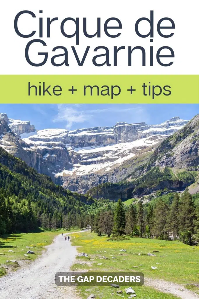
The Cirque de Gavarnie hike is one of the most rewarding walks we’ve done anywhere in the French Pyrenees. We’d seen plenty of photographs before arriving, but nothing prepared us for the sheer scale of the limestone cliffs, the waterfalls cascading hundreds of metres from above, and the vast natural amphitheatre waiting at the end of an easy walk.
If you’re planning the Cirque de Gavarnie hike, this guide covers everything you need to know before you go, including parking, the walking route, how difficult it really is, how long to allow, and what to expect along the trail, together with our own experience of visiting one of France’s most remarkable landscapes.
Last visited: July 2026 (first visited September 2018)
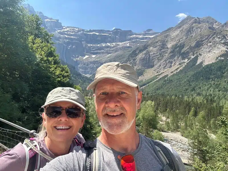
We first hiked to the Cirque de Gavarnie in September 2018, just a few months after setting off on our full-time travels around Europe. It quickly became one of the favourite walks of our Pyrenees road trip, and over the years we’ve often found ourselves recommending it to other travellers.
Eight years later, in July 2026, we returned to see whether it was as spectacular as we remembered. It was. The towering limestone cliffs, the waterfalls spilling from hundreds of metres above and the sense of scale were every bit as impressive as they had been on our first visit.
We’ve updated this guide following our latest hike to include the most up-to-date information on parking, the walking route, facilities and our latest tips, so you can plan your own visit with confidence.
What is the Cirque de Gavarnie?
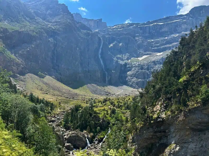
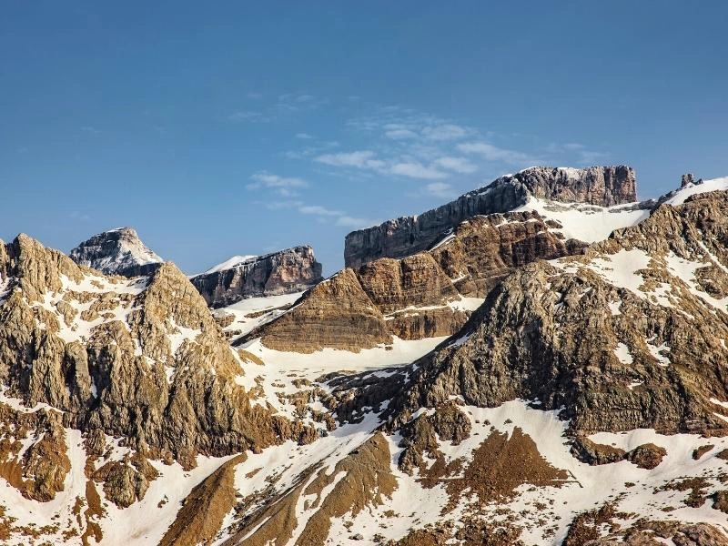
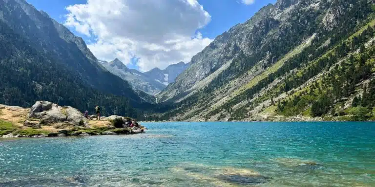
The Cirque de Gavarnie is a vast natural amphitheatre formed by glacial erosion in the French Pyrenees. Its towering limestone walls rise to around 1,700 metres and extend for approximately 14 kilometres, surrounded by 3,000-metre peaks including Mont Perdu, Marboré, Taillon and the distinctive Brèche de Roland.
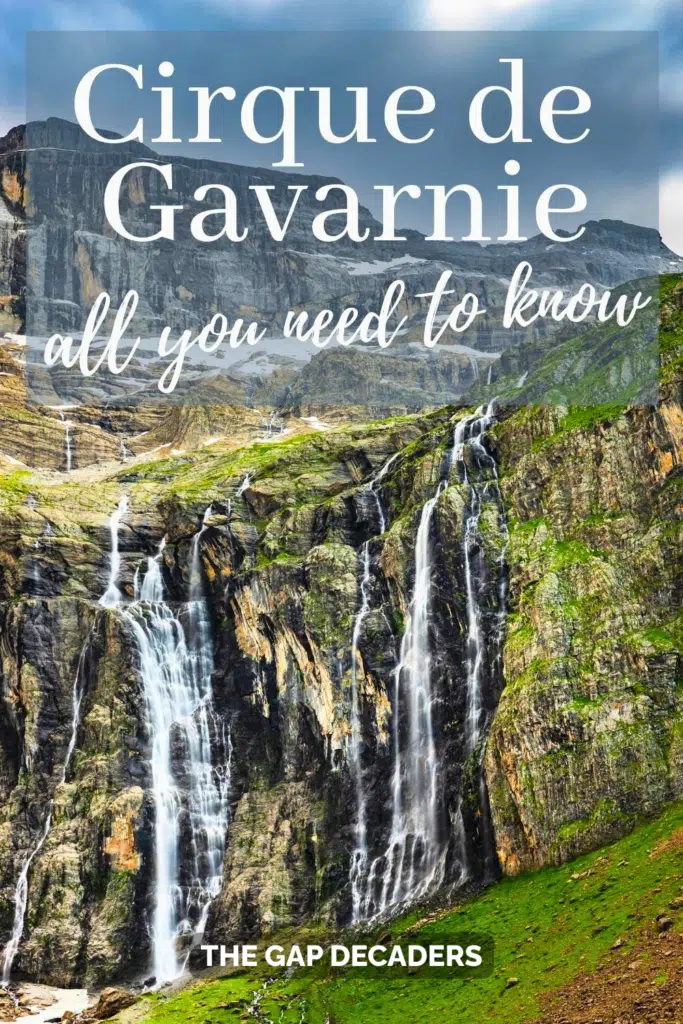
At the heart of the cirque is the Grande Cascade de Gavarnie, one of the highest waterfalls in Europe, with a total drop of around 422 metres. It is the scale of the landscape that makes the hike so memorable, as the cliffs and waterfall grow steadily more imposing as you approach.
Gavarnie forms part of the wider Mont Perdu landscape, which straddles the border between France and Spain. On the French side are the greener cirques of Gavarnie, Troumouse and Estaubé. Across the border in Spain, the scenery becomes drier and more dramatic in the canyons of Ordesa, Pineta and Añisclo.
Cirque de Gavarnie Walk at a Glance
Distance: 8.5 km
Elevation Gain: ~350 m to 365 m
Time: 3 to 4 hours
Route: Linear
Difficulty: Easy to moderate
Is the Cirque de Gavarnie hike worth it?
Yes. We’ve completed the hike twice, first in September 2018 and again in July 2026, and it remains one of our favourite walks in the French Pyrenees. The 8.5 km return route is suitable for most walkers and rewards you with spectacular views of Europe’s highest limestone cirque and the 422 m Grande Cascade.
Is this your first time visiting France? Get all the information you need in our France Travel Guide, including what to pack, the best time of year to go, getting there and practical tips to help you have the best trip!
Cirque de Gavarnie Tips and Info
Cirque de Gavarnie Weather
May to October is the best time for hiking in the Pyrénées mountains of France. Outside of these times, there may well be snow below 2,500m and the weather can become very changeable. Only experienced hikers should head out between November and April.
Whenever you hike the Pyrenees, check the weather before setting off and make sure you have appropriate clothing for the forecast.
Equipment
Hiking boots are not necessary for this walk. Sturdy trainers or approach shoes will be sufficient. Poles may be helpful for the final scramble to the waterfall, or if you’re not sure of foot.
Always carry a waterproof layer and warm dry clothes. Take a packed lunch or snack and plenty of water, as well as a sunscreen and hat in hot weather, and a mobile phone.
Cirque de Gavarnie How to Get There
By car: The commune of Gavarnie-Gèdre in the central Pyrenees is around a 1-hour drive from the nearest large town of Lourdes.
By train and bus: There is a direct SNCF train from Paris to Lourdes, taking around 4 hours and 30 minutes. The 965 bus line takes 1 hour 20 minutes from Lourdes, passing through Cauterets along the route.
Gavarnie Parking
Cars: There is a lot of paid parking along the sides of the main roads through the village. In summer, you need to get there early to secure a space, and it costs €8 per 24 hours for standard cars and €10 per 24 hours for campervans in designated spaces.
Motorhomes: As you head out of the village of Gavarnie on the D923, there is an aire with services on the left side of the road, about 2km outside the village, which costs €10 a night. Or, head further up the D923 to the Col de Tentes for fantastic off-grid wild camping. There are also a handful of campsites on the road up to Gavarnie.
Family Friendly
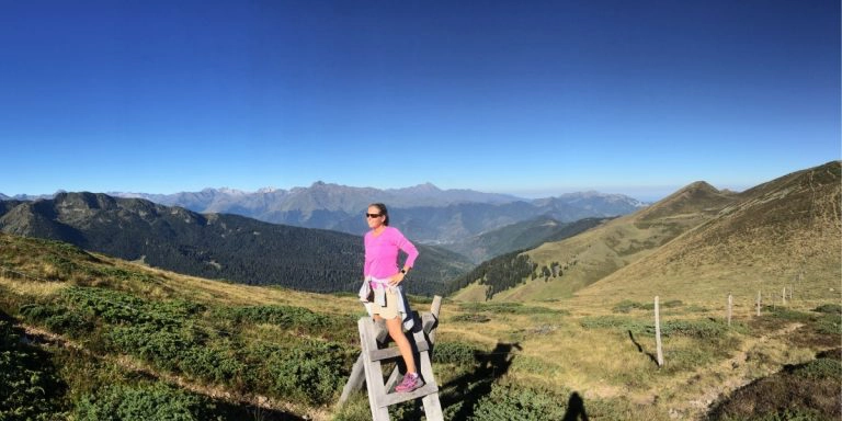
The Cirque de Gavarnie walk can be as family friendly as you want to make it. The route to the cirque is well maintained and level underfoot, with minimal altitude gain, and at 8.5km or 5.2 miles, it’s a kid-friendly distance!
We saw plenty of families with young children completing the walk at their own pace. The wide track and gentle gradient make it one of the more accessible mountain walks in the Pyrenees, although the final scramble to the waterfall is much steeper.
Gavarnie Facilities
There are lots of bars and shops in Gavarnie village and plenty of Gavarnie hotels too. The last toilets are soon after the start, on the left of the main street.
Just before the Cirque proper, there is the Cirque de Gavarnie Hôtel where you can get a cold drink, have something to eat, and use the loo.
Crowd Levels
There will always be lots of people hiking Cirque de Gavarnie in summer, especially along the trail to the cirque. Numbers drop a bit after this as the terrain becomes a little more challenging.
In high season, the crowd levels at Gavarnie can be extreme. Start your hike early to enjoy people-free tracks and views, or visit in May, June or September when there will be fewer people around.
Other Things to Know
The Cirque de Gavarnie is a UNESCO World Heritage Site as well as being in the Parc National des Pyrénées. This means strict regulations apply to protect the nature and wildlife in the area and help visitors respect the national park and its surroundings:
Cirque de Gavarnie Hiking Map
How to use this map: Use your fingers (or computer mouse) to zoom in and out. Click or touch the icons to get more info about a place, and click the arrow in the box top left to open the index. To add to your own Google Maps account, click the star next to the title of the map.
The Cirque de Gavarnie Hike
We’d read Victor Hugo’s description of the Cirque de Gavarnie as the “Colosseum of nature” before visiting, but standing beneath the towering cliffs ourselves, it suddenly made perfect sense. Although the path is straightforward and never particularly demanding, every bend reveals another spectacular view until you finally reach the cirque itself. For us, this was one of the most memorable hikes we’ve done anywhere in the French Pyrenees.
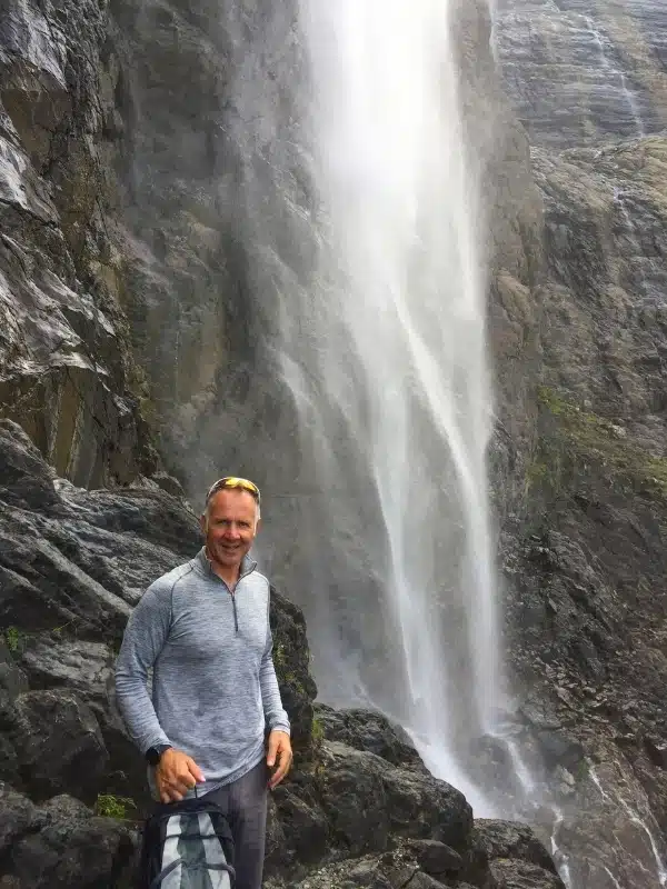
The Cirque itself is full of wildflowers and littered with sheep, goats and incredible waterfalls rushing down the sheer vertical walls of this behemoth of nature. At 422m, the Cirque de Gavarnie waterfall is the highest in mainland France and the fifth highest in Europe (and you can stand right underneath it!)
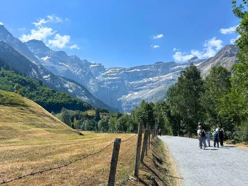
- To start the hike, head downhill from the main car park to the crossroads in the centre of Gavarnie village. Follow the main street south. The Cirque is visible from here; even from a distance you can see how it dominates the skyline and landscape.
- Follow this road as it runs out of the village and along the pretty river, called Gave de Gavarnie. There are a couple of bars on the other side of the river. Cross the bridge just after these and follow the road until it becomes a gravel track, the starting point of the Cirque de Gavarnie trek.
- Keep on this track, perhaps stopping at the traditional stone bridge, the Pont de Nadau, which crosses the Gave de Gavarnie, now a stream. Do not cross the bridge (although it’s a great spot for a photo op) and keep following the main track. Once you leave the village behind, the noise quickly disappears, and all you can hear are cowbells, the river and the waterfalls echoing from the cliffs ahead.
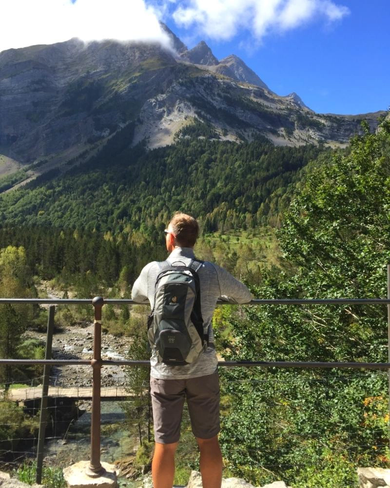
- From here you’ll start to notice the track inclining as you pass through forest and the UNESCO World Heritage sign. The views start to become really stunning, with the Cirque ahead in all its glory. The Cirque looks deceptively close for much of the walk, but because of its enormous scale it takes longer than you’d expect to reach it!
- The track starts to descend to open ground and then rises gently up to around 1400m. From here, it becomes quite steep for a few hundred meters, the most difficult part of this hike. You’ll soon spot the Hotel du Cirque in the distance, with the Cirque and waterfalls providing breathtaking views.
- You are now at 1570m elevation. Look up to the highest walls of the Cirque, where the peaks are over 3000m and may well still be covered in snow. Somewhere up there is the Brèche de Roland (or Roland’s Breach), a gap in the upper layer of the Cirque at 2807m on the border with Spain.
- The huge Grande Cascade can be reached by continuing along the main path before tackling the final scramble over loose shale. Getting to the tallest waterfall in France can be a tricky ascent and descent, as the shale is loose and steep. If you’re not sure-footed, poles may help.
Literally on the other side of the Cirque de Gavarnie, over Mont Perdu, or Monte Perdido (which means ‘hidden mountain’ in Spanish, as it cannot be seen from France) is the Circo de Soaso in the Ordesa National Park in Spain.
It is possible to hike to Roland’s Breach and across the Spanish border between the cirques, staying at the Refuge des Sarradets en route, a relatively easy hike from the Col de Tentes.
What is Roland’s Breach?
Roland’s Breach, or Brècha de Roland, is the name of a natural gapin the Pyrenees, which is situated in the Ordesa y Monte Perdido National Park on the border of Hautes-Pyrénées, France and Aragón, Spain. Measuring 40m across and 100m high, at an elevation of 2804m, the gap is a distinctive landmark in these dramatic mountains and leads into the Cirque de Gavarnie.
According to history and legend, Count Roland, one of Charlemagne’s knights, used his sword Durendal to cut the gap after being defeated during the Battle of Roncevaux Pass in Spain in 778, so he could see France one last time before he died.
Nearby Pyrenees Hiking Trails to Explore
Lac de Gaube Hike: Our Guide to the French Pyrenees’ Most Beautiful Lake
How to Hike Mont Ne & Lac de Bareilles
How to Hike the Circo de Soaso via Faja Pelay – Ordesa Valley
How to Hike Pic de Tentes & Port de Boucharo
Love it? Pin It!